Category:Narrative of a survey of the intertropical and western coasts of Australia
Jump to navigation
Jump to search
Countries of Oceania: Australia
Media in category "Narrative of a survey of the intertropical and western coasts of Australia"
The following 23 files are in this category, out of 23 total.
-
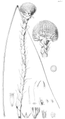
 App Tab A - Chlamydosaurus Kingii.png 3,742 × 1,929; 2.23 MB
-
 App Tab B - Carpophagus Banksiæ.png 2,435 × 3,856; 1.15 MB
-
 App Tab C - Kingia Australis.png 2,777 × 5,093; 5.09 MB
-
 Chart of Port Cockburn at Melville Island.png 2,185 × 3,185; 1.44 MB
-
 General Chart of the North-west and West Coasts.png 4,548 × 3,180; 1.15 MB
-
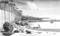
 Huts of the Natives at Careening Bay.png 2,093 × 1,091; 1.02 MB
-
 Interview with the Natives of St Asaphs Bay Melville Island.png 3,201 × 1,998; 4.22 MB
-

-

-

-
 Narrative of a survey of the intertropical and western coasts of Australia, Volume 1.djvu 1,521 × 2,463, 524 pages; 7.95 MB
-

-

-

-
 Narrative of a survey of the intertropical and western coasts of Australia, Volume 2.djvu 1,508 × 2,458, 679 pages; 11.65 MB
-

-
 View of Inner Harbour, Port Essington from spear point.png 3,207 × 1,924; 2.67 MB
-
 View of South West Bay, Goulburn Island.png 3,198 × 1,928; 3.71 MB
-
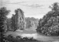
 View of the cascade in prince regent's river.png 3,192 × 1,974; 3.92 MB
-
 View of the encampment in Careening bay where the Mermaid was repaired.png 3,171 × 1,938; 3.71 MB
-
 View of the entrance of Port Macquarie.png 2,009 × 1,463; 1.59 MB
-
 View up the River Hastings at its junction with Kings River.png 1,999 × 1,435; 2 MB
-
 Weapons &c. of the natives of hanover bay.png 3,588 × 2,109; 1.53 MB


.png)
.png)

.png)


.png)