Category:National Register of Historic Places in Benton County, Arkansas
Jump to navigation
Jump to search
Counties of Arkansas: Arkansas · Ashley · Baxter · Benton · Boone · Bradley · Calhoun · Carroll · Chicot · Clark · Clay · Cleburne · Cleveland · Columbia · Conway · Craighead · Crawford · Crittenden · Cross · Dallas · Desha · Drew · Faulkner · Franklin · Fulton · Garland · Grant · Greene · Hempstead · Hot Spring · Howard · Independence · Izard · Jackson · Jefferson · Johnson · Lafayette · Lawrence · Lee · Lincoln · Little River · Logan · Lonoke · Madison · Marion · Miller · Mississippi · Monroe · Montgomery · Nevada · Newton · Ouachita · Perry · Phillips · Pike · Poinsett · Polk · Pope · Prairie · Pulaski · Randolph · Saline · Scott · Searcy · Sebastian · Sevier · Sharp · St. Francis · Stone · Union · Van Buren · Washington · White · Woodruff · Yell
Wikimedia category | |||||
| Upload media | |||||
| Instance of | |||||
|---|---|---|---|---|---|
| |||||
Subcategories
This category has the following 18 subcategories, out of 18 total.
B
- Bentonville High School (3 F)
C
E
G
- Gypsy Camp Historic District (17 F)
M
- Monte Ne, Arkansas (17 F)
O
- Old High Middle School (3 F)
- Osage Creek Bridge (9 F)
P
S
- Spavinaw Creek Bridge (10 F)
W
- Winkley Bridge (13 F)
Media in category "National Register of Historic Places in Benton County, Arkansas"
The following 73 files are in this category, out of 73 total.
-
 09-02-06-BentonvilleConfed-monument.jpg 792 × 1,056; 362 KB
-
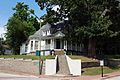
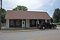
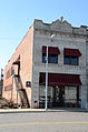 Applegate Drugstore.JPG 3,264 × 4,928; 6.75 MB
-
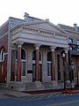
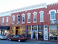
 Bank of Gentry.jpg 1,993 × 2,490; 1.69 MB
-
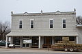
 Bank of Rogers Building.JPG 3,264 × 4,928; 6.07 MB
-
 Bella Vista Water Tank.JPG 4,928 × 3,264; 13.35 MB
-
 Benton County Jail, Bentonville, AR.jpg 3,117 × 2,338; 2.53 MB
-
 Benton County National Bank.jpg 1,872 × 2,499; 1.97 MB
-
 Benton County Poor Farm Cemetery.JPG 4,928 × 3,264; 9.32 MB
-
 Bentonville Train Station.jpg 3,816 × 2,544; 3.1 MB
-
 BLACKWELL-PAISLEY CABIN, BELLA VISTA, BENTON COUNTY, AR.jpg 2,784 × 1,848; 5.73 MB
-
 Bogart Hardware Building.jpg 2,152 × 2,880; 2.02 MB
-
 Camp Crowder Gymnasium.JPG 4,928 × 3,264; 6.84 MB
-
 Carpenter Building in Gentry, AR.jpg 3,888 × 2,592; 2.36 MB
-
 Charles R. Craig Building.jpg 2,373 × 3,157; 3.09 MB
-
 City Park, Siloam Springs, AR 001.jpg 4,128 × 2,322; 5.31 MB
-
 City Park, Siloam Springs, AR 002.jpg 4,128 × 2,322; 4.51 MB
-
 Coal Gap School.JPG 4,928 × 3,264; 8.18 MB
-
 Coats School.JPG 4,928 × 3,264; 8.89 MB
-
 Coon Creek Bridge.JPG 4,928 × 3,264; 13.33 MB
-
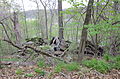 Deaton Cabin ( all that remains).JPG 4,928 × 3,264; 10.99 MB
-
 Decatur Train Station in Decatur, Arkansas.jpg 2,808 × 2,106; 1.99 MB
-
 Downtown Siloam Springs, AR 006.jpg 2,168 × 3,269; 2.51 MB
-
 Downtown Siloam Springs, AR 008.jpg 2,322 × 1,549; 1.77 MB
-
 Downtown Siloam Springs, AR 010.jpg 2,023 × 3,042; 2.22 MB
-
 Downtown Siloam Springs, AR 011.jpg 2,322 × 1,557; 2.41 MB
-
 Downtown Siloam Springs, AR 023.jpg 2,322 × 3,098; 2.87 MB
-
 Gailey Hollow Farmstead.JPG 4,928 × 3,264; 12.5 MB
-
 Garfield Elementary.jpg 3,947 × 2,635; 1.73 MB
-
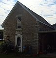
 Hagler-Cole Cabin.JPG 4,928 × 3,264; 9.85 MB
-
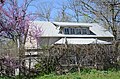
 Highfill Community Building.jpg 3,379 × 2,253; 1.52 MB
-
 HIWASSE BANK BUILDING, BENTON COUNTY, AR.jpg 2,784 × 1,848; 2.84 MB
-
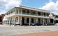
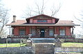
 Hotel Massey.jpg 4,000 × 3,000; 3.5 MB
-
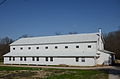
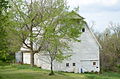 Johnson Barn.JPG 4,928 × 3,264; 10.83 MB
-
 Kansas City Southern caboose in Decatur, AR.jpg 2,265 × 1,700; 1.72 MB
-
 Kansas City Southern caboose in Gravette, AR.jpg 2,861 × 2,141; 2.64 MB
-
 Kansas City Southern engine 73D.jpeg 2,448 × 3,264; 2.87 MB
-
 Lakeside Hotel 001.jpg 3,714 × 2,322; 3.07 MB
-
 LAMBERTON CABIN, BELLA VISTA, BENTON COUNTY, AR.jpg 2,707 × 1,753; 5.77 MB
-
 Lane Hotel.JPG 4,928 × 3,264; 7.59 MB
-
 MillerHomesteadPeaRidgeAR.JPG 1,868 × 1,954; 1.05 MB
-
 Mutual Aid Union Building.JPG 4,928 × 3,264; 10.17 MB
-
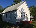
 New Home School and Church.JPG 4,928 × 3,264; 10.59 MB
-
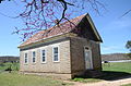
 Norwood School (Norwood, Arkansas).jpg 2,362 × 1,776; 1.72 MB
-
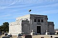 Oak Hill Mausoleum.JPG 4,928 × 3,264; 5.73 MB
-
 Osage Creek Bridge.jpg 4,764 × 3,735; 2.51 MB
-
 Osage Mills Dam.JPG 4,928 × 3,264; 7.95 MB
-
 PeaRidgeHistoricCommercialDistrictAR.JPG 3,138 × 1,083; 1.3 MB
-
 PHARR CABIN, BELLA VISTA, BENTON COUNTY, AR.jpg 2,784 × 1,848; 4.52 MB
-
 Piercy Farmstead.JPG 4,928 × 3,264; 7.67 MB
-
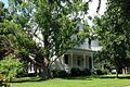
 Princedom.JPG 1,632 × 1,224; 962 KB
-
 Putman Cemetery.JPG 4,928 × 3,264; 11.55 MB
-
 Rife Farmstead.JPG 4,928 × 3,264; 8.95 MB
-
 RockyBranchSchoolAR.JPG 2,789 × 2,195; 2.76 MB
-
 Rogers City Hall.JPG 4,928 × 3,264; 6.14 MB
-
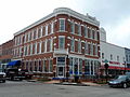
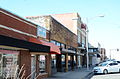 Rogers Commercial Historic District, 1 of 4.JPG 4,928 × 3,264; 6.51 MB
-
 Rogers Commercial Historic District, 2 of 4.JPG 4,928 × 3,264; 7.1 MB
-
 Rogers Commercial Historic District, 3 of 4.JPG 4,928 × 3,264; 6.68 MB
-
 Rogers Commercial Historic District, 4 of 4.JPG 4,928 × 3,264; 6.48 MB
-
 Rogers Post Office Building.JPG 4,928 × 3,264; 11.39 MB
-
 Roy's Office Supply Building.jpg 2,969 × 2,230; 2.44 MB
-
 ShadyGroveSchoolPeaRidgeAR.JPG 2,925 × 2,059; 2.92 MB
-
 Shores Warehouse.JPG 4,928 × 3,264; 6.3 MB
-
 Simon Sager Cabin, DAR Plaque.JPG 3,264 × 4,928; 8.19 MB
-
 Simon Sager Cabin, Historic Plaque.JPG 4,928 × 3,264; 5.66 MB
-
 Springfield to Fayetteville Road-Cross Hollow Segment.JPG 4,928 × 3,264; 10.32 MB
-
 Springfield to Fayetteville Road-Elkhorn Tavern Segment.JPG 3,264 × 4,928; 11.34 MB
-
 Sulphur Springs Old School Complex Historic District.JPG 4,928 × 3,264; 6.01 MB
-
 Sulphur Springs Park Reserve.JPG 4,928 × 3,264; 12.22 MB
-
 SUTHERLIN CABIN, BELLA VISTA, BENTON COUNTY, AR.jpg 2,784 × 1,848; 4.48 MB
-
 Terry Block Building.jpg 2,980 × 2,233; 2.33 MB
-
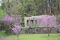
 Van Winkle's Mill Site.jpg 2,304 × 1,728; 1.4 MB
-
 Wee Pine Knot.JPG 4,928 × 3,264; 8.02 MB
-
 Wonderland Cave.JPG 4,928 × 3,264; 11.99 MB


.JPG)


.jpg)


