Category:Nautic charts of the Seine Estuary
Jump to navigation
Jump to search
Media in category "Nautic charts of the Seine Estuary"
The following 4 files are in this category, out of 4 total.
-
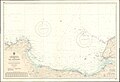 Admiralty Chart No 2613 Cherbourg to Cap d'Antifer, Published 1961.jpg 16,455 × 11,286; 37.36 MB
-
 Admiralty Chart No 2613 France N. Coast Sheet XI Cape Levi to Fecamp, Published 1894.jpg 16,011 × 13,292; 58.72 MB
-
 Admiralty Chart No 2675c English Channel Eastern Part, Published 1885.jpg 11,222 × 16,467; 18.52 MB
-
 Admiralty Chart No 2990 Le Havre and approaches to the Seine, Published 1924.jpg 21,952 × 11,307; 76.13 MB


