Category:Neath
Jump to navigation
Jump to search
English: Neath.
Cymraeg: Castell-nedd.
town and community in county borough of Neath Port Talbot, Wales  | |||||
| Upload media | |||||
| Instance of | |||||
|---|---|---|---|---|---|
| Location |
| ||||
| Population |
| ||||
| official website | |||||
 | |||||
Subcategories
This category has the following 11 subcategories, out of 11 total.
*
- 2011 in Neath (29 F)
- 2014 in Neath (4 F)
B
C
- Cimla (5 F)
G
- Gnoll House (10 F)
J
N
- Neath Bus Tour December 2010 (11 F)
P
R
- Rhyd Hir, Neath (1 F)
T
V
Media in category "Neath"
The following 200 files are in this category, out of 753 total.
(previous page) (next page)-
 'Gelligaer Fach' from Bwlch Road - geograph.org.uk - 223157.jpg 640 × 430; 183 KB
-
 'Stockham's Corner' on the A474 at Neath - geograph.org.uk - 226288.jpg 640 × 493; 157 KB
-

-
 2010 Wales Neath Port Talbot Community Neath map.svg 512 × 666; 423 KB
-
 2024 Wales Neath Port Talbot Community Neath map.svg 512 × 666; 548 KB
-

-

-

-
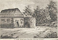 A lime kiln, near Neath, south Wales.jpeg 700 × 483; 176 KB
-

-
 A rooftop view of Neath - geograph.org.uk - 1618067.jpg 640 × 480; 100 KB
-
 A triangular square in Neath - geograph.org.uk - 3909685.jpg 800 × 600; 143 KB
-
 A.S.A. Neath - geograph.org.uk - 4945159.jpg 800 × 614; 106 KB
-

-
 A474 in Melincryddan - geograph.org.uk - 5895286.jpg 1,024 × 737; 97 KB
-
 A474 slip road, Neath - geograph.org.uk - 3855224.jpg 800 × 577; 131 KB
-
 ABC child-friendly hair salon, Neath - geograph.org.uk - 3849481.jpg 800 × 695; 155 KB
-
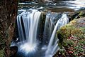 AberdulaisFalls2015.jpg 7,090 × 4,732; 1.25 MB
-
 Afon Nedd - geograph.org.uk - 380603.jpg 640 × 480; 107 KB
-
 Afon Nedd a'r A474 - Neath River and the A474 - geograph.org.uk - 6039792.jpg 1,024 × 768; 224 KB
-
 Afon Veterinary Centre, Neath - geograph.org.uk - 4937181.jpg 784 × 800; 160 KB
-

-
 Allister Street, Neath - geograph.org.uk - 2006076.jpg 640 × 480; 203 KB
-
 Allister Street, Neath - geograph.org.uk - 4011207.jpg 799 × 800; 134 KB
-

-
 Anarkali Tandoori takeaway, Neath - geograph.org.uk - 4963163.jpg 800 × 785; 132 KB
-
 Angel Street, Neath - geograph.org.uk - 3909812.jpg 695 × 800; 152 KB
-
 Aqueduct over the river Neath.jpeg 700 × 525; 182 KB
-
 Astleys car and office, Neath - geograph.org.uk - 4962972.jpg 731 × 800; 127 KB
-
 B4434 Llantwit Road - geograph.org.uk - 5895284.jpg 1,024 × 724; 131 KB
-
 B4434 mini-roundabout, Neath - geograph.org.uk - 4935533.jpg 800 × 490; 89 KB
-
 Baptist Church - geograph.org.uk - 5421615.jpg 2,303 × 3,070; 1.54 MB
-
 Barclays Bank, Neath - geograph.org.uk - 3849506.jpg 519 × 800; 94 KB
-
 Barclays Bank, Neath - geograph.org.uk - 4969171.jpg 562 × 800; 99 KB
-
 Barn at Ty'n y Waun - geograph.org.uk - 5469384.jpg 3,264 × 2,448; 1.88 MB
-
 Bay Radio, Newby House, Neath - geograph.org.uk - 1713246.jpg 3,072 × 2,304; 2.84 MB
-
 Beechwood Avenue, Neath - geograph.org.uk - 3861347.jpg 800 × 463; 101 KB
-
 Bellybusters Café, Neath - geograph.org.uk - 3852223.jpg 800 × 589; 128 KB
-
 Bend in Llantwit Road, Llantwit, Neath - geograph.org.uk - 6030477.jpg 1,024 × 768; 244 KB
-
 Bend in the Neath Canal, Neath - geograph.org.uk - 3852197.jpg 756 × 800; 272 KB
-

-

-
 Big Cam, Neath - geograph.org.uk - 3868588.jpg 800 × 717; 170 KB
-

-

-

-

-

-

-
 Birds flock to it^ Windsor Road, Neath - geograph.org.uk - 6070211.jpg 1,024 × 865; 231 KB
-
 Black signpost, Water Street, Neath - geograph.org.uk - 4964846.jpg 800 × 600; 125 KB
-
 Blinds 2000 shop, 8 Croft Road, Neath - geograph.org.uk - 5508136.jpg 800 × 732; 132 KB
-
 Blue bus shelter, Llantwit Road, Llantwit, Neath - geograph.org.uk - 6030420.jpg 1,024 × 768; 135 KB
-
 Bluebell Hotel, Neath - geograph.org.uk - 2384759.jpg 640 × 618; 83 KB
-
 Bluebell Hotel, Neath - geograph.org.uk - 3888842.jpg 800 × 583; 90 KB
-

-

-
 Bohgan Cimla Stores, Neath - geograph.org.uk - 3849686.jpg 800 × 707; 158 KB
-
 Booze Express, Neath - geograph.org.uk - 3888748.jpg 800 × 655; 126 KB
-
 Borough Arms name sign, Neath - geograph.org.uk - 4945585.jpg 799 × 800; 123 KB
-
 Borough Arms, Neath - geograph.org.uk - 4945517.jpg 784 × 800; 141 KB
-
 Borough Arms, Neath - geograph.org.uk - 4945625.jpg 791 × 800; 140 KB
-
 Bravegate, Neath - geograph.org.uk - 5508024.jpg 800 × 586; 108 KB
-
 Bridge at Crythan Brook - geograph.org.uk - 5469392.jpg 3,264 × 2,448; 4.23 MB
-
 Bridge over River Neath - geograph.org.uk - 2597135.jpg 640 × 480; 137 KB
-
 Bridge Street railway bridge, Neath - geograph.org.uk - 3849276.jpg 800 × 715; 143 KB
-

-

-
 British Red Cross, The Ropewalk, Neath - geograph.org.uk - 3861159.jpg 800 × 697; 112 KB
-
 Brookdale Street, Neath - geograph.org.uk - 4960194.jpg 800 × 693; 121 KB
-
 Brown's of Neath Service Centre - geograph.org.uk - 3909795.jpg 752 × 800; 171 KB
-
 Brynau Woods - geograph.org.uk - 3099166.jpg 3,168 × 4,752; 5.8 MB
-

-

-
 Burger Station and Buffalo Bill, Neath - geograph.org.uk - 3888892.jpg 799 × 800; 178 KB
-
 B^B Hair, Neath - geograph.org.uk - 4011327.jpg 800 × 700; 147 KB
-
 B^Q Neath - geograph.org.uk - 2332243.jpg 640 × 409; 73 KB
-
 Café Espresso, Neath - geograph.org.uk - 3849562.jpg 800 × 645; 107 KB
-
 Camlas Nedd - Neath Canal - geograph.org.uk - 5062602.jpg 640 × 480; 111 KB
-
 Camlas Nedd - Neath Canal - geograph.org.uk - 6039874.jpg 1,024 × 768; 246 KB
-
 Canal Road, Neath - geograph.org.uk - 3852195.jpg 799 × 800; 231 KB
-
 Cancer Research UK charity shop, Neath - geograph.org.uk - 4965368.jpg 800 × 722; 134 KB
-
 Car-lined Croft Road, Neath - geograph.org.uk - 6070216.jpg 1,024 × 673; 127 KB
-
 Card Centre, Neath - geograph.org.uk - 3903023.jpg 800 × 669; 155 KB
-

-
 Carlo's Fish Bar, Neath - geograph.org.uk - 3909704.jpg 800 × 748; 166 KB
-
 Castellated church tower, Llantwit, Neath - geograph.org.uk - 6030456.jpg 1,024 × 903; 212 KB
-
 Castle Bingo, Neath - geograph.org.uk - 2283481.jpg 640 × 480; 55 KB
-
 Castle Hotel & Restaurant, Neath (geograph 6070215).jpg 1,024 × 869; 194 KB
-
 Castle Quay, Neath Canal - geograph.org.uk - 2597035.jpg 640 × 480; 193 KB
-
 Castle Surgery, Neath - geograph.org.uk - 2331987.jpg 640 × 411; 51 KB
-
 CastleHotelNeath.jpg 1,024 × 683; 360 KB
-

-
 Cattle Street flats, Neath - geograph.org.uk - 4967290.jpg 800 × 600; 102 KB
-
 Cedar Road, Neath - geograph.org.uk - 2281984.jpg 640 × 529; 94 KB
-
 Cefn Saeson - geograph.org.uk - 5421610.jpg 2,718 × 1,823; 896 KB
-
 Cemetery at Llantwit, Neath - geograph.org.uk - 5935723.jpg 3,264 × 2,448; 2.96 MB
-
 Central post office, Neath - geograph.org.uk - 2282205.jpg 640 × 580; 83 KB
-
 Chan's Cafe, Neath - geograph.org.uk - 4011211.jpg 800 × 625; 120 KB
-
 Chandni, Neath - geograph.org.uk - 4011242.jpg 729 × 800; 139 KB
-

-
 Chopsticks in Neath - geograph.org.uk - 4937213.jpg 800 × 600; 140 KB
-
 Church Place, Neath - geograph.org.uk - 3909338.jpg 756 × 800; 188 KB
-
 Cimla Close, Neath - geograph.org.uk - 3964516.jpg 719 × 800; 183 KB
-
 Cimla Common - geograph.org.uk - 5469388.jpg 3,264 × 2,448; 2.11 MB
-
 Cimla Crescent, Cimla, Neath - geograph.org.uk - 3849740.jpg 800 × 485; 99 KB
-
 Cimla Funeral Home, Neath - geograph.org.uk - 3849645.jpg 800 × 492; 89 KB
-
 CISS charity shop in Neath - geograph.org.uk - 4011256.jpg 800 × 630; 121 KB
-
 Citizens Advice Bureau, Neath - geograph.org.uk - 2282228.jpg 480 × 640; 56 KB
-

-
 Clifford Street, Neath - geograph.org.uk - 4945647.jpg 800 × 737; 106 KB
-
 Clive Sinclair Motors, Neath - geograph.org.uk - 3852203.jpg 800 × 498; 100 KB
-
 Coal from Cwmgrach - geograph.org.uk - 943973.jpg 640 × 417; 90 KB
-
 Coal works - a view near Neath in Glamorganshire, south Wales.jpeg 700 × 501; 113 KB
-
 Cocoa Beach, Neath - geograph.org.uk - 3986181.jpg 800 × 768; 153 KB
-

-

-
 Community Centre (geograph 6015166).jpg 3,264 × 2,448; 2.9 MB
-
 Constitutional Club, Neath (cropped).jpg 2,500 × 2,504; 6 MB
-
 Constitutional Club, Neath.jpg 3,766 × 2,504; 6.94 MB
-
 Construction work, central Neath - geograph.org.uk - 2382890.jpg 640 × 482; 79 KB
-
 Cooking Papa Chinese Takeaway, Neath - geograph.org.uk - 3986089.jpg 800 × 583; 135 KB
-

-

-

-
 Crazy Cow in Neath - geograph.org.uk - 4945166.jpg 685 × 800; 141 KB
-
 Creswell Road, Neath - geograph.org.uk - 3896694.jpg 800 × 744; 118 KB
-

-
 Cribbs Row, Neath - geograph.org.uk - 5508029.jpg 800 × 479; 89 KB
-
 Croeso i Gastell Nedd, Neath - geograph.org.uk - 4960160.jpg 800 × 477; 120 KB
-
 Croft Road, Neath - geograph.org.uk - 2006084.jpg 640 × 480; 230 KB
-

-
 Crowded grass triangle at the SW edge of Tonna - geograph.org.uk - 6033225.jpg 1,024 × 787; 265 KB
-

-

-
 Cryddan Brook, Neath - geograph.org.uk - 2283474.jpg 640 × 537; 125 KB
-
 CVS office in Neath - geograph.org.uk - 4963026.jpg 800 × 663; 95 KB
-
 Cwm Llwyn Eryr - Eaglesbush Valley - geograph.org.uk - 4063449.jpg 640 × 480; 132 KB
-
 Cyffordd o lwybrau - A junction of paths - geograph.org.uk - 6039648.jpg 1,024 × 767; 392 KB
-
 Cyprus and Jamaican in Neath - geograph.org.uk - 4969186.jpg 800 × 637; 128 KB
-
 C^S (Neath) Steel Services, Neath - geograph.org.uk - 3852185.jpg 800 × 763; 166 KB
-
 Dark Arch bridge, Neath - geograph.org.uk - 3852180.jpg 800 × 565; 106 KB
-
 Dark Arch Milland Road Neath - geograph.org.uk - 5780316.jpg 3,264 × 2,448; 3.54 MB
-
 Delivery area, Morrisons, Neath - geograph.org.uk - 3909837.jpg 800 × 473; 110 KB
-

-

-
 Digby Road, Llantwit, Neath - geograph.org.uk - 6030313.jpg 1,024 × 917; 207 KB
-
 Directions sign facing Dyfed Road, Neath - geograph.org.uk - 4964575.jpg 800 × 685; 169 KB
-

-

-

-

-

-
 Directions sign, Gnoll Park Road, Neath - geograph.org.uk - 4939522.jpg 800 × 664; 117 KB
-
 Doghouse Gym, Neath - geograph.org.uk - 4963005.jpg 800 × 743; 119 KB
-
 Dragon fly on fruit.jpg 960 × 720; 173 KB
-
 Dragon House, Neath - geograph.org.uk - 4959859.jpg 714 × 800; 154 KB
-
 DV405 no.168 Neath.png 2,038 × 1,226; 7.16 MB
-
 Dyfed Road Health Centre, Neath - geograph.org.uk - 2277155.jpg 640 × 480; 58 KB
-
 Dyfed Road Pharmacy, Neath - geograph.org.uk - 2281929.jpg 640 × 481; 70 KB
-
 Dyfed Road Pharmacy, Neath - geograph.org.uk - 4938974.jpg 800 × 623; 126 KB
-
 Dyfed Road Pharmacy, Neath - geograph.org.uk - 4939395.jpg 800 × 658; 131 KB
-
 Dyfed Road, Neath - geograph.org.uk - 5021109.jpg 800 × 589; 104 KB
-
 Dyfed Road, Neath - geograph.org.uk - 743838.jpg 640 × 480; 64 KB
-
 Dyffryn Nedd.jpeg 700 × 518; 145 KB
-
 Dylais Fall, near Neath, Glamorganshire.jpeg 700 × 517; 156 KB
-
 Early May colours, Fairyland Road, Tonna - geograph.org.uk - 6033219.jpg 1,024 × 827; 278 KB
-

-
 Eastern edge of Dark Arch bridge, Neath - geograph.org.uk - 3855367.jpg 640 × 800; 117 KB
-
 Eastern edge of Neath Castle - geograph.org.uk - 2331976.jpg 640 × 347; 59 KB
-
 Eastern end of High Street Neath - geograph.org.uk - 4935467.jpg 800 × 720; 124 KB
-
 Eastland Place flats, Neath - geograph.org.uk - 4942820.jpg 800 × 660; 117 KB
-
 Eastland Place, Neath - geograph.org.uk - 3964564.jpg 800 × 401; 102 KB
-
 Eastland Road houses, Neath - geograph.org.uk - 3964592.jpg 800 × 578; 144 KB
-
 Eastland Road pelican crossing, Neath - geograph.org.uk - 4942778.jpg 800 × 591; 113 KB
-
 Eastland Road, Neath - geograph.org.uk - 4959794.jpg 800 × 752; 137 KB
-

-
 Eclipse in Neath - geograph.org.uk - 3986054.jpg 800 × 799; 172 KB
-
 Eden Bar ^ Grill, Neath - geograph.org.uk - 6070209.jpg 1,016 × 1,024; 191 KB
-
 Edwardian chapel in High Street, Neath - geograph.org.uk - 4967139.jpg 600 × 800; 110 KB
-
 Edwards coach, Windsor Road, Neath - geograph.org.uk - 6070200.jpg 1,024 × 768; 208 KB
-

-
 Elias Street, Neath - geograph.org.uk - 4963372.jpg 800 × 687; 127 KB
-
 Elysium Hair ^ Beauty, Neath - geograph.org.uk - 4938890.jpg 800 × 703; 117 KB
-
 Emanuel Place, Neath - geograph.org.uk - 4945724.jpg 800 × 508; 105 KB
-
 Ena Avenue, Neath - geograph.org.uk - 3861321.jpg 789 × 800; 190 KB
-
 English Baptist Chapel, Neath - geograph.org.uk - 2382909.jpg 640 × 537; 77 KB
-
 English Baptist Chapel, Neath - geograph.org.uk - 5020959.jpg 800 × 656; 122 KB
-
 Entrance B, The Gnoll, Neath - geograph.org.uk - 4939546.jpg 800 × 600; 99 KB
-
 Entrance to a military site in Neath - geograph.org.uk - 3861297.jpg 800 × 502; 118 KB
-

-
 Entrance to Neath railway station - geograph.org.uk - 2331483.jpg 640 × 480; 101 KB
-
 Entrance to St David's Church, Neath - geograph.org.uk - 5021601.jpg 600 × 800; 139 KB
-
-

-
 Entrance to Travis Perkins, Neath - geograph.org.uk - 4953267.jpg 800 × 455; 81 KB
-
 Fabuluzz in Neath - geograph.org.uk - 5066046.jpg 639 × 800; 125 KB
-
 Faded Full Moon name sign, Neath - geograph.org.uk - 4969229.jpg 495 × 640; 101 KB
-
 Fairfield Way, Neath - geograph.org.uk - 4935480.jpg 800 × 731; 113 KB
-
 Fairyland Road semis, Tonna - geograph.org.uk - 6033222.jpg 1,024 × 836; 237 KB


_and_a_large_storage_jar_(right)_from_the_Roman_settlement_of_Nidum_(Neath),_Wales.jpg)


.jpg)


.jpg)
.jpg)


_Steel_Services,_Neath_-_geograph.org.uk_-_3852185.jpg)


