Category:Nederlands Hervormde Kerk, Kapel-Avezaath
Jump to navigation
Jump to search
| Object location | | View all coordinates using: OpenStreetMap |
|---|
church building in Tiel, Netherlands  | |||||
| Upload media | |||||
| Instance of | |||||
|---|---|---|---|---|---|
| Dedicated to | |||||
| Location | Kapel-Avezaath, Buren, Gelderland, Netherlands | ||||
| Street address |
| ||||
| Heritage designation |
| ||||
| Significant event |
| ||||
 | |||||
|
This is a category about rijksmonument number 35612
|
| Address |
|
Media in category "Nederlands Hervormde Kerk, Kapel-Avezaath"
The following 29 files are in this category, out of 29 total.
-
 Aanbouw noord-oost gevel - Kapel-Avezaath - 20124017 - RCE.jpg 1,200 × 791; 320 KB
-
 Detail noord muur - Kapel-Avezaath - 20123845 - RCE.jpg 953 × 1,200; 403 KB
-
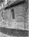
 Detail zuidgevel - Kapel-Avezaath - 20124013 - RCE.jpg 1,200 × 788; 362 KB
-
 Detail zuidgevel - Kapel-Avezaath - 20124014 - RCE.jpg 788 × 1,200; 335 KB
-
 Dorpsgezicht met boomgaard en kerktoren - Kapel-Avezaath - 20404435 - RCE.jpg 1,200 × 955; 348 KB
-
 Dorpsgezicht met kerktoren - Kapel-Avezaath - 20404432 - RCE.jpg 1,200 × 954; 324 KB
-
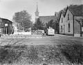 Dorpsgezicht met kerktoren - Kapel-Avezaath - 20404434 - RCE.jpg 1,200 × 947; 325 KB
-
 Exterieur - Kapel-Avezaath - 20123843 - RCE.jpg 1,200 × 887; 211 KB
-
 Exterieur - Kapel-Avezaath - 20123846 - RCE.jpg 1,200 × 811; 184 KB
-
 Interieur koor (na restauratie ) - Kapel-Avezaath - 20123851 - RCE.jpg 1,192 × 1,200; 201 KB
-
 Interieur koor - Kapel-Avezaath - 20124019 - RCE.jpg 1,200 × 788; 138 KB
-
 Interieur naar het oosten (na restauratie ) - Kapel-Avezaath - 20123850 - RCE.jpg 1,188 × 1,200; 195 KB
-
 Interieur naar het oosten - Kapel-Avezaath - 20123844 - RCE.jpg 954 × 1,200; 156 KB
-
 Interieur naar het oosten - Kapel-Avezaath - 20124018 - RCE.jpg 1,200 × 796; 151 KB
-
 Interieur naar het orgel - Kapel-Avezaath - 20123853 - RCE.jpg 1,197 × 1,200; 216 KB
-
 Interieur naar het westen (na restauratie ) - Kapel-Avezaath - 20123852 - RCE.jpg 1,195 × 1,200; 192 KB
-
 Interieur naar het westen - Kapel-Avezaath - 20124020 - RCE.jpg 1,200 × 788; 161 KB
-
 N-H Agatha-kapel Kapel-Avezaath.jpg 3,264 × 2,448; 6.22 MB
-
 Noordgevel - Kapel-Avezaath - 20124015 - RCE.jpg 1,200 × 788; 345 KB
-
 Noordgevel - Kapel-Avezaath - 20124016 - RCE.jpg 793 × 1,200; 347 KB
-
 Overzicht - Kapel-Avezaath - 20124021 - RCE.jpg 1,188 × 1,200; 301 KB
-
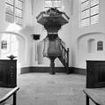 Preekstoel - Kapel-Avezaath - 20123854 - RCE.jpg 1,195 × 1,200; 193 KB
-
 Raam in koor noord-oost hoek, exterieur - Kapel-Avezaath - 20123847 - RCE.jpg 1,200 × 1,176; 357 KB
-
 Raam in koor, exterieur - Kapel-Avezaath - 20123848 - RCE.jpg 1,200 × 1,167; 264 KB
-
 Raam in koor, exterieur - Kapel-Avezaath - 20123849 - RCE.jpg 1,200 × 1,165; 311 KB
-
 Zuidgevel - Kapel-Avezaath - 20124012 - RCE.jpg 1,200 × 788; 334 KB
-
 Zuidgevel - Kapel-Avezaath - 20124022 - RCE.jpg 1,197 × 1,200; 376 KB
-
 Zuidgevel - Kapel-Avezaath - 20124024 - RCE.jpg 1,192 × 1,200; 443 KB
-
 Zuidgevel koor - Kapel-Avezaath - 20124023 - RCE.jpg 1,192 × 1,200; 427 KB


_-_Kapel-Avezaath_-_20123851_-_RCE.jpg)

_-_Kapel-Avezaath_-_20123850_-_RCE.jpg)


_-_Kapel-Avezaath_-_20123852_-_RCE.jpg)


