Category:Nederlands Hervormde Kerk, Klundert
Jump to navigation
Jump to search
| Object location | | View all coordinates using: OpenStreetMap |
|---|
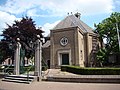
Nederlands: Afbeeldingen van de Nederlands Hervormde Kerk, Kerkring 1, 4791 HE Klundert. Gelegen in Klundert in de provincie Noord-Brabant in het zuiden van Nederland
Subcategories
This category has the following 2 subcategories, out of 2 total.
Media in category "Nederlands Hervormde Kerk, Klundert"
The following 16 files are in this category, out of 16 total.
-
 Exterieur OVERZICHT - Klundert - 20274547 - RCE.jpg 1,200 × 781; 178 KB
-
 Klundert 240.JPG 3,264 × 2,448; 2.1 MB
-
 Klundert, Hekwerk NH-Kerk in de Kerkring JVL 5706.jpg 1,944 × 2,896; 2.82 MB
-
 Klundert-herv-kerk.jpg 400 × 300; 28 KB
-
 Nederlands Hervormde Kerk, Klundert P1170453.jpg 4,000 × 2,672; 6 MB
-
 Nederlands Hervormde Kerk, Klundert P1170454.jpg 4,000 × 2,672; 6.03 MB
-
 Nederlands Hervormde Kerk, Klundert P1170455.jpg 4,000 × 2,672; 6.04 MB
-
 Nederlands Hervormde Kerk, Klundert P1170456.jpg 4,000 × 2,672; 6.05 MB
-
 Nederlands Hervormde Kerk, Klundert P1170457.jpg 4,000 × 2,672; 6.06 MB
-
 Nederlands Hervormde Kerk, Klundert P1170462.jpg 4,000 × 2,672; 6.14 MB
-
 Nederlands Hervormde Kerk, Klundert P1170479.jpg 4,000 × 2,672; 6 MB
-
 Nederlands Hervormde Kerk, Klundert P1170528.jpg 4,000 × 2,672; 5.84 MB
-
 Nederlands Hervormde Kerk, Klundert P1170530.jpg 4,000 × 2,672; 6.1 MB
-
 Overzicht met N.H.Kerk - Klundert - 20126050 - RCE.jpg 1,200 × 805; 167 KB
-
 Toren P1170463.jpg 2,672 × 4,000; 4.79 MB
-
 Toren P1170478.jpg 2,672 × 4,000; 5.24 MB


