Category:Nederstraat 3, Amerongen
Jump to navigation
Jump to search
| Object location | | View all coordinates using: OpenStreetMap |
|---|
.jpg) | |||||
| Upload media | |||||
| Instance of |
| ||||
|---|---|---|---|---|---|
| Location | Amerongen, Utrecht, Netherlands | ||||
| Street address |
| ||||
| Located on street |
| ||||
| Heritage designation |
| ||||
 | |||||
|
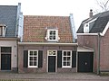
This is a category about rijksmonument number 7762
|
| Address |
|
Media in category "Nederstraat 3, Amerongen"
The following 7 files are in this category, out of 7 total.
-
 Amerongen november 2010 (63).jpg 3,264 × 2,448; 3.07 MB
-
 Amerongen november 2010 (64).jpg 3,264 × 2,448; 2.88 MB
-
 Amerongen november 2010 (66).jpg 3,264 × 2,448; 2.56 MB
-
 Amerongen november 2010 (70).jpg 3,264 × 2,448; 2.02 MB
-
 Amerongen november 2010 (75).jpg 3,264 × 2,448; 2.13 MB
-
 Voor en linker zijgevel - Amerongen - 20008808 - RCE.jpg 1,200 × 958; 277 KB
-
 Voorgevel - Amerongen - 20008806 - RCE.jpg 1,200 × 807; 193 KB
.jpg)
.jpg)
.jpg)
.jpg)

