Category:Nelson River
Jump to navigation
Jump to search
river that flows from Lake Winnipeg to Hudson's Bay  povodí řeky Nelson (vyšrafovaná je část povodí řeky Churchill, ze které je část vody odváděna do povodí Nelsonu)  | |||||
| Upload media | |||||
| Instance of | |||||
|---|---|---|---|---|---|
| Location | Manitoba, Canada | ||||
| Length |
| ||||
| Origin of the watercourse | |||||
| Mouth of the watercourse | |||||
| Drainage basin |
| ||||
| Tributary |
| ||||
| Lake on watercourse | |||||
 | |||||
Subcategories
This category has the following 6 subcategories, out of 6 total.
C
- Cross Lake (Manitoba) (5 F)
F
- Frozen Nelson River (10 F)
K
- Kichi Sipi Bridge (2 F)
M
- Maps of the Nelson River (9 F)
N
P
Media in category "Nelson River"
The following 45 files are in this category, out of 45 total.
-
 2 dredges in Port Nelson.jpg 362 × 288; 10 KB
-

-

-
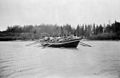
 A tugboat on the Nelson River .jpg 432 × 253; 7 KB
-
 A York boat on the Nelson River, Manitoba, 1913.jpg 760 × 497; 48 KB
-
 Aerial photo of Port Nelson, Manitoba -a.png 1,024 × 702; 61 KB
-

-
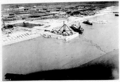
 Aerial photo of the Port Nelson causeway -a.png 971 × 792; 40 KB
-
 Aerial photo of the Port Nelson causeway -b.png 1,008 × 703; 57 KB
-
 Close up of dredge 1924.jpg 432 × 270; 12 KB
-
 SS Colvile.jpg 752 × 899; 67 KB
-
 Complexe-Nelson.PNG 341 × 367; 13 KB
-
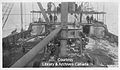 Deck of a dredge at Port Nelson.jpg 432 × 253; 13 KB
-
 First Nations people on the Nelson River.jpg 760 × 471; 59 KB
-
 Franklin 2 (2) (3) (1).jpg 912 × 347; 149 KB
-
 H.B.R. Bridge at Kettle Rapids, Mile 339, 1924.jpg 432 × 268; 11 KB
-

-

-

-
 Hudsonbayrailway1.jpg 500 × 319; 25 KB
-

-
 Limestone River Sectional Map 524 (1915) (2116319012).jpg 8,458 × 6,584; 5.85 MB
-
 Map of the Nelson and Churchill Rivers, in Manitoba.jpg 3,441 × 1,544; 844 KB
-
 Million dollar dredge and pontoon pipeline, 1924.jpg 432 × 267; 15 KB
-
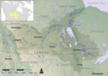 Nelson river basin map.png 1,200 × 848; 1.72 MB
-
 Nelson River near Norway House, from the air.jpg 3,648 × 2,736; 1.86 MB
-
 Nelson-Project.PNG 341 × 367; 13 KB
-
 Port causeway in Port Nelson -a.jpg 354 × 281; 8 KB
-
 Port Nelson causeway -b.jpg 336 × 264; 8 KB
-
 Port Nelson causeway -d.jpg 468 × 359; 9 KB
-
 Port Nelson causeway -e.jpg 441 × 278; 18 KB
-
 Port Nelson causeway -f.jpg 480 × 300; 18 KB
-
 Port Nelson causeway -g.jpg 447 × 276; 13 KB
-
 Port Nelson causeway -h.jpg 411 × 225; 11 KB
-
 Port Nelson causeway -i.jpg 412 × 248; 17 KB
-
 Port Nelson causeway -j.jpg 398 × 269; 14 KB
-
 Port Nelson causeway -k.jpg 276 × 271; 10 KB
-
 Port Nelson causeway -l.jpg 358 × 224; 11 KB
-
 Port Nelson dredge -a.jpg 452 × 353; 9 KB
-
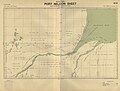 Port Nelson Sectional Map 575 (1915).jpg 8,742 × 6,658; 11.24 MB
-

-
 Satellite image of fires in Manitoba and Northern Ontario - 2003-09-09.jpg 1,500 × 2,000; 550 KB
-
 Tug pulling wooden structure on the Nelson River .jpg 383 × 288; 11 KB
-
 Tugboat Geo W Yates on the Nelson River .jpg 425 × 261; 12 KB
-
 York boat in Manitoba, Canada. 1913.jpg 600 × 315; 23 KB

.jpg)
.jpg)


.jpg)
_(2116319012).jpg)


.jpg)
.jpg)


_(3)_(1).jpg)