Category:Nempnett Thrubwell
Jump to navigation
Jump to search
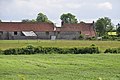
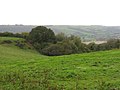
English: Nempnett Thrubwell is a small village and civil parish in dairying country on the western edge of Bath and North East Somerset, in the county of Somerset, England. It is about 15 km south-west of Bristol. The parish, which has a population of 189, is sheltered by the Mendip Hills, near the River Yeo in the Chew Valley. It is the site of the Fairy Toot oval barrow.
village and civil parish in Somerset, UK  | |||||
| Upload media | |||||
| Instance of | |||||
|---|---|---|---|---|---|
| Location | Bath and North East Somerset, Somerset, South West England, England | ||||
 | |||||
Subcategories
This category has only the following subcategory.
M
Media in category "Nempnett Thrubwell"
The following 82 files are in this category, out of 82 total.
-
 A footpath above Nempnett Thrubwell - geograph.org.uk - 2662376.jpg 2,592 × 1,944; 1.6 MB
-

-
 Awkward Hill - geograph.org.uk - 3510245.jpg 2,304 × 1,704; 1.68 MB
-
 Awkward Hill in Nempnett Thrubwell - geograph.org.uk - 162061.jpg 640 × 426; 155 KB
-
 Awkward Hill, Nempnett Thrubwell - geograph.org.uk - 2662384.jpg 2,592 × 1,944; 1.8 MB
-
 Back to Awkward Hill - geograph.org.uk - 3510265.jpg 2,304 × 1,704; 1.54 MB
-
 Bath and North East Somerset , Country Road - geograph.org.uk - 3511286.jpg 4,288 × 2,848; 6.4 MB
-
 Bath and North East Somerset , Grassy Field - geograph.org.uk - 3511287.jpg 4,288 × 2,848; 6.21 MB
-
 Bath and North East Somerset , Grassy Field - geograph.org.uk - 3511312.jpg 2,848 × 4,288; 6.08 MB
-
 Bath and North East Somerset , Grassy Field ^ Cattle - geograph.org.uk - 3511298.jpg 4,288 × 2,848; 6.17 MB
-
 Bath and North East Somerset , Grassy Fields - geograph.org.uk - 3511310.jpg 4,288 × 2,848; 6.88 MB
-
 Bath and North East Somerset , Kingdown Road - geograph.org.uk - 3511297.jpg 4,288 × 2,848; 6.33 MB
-
 Bath and North East Somerset , Kingdown Road - geograph.org.uk - 3511314.jpg 4,288 × 2,848; 6.33 MB
-
 Bath and North East Somerset , Long Lane - geograph.org.uk - 3511295.jpg 4,288 × 2,848; 6.18 MB
-
 Bath and North East Somerset , Road ^ Info Sign - geograph.org.uk - 3511291.jpg 4,288 × 2,848; 6.43 MB
-
 Bath and North East Somerset , Thrubwell Farm - geograph.org.uk - 3511306.jpg 4,288 × 2,848; 6.18 MB
-
 Bellevue House on the Northern shore of Blagdon Lake - geograph.org.uk - 4850824.jpg 3,648 × 2,048; 2.52 MB
-
 Belvedere Manor, Nempnett Thrubwell - geograph.org.uk - 2266673.jpg 3,296 × 2,472; 1.81 MB
-
 Blagdon Lake 2.jpg 5,472 × 3,648; 15.19 MB
-
 Boggy ground - geograph.org.uk - 4850790.jpg 3,648 × 2,048; 3.64 MB
-
 Breach Farm - geograph.org.uk - 162098.jpg 640 × 426; 124 KB
-
 Buildings at West Town - geograph.org.uk - 4507431.jpg 2,311 × 1,660; 880 KB
-
 Byway - geograph.org.uk - 2837426.jpg 2,304 × 1,704; 1.57 MB
-
 Cattle pasture near Butcombe - geograph.org.uk - 4507259.jpg 1,920 × 1,440; 632 KB
-
 Chapel Cottage and Chapel, Nempnett Thrubwell - geograph.org.uk - 4507547.jpg 1,920 × 2,124; 641 KB
-
 Church of St Mary the Virgin, Nempnett Thrubwell - geograph.org.uk - 4819845.jpg 1,197 × 1,600; 413 KB
-
 Cook's Gully - geograph.org.uk - 2662356.jpg 2,592 × 1,944; 1.37 MB
-
 Countryside near Southmead Farm - geograph.org.uk - 4665671.jpg 640 × 428; 75 KB
-
 Crossroads at Dewdown Lodge - geograph.org.uk - 4830899.jpg 3,776 × 2,520; 3.15 MB
-

-

-
 Easy does it - geograph.org.uk - 2836951.jpg 2,304 × 1,704; 1.72 MB
-
 Fairy Toot Field - geograph.org.uk - 2655676.jpg 2,592 × 1,944; 1.1 MB
-
 Fairy Toot.JPG 3,456 × 2,304; 3.37 MB
-
 Farmyard, Church Farm, Nempnett Thrubwell - geograph.org.uk - 2266661.jpg 3,296 × 2,472; 1.91 MB
-
 Field near West Town - geograph.org.uk - 4507566.jpg 1,920 × 1,193; 593 KB
-
 Footpath sign near Bellvue Farm - geograph.org.uk - 5899556.jpg 4,896 × 3,672; 6.16 MB
-
 Footpath with a canopy^ - geograph.org.uk - 2837346.jpg 1,704 × 2,304; 1.72 MB
-
 For wide travellers - geograph.org.uk - 2837385.jpg 2,304 × 1,704; 1.63 MB
-
 Grazing pastures on the Northern shore of Blagdon Lake - geograph.org.uk - 4850804.jpg 3,648 × 2,048; 3.49 MB
-
 Green Triangle at Dewdown Lodge - geograph.org.uk - 4669552.jpg 640 × 428; 71 KB
-
 Horse Boy on Breach Hill - geograph.org.uk - 162107.jpg 640 × 426; 113 KB
-
 Lane to Butcombe - geograph.org.uk - 4507235.jpg 1,920 × 2,560; 1.87 MB
-
 Leafy Byway - geograph.org.uk - 2455753.jpg 2,592 × 1,944; 1.75 MB
-
 Nempnett Farm - geograph.org.uk - 4507581.jpg 1,920 × 2,357; 1.25 MB
-
 Nempnett Thrubwell's Water Pump - geograph.org.uk - 163692.jpg 426 × 640; 131 KB
-

-
 Nempnett Thrubwell, Awkward Hill - geograph.org.uk - 3341686.jpg 640 × 480; 141 KB
-

-

-

-

-

-
 Nempnett Thrubwell, the telephone box - geograph.org.uk - 3341698.jpg 640 × 480; 120 KB
-
 Nempnett Thrubwell, the village pump - geograph.org.uk - 3341694.jpg 640 × 480; 135 KB
-
 New Hard Standing - geograph.org.uk - 4600435.jpg 640 × 428; 75 KB
-
 No access^ - geograph.org.uk - 2837309.jpg 2,304 × 1,704; 1.58 MB
-
 Not that you'd get a motorbike through - geograph.org.uk - 3510267.jpg 2,304 × 1,704; 2.24 MB
-
 Oaks and track, Nempnett Thrubwell - geograph.org.uk - 1887058.jpg 640 × 480; 79 KB
-

-

-

-

-

-
 Ordnance Survey Cut Mark - geograph.org.uk - 4261358.jpg 480 × 640; 116 KB
-
 Original and usefully informative street naming - geograph.org.uk - 4850817.jpg 3,648 × 2,048; 3.39 MB
-
 Puddle on Pit Lane - geograph.org.uk - 4830906.jpg 3,776 × 2,520; 4.18 MB
-
 Road junction north-east of Butcombe - geograph.org.uk - 4507175.jpg 1,920 × 1,199; 499 KB
-
 Rush hour at Nempnett Thrubwell - geograph.org.uk - 3145956.jpg 640 × 480; 91 KB
-
 Second star to the right... - geograph.org.uk - 2837369.jpg 1,704 × 2,304; 1.41 MB
-
 Shed near Bicknell Farm - geograph.org.uk - 4507168.jpg 2,452 × 1,700; 713 KB
-
 Sheep near Butcombe - geograph.org.uk - 4507224.jpg 1,920 × 2,314; 1.29 MB
-
 Signpost at the crossroads, Nempnett Thrubwell - geograph.org.uk - 2266697.jpg 3,000 × 4,000; 3.32 MB
-
 Signpost at the road junction at Plaisters Green - geograph.org.uk - 2266602.jpg 4,000 × 3,000; 2.76 MB
-
 Signpost near Nempnett Farm - geograph.org.uk - 4507759.jpg 1,920 × 1,369; 967 KB
-
 St Mary the Virgin, Nempnett Thrubwell - geograph.org.uk - 4751156.jpg 800 × 600; 128 KB
-
 The Byway towards Strode - geograph.org.uk - 2456369.jpg 2,592 × 1,944; 1.74 MB
-

-
 The lane to Strode - geograph.org.uk - 2455736.jpg 2,592 × 1,944; 1.66 MB
-
 The Old Rectory, Nempnett Thrubwell - geograph.org.uk - 2266630.jpg 4,000 × 3,000; 2.16 MB
-
 Thrubwell Lane tree - geograph.org.uk - 2836954.jpg 1,704 × 2,304; 2.27 MB
-
 View from a gate - geograph.org.uk - 2837402.jpg 2,304 × 1,704; 1.65 MB


