Category:Nesfield with Langbar
Jump to navigation
Jump to search
civil parish in Harrogate, North Yorkshire, England  | |||||
| Upload media | |||||
| Instance of | |||||
|---|---|---|---|---|---|
| Location | Harrogate, North Yorkshire, Yorkshire and the Humber, England | ||||
 | |||||
Subcategories
This category has the following 2 subcategories, out of 2 total.
L
- Langbar, North Yorkshire (11 F)
N
Media in category "Nesfield with Langbar"
The following 96 files are in this category, out of 96 total.
-
 A path leading to Nesfield - geograph.org.uk - 3213799.jpg 800 × 600; 126 KB
-
 A view of Bull Coppice - geograph.org.uk - 4662631.jpg 3,628 × 4,890; 4.83 MB
-
 A wet and windy day on Currer Lane - geograph.org.uk - 4358573.jpg 1,024 × 768; 135 KB
-
 Access Drive to Currer Hall - geograph.org.uk - 2678118.jpg 4,320 × 3,240; 5.02 MB
-
 At West Hall - View to the north - geograph.org.uk - 4662625.jpg 3,888 × 5,184; 5.99 MB
-
 Bags of cut heather near Bramberry Hill - geograph.org.uk - 3768637.jpg 1,600 × 1,200; 358 KB
-
 Battered Gate on Round Hill - geograph.org.uk - 2679215.jpg 4,320 × 3,240; 3.93 MB
-
 Beach House Farm - geograph.org.uk - 3768624.jpg 1,600 × 1,200; 489 KB
-
 Bijou shippon near the head of Dean Beck - geograph.org.uk - 6090116.jpg 1,024 × 768; 201 KB
-
 Black Foss Farm - geograph.org.uk - 3768622.jpg 1,600 × 1,200; 466 KB
-
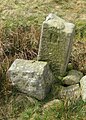
 Boundary stone - geograph.org.uk - 4439558.jpg 1,600 × 1,200; 356 KB
-
 Boundary stone - geograph.org.uk - 4439564.jpg 1,600 × 1,200; 358 KB
-
 Boundary stone - geograph.org.uk - 4439578.jpg 1,600 × 1,200; 372 KB
-
 Boundary stone - geograph.org.uk - 4439580.jpg 1,600 × 1,200; 347 KB
-
 Boundary Stone on Round Hill - geograph.org.uk - 5103853.jpg 1,299 × 948; 578 KB
-
 Boundary Stone, Beamsley Moor - geograph.org.uk - 6119717.jpg 1,024 × 683; 214 KB
-
 Bramberry Hill - geograph.org.uk - 3243741.jpg 4,608 × 3,072; 1.37 MB
-
 Fallen boundary stone - geograph.org.uk - 4439573.jpg 1,600 × 1,200; 339 KB
-
 Fallen boundary stone on Bramberry Hill - geograph.org.uk - 3768640.jpg 1,600 × 1,200; 378 KB
-
 Farm Track to West Hall - geograph.org.uk - 5829191.jpg 4,000 × 3,000; 3.81 MB
-
 Farmland along Ellishaw Beck - geograph.org.uk - 4358681.jpg 1,024 × 615; 108 KB
-
 Farmland west of Spring Well Farm, Langbar - geograph.org.uk - 4358596.jpg 1,024 × 615; 104 KB
-
 Fencing in a land of drystone walls - geograph.org.uk - 4358628.jpg 1,024 × 768; 144 KB
-
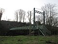
 Footbridge at Ilkley Golf Club - geograph.org.uk - 3768602.jpg 1,600 × 1,200; 744 KB
-
 Footbridge over the Wharfe - geograph.org.uk - 2170424.jpg 2,448 × 3,264; 2.42 MB
-
 Footpath beside a Wall at Little Gate - geograph.org.uk - 2679209.jpg 4,320 × 3,240; 4.2 MB
-
 Footpath crossing fields, fences and stiles at Low Austby - geograph.org.uk - 5829184.jpg 4,000 × 3,000; 4.81 MB
-
 Footpath on Beamsley Level - geograph.org.uk - 2679179.jpg 4,320 × 3,240; 3.44 MB
-
 Footpath on Low Moor - geograph.org.uk - 2678089.jpg 4,320 × 3,240; 3.74 MB
-
 Footpath towards Ilkley via the golf course - geograph.org.uk - 3768606.jpg 1,600 × 1,200; 543 KB
-
 Gateway to Moor End Farm - geograph.org.uk - 123862.jpg 640 × 480; 110 KB
-
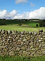
 Golf, a good walk spoilt - geograph.org.uk - 3213788.jpg 800 × 600; 150 KB
-

-
 Hardings Lane crossing Middleton Low Moor - geograph.org.uk - 4358669.jpg 1,024 × 768; 131 KB
-
 Hardings Lane, Langbar - geograph.org.uk - 4358587.jpg 1,024 × 768; 123 KB
-
 Hardistys Farm - geograph.org.uk - 3768619.jpg 1,600 × 1,200; 396 KB
-
 High Mill Weir, Addingham - geograph.org.uk - 725164.jpg 640 × 480; 87 KB
-
 Hillside below Beacon Hill House - geograph.org.uk - 4358582.jpg 1,024 × 768; 177 KB
-
 Ilkley Golf Course from the Dales Way - geograph.org.uk - 6271476.jpg 5,184 × 3,456; 7.57 MB
-
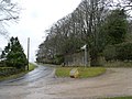 Junction of two lanes below Beacon Hill House - geograph.org.uk - 4358585.jpg 1,024 × 768; 156 KB
-
 Lane near High Lathe - geograph.org.uk - 3768614.jpg 1,600 × 1,200; 974 KB
-
 Lane to Nesfield at Low Moor - geograph.org.uk - 3768617.jpg 1,600 × 1,200; 609 KB
-
 Lane towards High Lathe - geograph.org.uk - 3768611.jpg 1,600 × 1,200; 730 KB
-
 Little Gate - geograph.org.uk - 6119728.jpg 1,024 × 683; 160 KB
-
 Looking across the River Wharfe - geograph.org.uk - 5266797.jpg 480 × 640; 132 KB
-

-

-
 Looking towards Blackhill House, Lingbar - geograph.org.uk - 4358616.jpg 1,024 × 768; 131 KB
-
 Mended boundary stone - geograph.org.uk - 6146671.jpg 1,763 × 2,302; 1 MB
-
 Middleton Moor Milestone - geograph.org.uk - 1535391.jpg 425 × 640; 71 KB
-
 Moor End Farm - geograph.org.uk - 2678106.jpg 4,320 × 3,240; 3.28 MB
-
 Moor End Farm - geograph.org.uk - 3768618.jpg 1,600 × 1,200; 434 KB
-
 Moor End Farm, Langbar - geograph.org.uk - 4358621.jpg 1,024 × 768; 148 KB
-
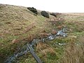 Moorland stream coming from Delves Tarn - geograph.org.uk - 4358612.jpg 1,024 × 768; 161 KB
-

-
 Old Boundary Marker on Beamsley Moor - geograph.org.uk - 6035539.jpg 485 × 640; 399 KB
-
 Old Boundary Marker on Beamsley Moor - geograph.org.uk - 6035803.jpg 481 × 640; 395 KB
-

-

-
-

-

-
 Open space along the road at Langbar - geograph.org.uk - 4358603.jpg 1,024 × 615; 120 KB
-
 Path to Beamsley Beacon - geograph.org.uk - 3244018.jpg 3,072 × 4,608; 1.51 MB
-
 Permissive Path to Beamsley Beacon - geograph.org.uk - 6119719.jpg 1,024 × 683; 186 KB
-
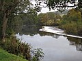
 River Wharfe - geograph.org.uk - 5408081.jpg 640 × 427; 135 KB
-

-
 River Wharfe, Low Mill Village - geograph.org.uk - 5266789.jpg 640 × 480; 138 KB
-
 Road across Middleton Low Moor - geograph.org.uk - 2174116.jpg 3,264 × 2,448; 1.63 MB
-
 Rough Pasture behind Chapel House - geograph.org.uk - 2678098.jpg 4,320 × 3,240; 4.09 MB
-
 Scarr House, Nesfield - geograph.org.uk - 3768608.jpg 1,600 × 1,200; 799 KB
-
 Someone has been playing here^ - geograph.org.uk - 3768630.jpg 1,600 × 1,200; 391 KB
-
 Spring Well Farm, Langbar - geograph.org.uk - 4358589.jpg 1,024 × 768; 129 KB
-
 Stile leading from Ilkley golf course - geograph.org.uk - 849383.jpg 480 × 640; 132 KB
-
 Stile leading on to Nesfield Road - geograph.org.uk - 849378.jpg 480 × 640; 143 KB
-
 Suspension bridge at Addingham - geograph.org.uk - 4803367.jpg 1,600 × 1,200; 668 KB
-
 The "Postman's Shelter", Nesfield, Ilkley (5611147478).jpg 3,000 × 4,000; 10.93 MB
-
 The Dales Way - geograph.org.uk - 3191740.jpg 800 × 600; 161 KB
-

-

-
 The Postman's Shelter, Nesfield - geograph.org.uk - 3213803.jpg 800 × 600; 174 KB
-
 The Postman's Shelter, Nesfield - geograph.org.uk - 3213804.jpg 800 × 600; 193 KB
-
 The practice ground at Ilkley Golf Club - geograph.org.uk - 3213793.jpg 800 × 600; 129 KB
-
 The River Wharfe near Low Mill Village - geograph.org.uk - 5268571.jpg 6,000 × 4,000; 4.16 MB
-
 Tour de France celebration - geograph.org.uk - 6152868.jpg 2,816 × 2,112; 1.09 MB
-
 Unmapped path on Middleton Low Moor - geograph.org.uk - 4358642.jpg 1,024 × 615; 96 KB
-
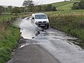
 Van, bales, wire and rubble - geograph.org.uk - 2159423.jpg 640 × 480; 92 KB
-

-
 Walking down towards Addingham - geograph.org.uk - 2159437.jpg 1,024 × 768; 233 KB
-
 West Hall Farm - geograph.org.uk - 2159442.jpg 640 × 480; 53 KB
-
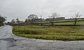
 West Hall Farm north of Nesfield - geograph.org.uk - 3213837.jpg 800 × 600; 80 KB
-
 West Hall Farm north of Nesfield - geograph.org.uk - 3213839.jpg 800 × 600; 157 KB
-
 West Hall Lane between Nesfield and Beamsley - geograph.org.uk - 5829188.jpg 4,000 × 3,000; 3.55 MB
-
 West Hall Lane north of Nesfield - geograph.org.uk - 3213809.jpg 800 × 600; 135 KB
-
 Western End of Ilkley Golf Course - geograph.org.uk - 6271482.jpg 5,184 × 3,456; 5.68 MB
-
 Wharfedale, near Ilkley - geograph.org.uk - 1278886.jpg 640 × 480; 88 KB


.jpg)


