Category:Neunkirchen (Saar)
Jump to navigation
Jump to search
Deutsch: Neunkirchen (Saar) ist eine saarländische Kreisstadt an der Blies; sie ist zirka 20 km nordöstlich der Landeshauptstadt Saarbrücken gelegen. Mit rund 49.000 Einwohnern ist sie die zweitgrößte Stadt des Saarlandes.
English: Neunkirchen is a town and a municipality in Saarland, Germany. It is the largest town in, but not the seat of the district of Neunkirchen. It is situated on the river Blies, approx. 20 km northeast of Saarbrücken. With about 50,000 inhabitants, Neunkirchen is the 2nd largest city of the Saarland. The name of the town means "new church" (but not "nine churches" as one might be tempted to assume). In the past, Neunkirchen's economy has been shaped almost exclusively by coal and steel. With the decline of this industry sector, Neunkirchen's economy had to face drastic changes and underwent a significant shift towards the service sector, although smaller industries still remain.
Français : Neunkirchen est une ville située en Sarre sur la Blies. Avec environ 50.000 habitants, elle est, après Sarrebruck (situé à 20 km au sud-ouest), la deuxième ville du Land.
Nederlands: Neunkirchen is een plaats in de Duitse deelstaat Saarland, gelegen in het district Neunkirchen. De stad heeft ongeveer 50.900 inwoners.
Polski: Neunkirchen - miasto w zachodniej części Niemiec, w kraju związkowym Saara, w Zagłębiu Saary. Około 52 tys. mieszkańców.
town and a municipality in Saarland, Germany | |||||
| Upload media | |||||
| Instance of |
| ||||
|---|---|---|---|---|---|
| Location |
| ||||
| Head of government | |||||
| Significant event |
| ||||
| Population |
| ||||
| Area |
| ||||
| Elevation above sea level |
| ||||
| Different from | |||||
| official website | |||||
 | |||||
Subcategories
This category has the following 25 subcategories, out of 25 total.
B
- Braumanufaktur Bach (5 F)
C
D
E
F
- Flora of Neunkirchen (Saar) (8 F)
H
- Heinitzer Weiher (6 F)
J
L
- Landschaftsschutzgebiet Geissheck (empty)
M
- Menschenhaus (7 F)
N
- Naturschutzgebiet Kasbruch (6 F)
P
S
T
Z
Pages in category "Neunkirchen (Saar)"
This category contains only the following page.
Media in category "Neunkirchen (Saar)"
The following 75 files are in this category, out of 75 total.
-
DEU Neunkirchen (Saar) COA.svg 512 × 597; 4 KB
-
2021-06-16 Neunkirchen Altes HüttenAreal (AHA).jpg 3,600 × 2,400; 2.25 MB
-
Altes Hüttenareal Neunkirchen.png 3,115 × 754; 3.06 MB
-
Atlas des concessions du terrain houiller de la Sarre (feuille 30).jpg 6,442 × 4,460; 11.04 MB
-
Atlas des concessions du terrain houiller de la Sarre (feuille 37).jpg 6,375 × 4,447; 14.31 MB
-
Bandfoto 2019 SV 250px.jpg 250 × 121; 10 KB
-
Bandfoto 2019 SV.jpg 1,600 × 777; 181 KB
-
Bücherzelle in Neunkirchen.jpg 3,024 × 4,032; 1.79 MB
-
Bürgermeister Ludwig-Straße.jpg 1,287 × 1,987; 1.25 MB
-
Clara Vogedes - Deutschland, Neunkirchen, 1935.jpg 3,093 × 2,721; 1.29 MB
-
Clara Vogedes - Deutschland, Neunkirchen, Mann im Eisenhütte, 1937.jpg 3,408 × 2,334; 1.32 MB
-
DB Baureihe 181 201-5.jpg 5,312 × 2,988; 7.65 MB
-
De-Neunkirchen.ogg 2.3 s; 22 KB
-
DEU Wiebelskirchen 1954 COA.svg 512 × 597; 878 bytes
-
Elektro Anschütz.jpg 1,740 × 2,138; 1.67 MB
-
Entrance to the Hauptfriedhof Scheib.JPG 2,560 × 1,920; 2 MB
-
Erbbegräbnisstätte familie stumm.JPG 2,448 × 3,264; 6.08 MB
-
Erinnerung Bombenangriff 4.11.1944.jpg 4,000 × 1,800; 4.23 MB
-
Evangelische Pauluskirche Neunkirchen 2.jpg 3,377 × 1,760; 2.15 MB
-
Evangelische Pauluskirche Neunkirchen.jpg 2,332 × 1,406; 1.18 MB
-
Flagge Neunkirchen.svg 500 × 300; 9 KB
-
Foerderkonzept GaS Stand 2012.png 901 × 704; 52 KB
-
Gebäude der KEW.jpg 3,341 × 2,228; 2.42 MB
-
Germany - Neunkirchen-Saar – Saarpark-Center vor den ehemalige Hüttenanlagen - panoramio.jpg 5,839 × 2,909; 1.86 MB
-
Gullideckel Neunkirchen Saar.jpg 1,749 × 1,700; 1.89 MB
-
Intercity-ExpressNeunkirchenL1070816 (2).jpg 1,488 × 740; 209 KB
-
Karl Schneider Grab.JPG 1,920 × 2,560; 2.02 MB
-
Karte Kreis Neunkirchen Neunkirchen.png 638 × 434; 155 KB
-
Konrad-Adenauer-Brücke, Neunkirchen (Saar) 01.JPG 3,968 × 2,976; 2.49 MB
-
Konrad-Adenauer-Brücke, Neunkirchen (Saar) 03.JPG 3,968 × 2,976; 2.76 MB
-
Konrad-Adenauer-Brücke, Neunkirchen (Saar).JPG 3,968 × 2,976; 2.62 MB
-
LASB K Hellwig 0936.tif 4,063 × 3,086; 35.55 MB
-
Logo GaS - DIN A0.svg 2,384 × 3,370; 2 KB
-
Luisenstraße (Kreuzung).jpg 4,000 × 1,800; 3.07 MB
-
Men at work - panoramio (1).jpg 4,812 × 1,081; 482 KB
-
Mond über NK 1.jpg 1,600 × 1,200; 345 KB
-
Nachtschicht Neunkirchen.jpg 2,082 × 1,560; 2.09 MB
-
Neunkirchen (Saar) Ansicht 2015-04-03 01.JPG 4,987 × 3,321; 5.68 MB
-
Neunkirchen (Saar) Ansicht 2015-04-03 02.JPG 5,184 × 3,456; 6.31 MB
-
Neunkirchen (Saar) Ansicht 2015-04-03 03.JPG 5,184 × 3,456; 5.47 MB
-
Neunkirchen (Saar) Ansicht 2015-04-03 04.JPG 5,001 × 3,456; 5.19 MB
-
Neunkirchen (Saar) Ansicht 2015-04-03 05.JPG 3,549 × 2,242; 2.34 MB
-
Neunkirchen (Saar) Hofgut Menschenhaus.JPG 3,958 × 2,942; 5.62 MB
-
Neunkirchen (Saar) Kirchen.JPG 3,479 × 2,628; 3.65 MB
-
Neunkirchen (Saarland) Wikivoyage Banner.JPG 2,532 × 362; 801 KB
-
Neunkirchen 11.jpg 2,848 × 1,472; 2.29 MB
-
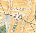
Neunkirchen 1564 Ausschnitt.jpg 703 × 657; 225 KB
-
Neunkirchen 1564.jpg 3,264 × 2,448; 950 KB
-
Neunkirchen Explosions 1933.jpg 283 × 170; 10 KB
-
Neunkirchen Saar Ansicht.JPG 2,532 × 757; 1.24 MB
-
Neunkirchen, Germany - panoramio (1).jpg 10,336 × 1,280; 743 KB
-
Neunkirchen-Saar – Hüttenbergstraße - panoramio.jpg 2,569 × 3,448; 1.49 MB
-
Neunkirchen-Saar – Saarpark-Center am Stummplatz - panoramio.jpg 4,320 × 2,045; 1.57 MB
-
Neunkirchen-Saar – Saarpark-Center vor den ehemalige Hüttenanlagen - panoramio.jpg 4,320 × 2,021; 1.54 MB
-
NKMenschenhaus.jpg 2,592 × 1,944; 1.27 MB
-
Palatinatus Rheni (Merian) 160.jpg 2,000 × 2,890; 839 KB
-
Parkweiher-Neunkirchen.JPG 1,600 × 1,200; 364 KB
-
Saar 1949 288 Bliestal mit Wiebelskirchen.jpg 640 × 1,000; 497 KB
-
Saar 1955 358 Rotary-Club.jpg 640 × 1,000; 477 KB
-
Schauinslandweg.20jpg.jpg 2,592 × 1,944; 2.97 MB
-
Schiffweiler, Blick von der Halde Reden nach Neunkirchen.jpg 4,158 × 2,840; 3.47 MB
-
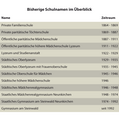
Schulnamen GaS Stand 2012.png 2,339 × 2,363; 69 KB
-
Schulnamen im Überblick Stand 2012.svg 842 × 850; 5 KB
-
Sender Neunkirchen (Saar)-Kuchenberg.jpg 624 × 2,032; 365 KB
-
StaticAge.jpg 3,968 × 2,976; 3.05 MB
-
Wagwiesental Neunkirchen Saar 2.jpg 4,000 × 1,800; 4.05 MB
-
Wagwiesental Neunkirchen Saar.jpg 2,228 × 1,271; 1.26 MB
-
Wagwiesental Schule.jpg 250 × 183; 26 KB
-
Wand der Erinnerung Bombenangriff 4.11.1944.jpg 1,685 × 3,998; 3.32 MB
-
Wappen Hangard.png 300 × 350; 36 KB
-
Wappen Neunkirchen (Saar).jpg 191 × 205; 10 KB
-
Wappen Wiebelskirchen.png 350 × 373; 36 KB
-
Zeitleiste GaS Stand 2012.png 2,835 × 850; 168 KB
-
Zeitleiste GaS Stand 2012.svg 5,669 × 1,701; 34 KB
-
Zweigwahl GaS Stand 2012.png 2,339 × 1,654; 48 KB


