Category:Newburgh, Lancashire
Jump to navigation
Jump to search
English: Newburgh (population 1,080) is a rural village and civil parish in Lancashire, England. (→Newburgh, Lancashire)
Nederlands: Newburgh is een plaats en civil parish in het bestuurlijke gebied West Lancashire, in het Engelse graafschap Lancashire met 1.080 inwoners. (→Newburgh (Lancashire))
Polski: Newburgh – wieś w Anglii, w hrabstwie Lancashire, w dystrykcie West Lancashire. Leży 39 km na zachód od miasta Manchester i 293 km na północny zachód od Londynu. W 2001 miejscowość liczyła 1080 mieszkańców. (→Newburgh (Lancashire))
rural village and civil parish in Lancashire, England  | |||||
| Upload media | |||||
| Instance of | |||||
|---|---|---|---|---|---|
| Location | West Lancashire, Lancashire, North West England, England | ||||
 | |||||
Subcategories
This category has the following 3 subcategories, out of 3 total.
Media in category "Newburgh, Lancashire"
The following 184 files are in this category, out of 184 total.
-

-
 A tunnel under the Leeds Liverpool Canal - Geograph 2485180.jpg 3,064 × 2,090; 3.89 MB
-
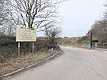
 A5209 Course Lane looking west - geograph.org.uk - 3322923.jpg 640 × 480; 44 KB
-
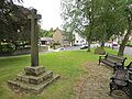
 Ancient cross and telephone box - geograph.org.uk - 3892641.jpg 768 × 1,024; 570 KB
-
 Aqueduct 35A crossing the River Tawd - geograph.org.uk - 5173015.jpg 800 × 600; 196 KB
-

-
 Aqueduct on Deans Lane - Geograph 2078746.jpg 1,600 × 1,198; 576 KB
-
 Aqueduct on Deans Lane - Geograph 2078754.jpg 1,600 × 1,198; 603 KB
-
 Ash Brow (A5209) - geograph.org.uk - 2088535.jpg 800 × 480; 194 KB
-
 Ash Brow (A5209) - geograph.org.uk - 4222342.jpg 640 × 480; 86 KB
-
 Ash Brow - geograph.org.uk - 1385946.jpg 480 × 640; 96 KB
-
 Back Lane, Newburgh - geograph.org.uk - 2090070.jpg 640 × 480; 151 KB
-
 Back Lane, Newburgh - geograph.org.uk - 2680836.jpg 4,592 × 3,056; 6.48 MB
-
 Back Lane, Newburgh - geograph.org.uk - 3892630.jpg 1,024 × 768; 671 KB
-
 Back lane, Newburgh - geograph.org.uk - 4369634.jpg 1,024 × 768; 200 KB
-
 Back Lane-Deans Lane Junction - geograph.org.uk - 2090077.jpg 640 × 480; 188 KB
-
 Barn conversion on Back Lane - geograph.org.uk - 2077980.jpg 1,600 × 1,198; 428 KB
-

-
 Bridge over Leeds and Liverpool Canal - geograph.org.uk - 330346.jpg 640 × 480; 104 KB
-
 Canal and railway - geograph.org.uk - 3892625.jpg 1,024 × 768; 585 KB
-
 Canal overflow to Tawd Culvert - geograph.org.uk - 4369514.jpg 1,024 × 820; 556 KB
-

-

-
 Christ Church, Newburgh - geograph.org.uk - 2089975.jpg 800 × 600; 520 KB
-
 Christ Church, Newburgh - geograph.org.uk - 2089980.jpg 800 × 600; 372 KB
-
 Christ Church, Newburgh - geograph.org.uk - 2089988.jpg 800 × 600; 301 KB
-
 Christ Church, Newburgh - geograph.org.uk - 2680801.jpg 4,443 × 2,957; 7.11 MB
-
 Christ Church, Newburgh - geograph.org.uk - 3892632.jpg 1,024 × 753; 739 KB
-
 Christ Church, Newburgh - geograph.org.uk - 4221575.jpg 640 × 480; 94 KB
-
 Christmas Tree Farm, Course Lane, Lathom - geograph.org.uk - 4369496.jpg 1,024 × 820; 494 KB
-
 Churchyard in Newburgh - geograph.org.uk - 3892636.jpg 1,024 × 768; 803 KB
-
 Coarse Bridge - geograph.org.uk - 2090100.jpg 640 × 480; 161 KB
-
 Coarse Lane (A5209) - geograph.org.uk - 2090086.jpg 640 × 480; 122 KB
-
 Cobb's Brow Lane - geograph.org.uk - 2971498.jpg 1,024 × 768; 232 KB
-
 Cobb's Brow Lane Closed - geograph.org.uk - 4846973.jpg 1,200 × 899; 518 KB
-
 Cobb's Brow Lane looking north - geograph.org.uk - 3322914.jpg 640 × 480; 94 KB
-
 Cobb's Brow Lane meets the A5209 - geograph.org.uk - 3322916.jpg 640 × 480; 99 KB
-
 Cobb's Brow Lane near Round O Quarry - geograph.org.uk - 2971532.jpg 640 × 481; 70 KB
-
 Conservation Area, Newburgh, Lancashire - geograph.org.uk - 2349451.jpg 3,069 × 2,056; 1.8 MB
-
 Cottage, Newburgh, Lancashire - Geograph 2349446.jpg 3,072 × 2,304; 1.55 MB
-
 Cottages, Newburgh, Lancashire - Geograph 2349440.jpg 3,063 × 2,000; 1.31 MB
-
 Cottages, Newburgh, Lancashire - geograph.org.uk - 2349432.jpg 3,072 × 2,304; 1.25 MB
-
 Course Lane (A5209), Newburgh - geograph.org.uk - 4221570.jpg 640 × 480; 84 KB
-
 Culvert Lane, Newburgh - Geograph 4369340.jpg 1,024 × 768; 398 KB
-
 Culvert Lane, Newburgh - geograph.org.uk - 4369322.jpg 1,024 × 768; 276 KB
-
 Deans Lane Crossing - geograph.org.uk - 5904707.jpg 1,600 × 1,067; 561 KB
-
 Electricity cable work on Cobb's Brow Lane - geograph.org.uk - 4846994.jpg 1,200 × 900; 626 KB
-
 Entering Newburgh - geograph.org.uk - 4221566.jpg 640 × 480; 75 KB
-
 Entrance to Round O Quarry on Cobb's Brow Lane - geograph.org.uk - 4846983.jpg 1,200 × 900; 610 KB
-
 Field of wheat - geograph.org.uk - 4357702.jpg 800 × 600; 429 KB
-
 Fields beside Frog Lane, Hoscar - geograph.org.uk - 5904729.jpg 1,600 × 1,067; 557 KB
-
 Fields beside the River Douglas at Parbold - geograph.org.uk - 5904698.jpg 1,600 × 1,065; 397 KB
-
 Fields near Woodcock Hall - geograph.org.uk - 2465907.jpg 4,592 × 3,056; 5.49 MB
-
 Flooded quarry in Delph Wood, Newburgh - geograph.org.uk - 4847945.jpg 1,200 × 900; 599 KB
-

-

-
 Footbridge over the River Tawd - geograph.org.uk - 2077938.jpg 1,600 × 1,198; 816 KB
-

-

-

-
 Footpath to Newburgh off Cobb's Brow Lane - geograph.org.uk - 4847000.jpg 1,200 × 900; 579 KB
-
 Footpath to Newburgh, East of Cobb's Brow Lane - geograph.org.uk - 4847028.jpg 961 × 1,200; 603 KB
-
 Giant's Hall - geograph.org.uk - 5129489.jpg 5,184 × 3,456; 1.67 MB
-
 Grazing north of Course Lane (A5209) - geograph.org.uk - 4221564.jpg 640 × 480; 109 KB
-
 Green Lane, Lathom - geograph.org.uk - 4846979.jpg 1,200 × 900; 595 KB
-
 Green, Newburgh - Geograph 4357713.jpg 800 × 600; 491 KB
-
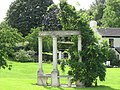 Hawthorn Cottage Garden Folly - geograph.org.uk - 1498298.jpg 640 × 480; 128 KB
-
 Hoscar Station - geograph.org.uk - 5129575.jpg 3,735 × 2,069; 2.02 MB
-
 House on Deans Lane, Newburgh - geograph.org.uk - 4369347.jpg 1,024 × 768; 257 KB
-
 Houses on Deans Lane - geograph.org.uk - 5173001.jpg 800 × 600; 159 KB
-
 Houses on Deans Lane near Newburgh - geograph.org.uk - 6182517.jpg 1,600 × 1,065; 598 KB
-
 Houses on Deans Lane, Newburgh - geograph.org.uk - 4369359.jpg 1,024 × 818; 390 KB
-
 Houses on Higher Lane - geograph.org.uk - 3284502.jpg 3,636 × 2,891; 1.92 MB
-
 I don't know what this is - geograph.org.uk - 2699613.jpg 4,592 × 2,682; 7.09 MB
-

-
 Junction of Back Lane and Dean's Lane, Newburgh - geograph.org.uk - 4369647.jpg 1,024 × 821; 314 KB
-
 Lathom , Leeds and Liverpool Canal - geograph.org.uk - 6298110.jpg 6,000 × 4,000; 4.62 MB
-
 Leeds and Liverpool Canal - geograph.org.uk - 5129490.jpg 5,125 × 3,136; 1.96 MB
-
 Leeds and Liverpool Canal near Parbold - geograph.org.uk - 5172970.jpg 800 × 579; 136 KB
-
 Leeds Liverpool canal at Parbold - geograph.org.uk - 3892616.jpg 1,024 × 768; 581 KB
-
 Leeds Liverpool canal near Newburgh - geograph.org.uk - 3892627.jpg 1,024 × 768; 585 KB
-
 Leeds Liverpool canal near Parbold - geograph.org.uk - 3892622.jpg 1,024 × 767; 561 KB
-
 Leeds ^ Liverpool Canal - geograph.org.uk - 6182434.jpg 1,600 × 1,065; 678 KB
-
 Leeds ^ Liverpool Canal - geograph.org.uk - 6182436.jpg 1,600 × 1,065; 613 KB
-
 Leeds ^ Liverpool Canal - geograph.org.uk - 6182443.jpg 1,600 × 1,065; 472 KB
-
 Leeds ^ Liverpool Canal - geograph.org.uk - 6182445.jpg 1,600 × 1,065; 466 KB
-
 Leeds ^ Liverpool Canal - geograph.org.uk - 6182449.jpg 1,600 × 1,065; 645 KB
-
 Leeds ^ Liverpool Canal - geograph.org.uk - 6182450.jpg 1,600 × 1,065; 602 KB
-
 Leeds ^ Liverpool Canal - geograph.org.uk - 6182453.jpg 1,600 × 1,065; 747 KB
-
 Leeds ^ Liverpool Canal - geograph.org.uk - 6182467.jpg 1,600 × 1,065; 647 KB
-
 Leeds ^ Liverpool Canal - geograph.org.uk - 6182468.jpg 1,600 × 1,065; 617 KB
-
 Leeds ^ Liverpool Canal - geograph.org.uk - 6182471.jpg 1,600 × 1,065; 718 KB
-
 Leeds ^ Liverpool Canal - geograph.org.uk - 6182483.jpg 1,600 × 1,065; 495 KB
-
 Leeds ^ Liverpool Canal - geograph.org.uk - 6182486.jpg 1,600 × 1,065; 863 KB
-
 Leeds ^ Liverpool Canal - geograph.org.uk - 6182522.jpg 1,600 × 1,065; 830 KB
-
 Leeds ^ Liverpool Canal - geograph.org.uk - 6182524.jpg 1,600 × 1,065; 711 KB
-
 Leeds ^ Liverpool Canal - geograph.org.uk - 6182527.jpg 1,600 × 1,065; 637 KB
-
 Leeds ^ Liverpool Canal - geograph.org.uk - 6182531.jpg 1,600 × 1,065; 615 KB
-
 Leeds ^ Liverpool Canal - geograph.org.uk - 6182535.jpg 1,600 × 1,065; 896 KB
-
 Leeds ^ Liverpool Canal - geograph.org.uk - 6182537.jpg 1,600 × 1,065; 523 KB
-
 Leeds ^ Liverpool Canal - geograph.org.uk - 6182538.jpg 1,600 × 1,065; 787 KB
-
 Leeds ^ Liverpool Canal - geograph.org.uk - 6182540.jpg 1,600 × 1,065; 482 KB
-
 Leeds ^ Liverpool Canal - geograph.org.uk - 6182541.jpg 1,600 × 1,065; 721 KB
-
 Leeds ^ Liverpool Canal - geograph.org.uk - 6182549.jpg 1,600 × 1,065; 521 KB
-
 Leeds ^ Liverpool Canal - geograph.org.uk - 6182552.jpg 1,600 × 1,065; 576 KB
-
 Leeds ^ Liverpool Canal - geograph.org.uk - 6182554.jpg 1,600 × 1,065; 572 KB
-
 Leeds ^ Liverpool Canal - geograph.org.uk - 6182557.jpg 1,600 × 1,065; 660 KB
-
 Leeds ^ Liverpool Canal - geograph.org.uk - 6182561.jpg 1,600 × 1,065; 894 KB
-
 Lowes Farm - geograph.org.uk - 128434.jpg 640 × 426; 78 KB
-
 Milepost on Leeds Liverpool Canal - geograph.org.uk - 2078762.jpg 1,600 × 1,198; 802 KB
-
 Mug House - geograph.org.uk - 128432.jpg 640 × 426; 73 KB
-
 Newburgh , Building - geograph.org.uk - 6298112.jpg 6,000 × 4,000; 4.96 MB
-
 Newburgh , Course Lane A5209 - geograph.org.uk - 6298102.jpg 6,000 × 4,000; 7.26 MB
-
 Newburgh , Course Lane A5209 - geograph.org.uk - 6298104.jpg 6,000 × 4,000; 5.21 MB
-
 Newburgh , Farm Track - geograph.org.uk - 6298105.jpg 6,000 × 4,000; 6.26 MB
-
 Newburgh , Higher Lane - geograph.org.uk - 6298099.jpg 6,000 × 4,000; 6.68 MB
-
 Newburgh , Houses - geograph.org.uk - 6298111.jpg 6,000 × 4,000; 6.47 MB
-
 Newburgh , Moorcroft House - geograph.org.uk - 6298101.jpg 6,000 × 4,000; 6.86 MB
-
 Newburgh , Red Lion Hotel - geograph.org.uk - 6298100.jpg 6,000 × 4,000; 5.23 MB
-
 Newburgh , Tabby's Nook - geograph.org.uk - 6298103.jpg 6,000 × 4,000; 7.67 MB
-
 Newburgh , War Memorial - geograph.org.uk - 6298114.jpg 6,000 × 4,000; 6.95 MB
-
 Newburgh Post Office - geograph.org.uk - 2089999.jpg 800 × 600; 256 KB
-
 Newburgh Post Office - geograph.org.uk - 2090007.jpg 800 × 600; 407 KB
-
 Newburgh Post Office and Tea Rooms, Lancashire - geograph.org.uk - 2640285.jpg 1,600 × 1,200; 480 KB
-
 Newburgh War Memorial - geograph.org.uk - 4221573.jpg 640 × 480; 110 KB
-
 NewburghPostOffice.JPG 4,000 × 3,000; 961 KB
-
 NewburghVillageCross.JPG 3,000 × 4,000; 912 KB
-
 On the edge - geograph.org.uk - 128429.jpg 640 × 426; 61 KB
-
 Path between Tears Farm and Delph Wood, Newburgh - geograph.org.uk - 4847284.jpg 1,200 × 900; 529 KB
-
 Path leading down to Deans Lane - geograph.org.uk - 6182484.jpg 1,600 × 1,065; 807 KB
-
 Path leading to Ash Lane, A5209 - geograph.org.uk - 6182440.jpg 1,600 × 1,065; 552 KB
-
-
 Pillbox Fortification on the Canal - geograph.org.uk - 52368.jpg 640 × 480; 156 KB
-
 Pillbox on the Leeds Liverpool Canal near Hoscar - geograph.org.uk - 2279998.jpg 1,600 × 1,198; 2.45 MB
-
 Plaque, Newburgh - geograph.org.uk - 2349424.jpg 3,072 × 2,304; 1.55 MB
-
 Post Office and Tea Rooms in Newburgh - geograph.org.uk - 3892638.jpg 1,024 × 763; 576 KB
-
 Post Office and Village Stores, Newburgh - geograph.org.uk - 702272.jpg 640 × 480; 197 KB
-
 Prescott's Farm - geograph.org.uk - 2465928.jpg 4,420 × 1,894; 4.8 MB
-
 Protest against Hoscar Solar Farm - geograph.org.uk - 4369599.jpg 1,024 × 768; 254 KB
-
 Red Lion Hotel - geograph.org.uk - 2088540.jpg 800 × 479; 179 KB
-
 Red Lion Hotel, Newburgh - geograph.org.uk - 4221578.jpg 640 × 480; 59 KB
-
 Red Lion Inn, Newburgh - geograph.org.uk - 2971494.jpg 640 × 441; 50 KB
-
-
 Sandy Close off Back Lane, Newburgh - geograph.org.uk - 4369651.jpg 1,024 × 768; 289 KB
-
 Sandy Lane, Newburgh - geograph.org.uk - 2659895.jpg 640 × 480; 100 KB
-
 Sign for the Red Lion Hotel, Newburgh - geograph.org.uk - 4221611.jpg 851 × 923; 241 KB
-
-
 Snape Cottage, Newburgh.jpg 1,024 × 768; 232 KB
-
 Spencer's Bridge - geograph.org.uk - 5402260.jpg 5,184 × 3,456; 1.72 MB
-
 Spencer's Bridge, Hollowford Lane - geograph.org.uk - 4369376.jpg 1,024 × 768; 250 KB
-
 Spencer's Bridge, Hollowford Lane - geograph.org.uk - 4369563.jpg 1,024 × 768; 304 KB
-
 Spencer's Bridge, Newburgh - geograph.org.uk - 1713242.jpg 3,648 × 2,736; 2.48 MB
-
 Spencer's Swing Bridge No 36 - geograph.org.uk - 4385808.jpg 2,556 × 1,914; 2.3 MB
-
 Spencer's Swing Bridge No 36 - geograph.org.uk - 5173009.jpg 800 × 511; 134 KB
-
 Spencer's Swing Bridge, Newburgh - geograph.org.uk - 4369382.jpg 1,024 × 769; 291 KB
-
 Steep steps down to the River Douglas - geograph.org.uk - 3892618.jpg 1,024 × 768; 811 KB
-
 Steps to stream East of Cobb's Brow Lane - geograph.org.uk - 4847035.jpg 1,200 × 900; 612 KB
-
 Stocks Farm, Hoscar - geograph.org.uk - 5904719.jpg 1,600 × 1,067; 576 KB
-

-
 Stone cross, Newburgh - geograph.org.uk - 1385961.jpg 480 × 640; 94 KB
-
 Stone Cross, Newburgh, Lancashire - geograph.org.uk - 2349428.jpg 2,304 × 3,072; 1.58 MB
-
 Stream East of Cobb's Brow Lane - geograph.org.uk - 4847046.jpg 900 × 1,200; 610 KB
-

-
 Tawd Culvert - geograph.org.uk - 4369430.jpg 768 × 1,024; 461 KB
-
 Tears Lane near Tears Farm, Newburgh - geograph.org.uk - 4847280.jpg 1,200 × 900; 491 KB
-
 The Leeds and Liverpool Canal - geograph.org.uk - 2485226.jpg 4,592 × 3,056; 5.99 MB
-
 The Leeds and Liverpool Canal at Newburgh - geograph.org.uk - 3440488.jpg 3,264 × 2,448; 3.13 MB
-
 The Leeds and Liverpool Canal near Parbold - geograph.org.uk - 3440582.jpg 3,264 × 2,448; 5.04 MB
-
 The Leeds Liverpool Canal - geograph.org.uk - 2485211.jpg 4,592 × 3,056; 7.39 MB
-
 The Leeds ^ Liverpool Canal from Spencer's Bridge - geograph.org.uk - 3887100.jpg 3,374 × 1,977; 2.74 MB
-
 The Red Lion at Newburgh - geograph.org.uk - 2465868.jpg 4,592 × 3,056; 4.64 MB
-
 The Red Lion at Newburgh - geograph.org.uk - 3892644.jpg 1,024 × 602; 345 KB
-
 The River Douglas - geograph.org.uk - 4222344.jpg 640 × 480; 92 KB
-
 The track towards the River Tawd - geograph.org.uk - 2699581.jpg 4,592 × 3,056; 6.81 MB
-
 The track towards the River Tawd enters woodland - geograph.org.uk - 2699594.jpg 4,592 × 3,056; 7.1 MB
-

-
 Track to Newburgh - geograph.org.uk - 3892628.jpg 1,024 × 768; 787 KB
-
 Trees by the River Tawd - geograph.org.uk - 2699609.jpg 4,592 × 2,337; 5.81 MB
-
 View Of Minor Road To Giant's Hall - geograph.org.uk - 4385781.jpg 2,560 × 1,920; 2.83 MB
-
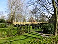
 Village Green, Newburgh (2) - geograph.org.uk - 3756281.jpg 5,184 × 3,456; 3.33 MB
-
 Village Green, Newburgh - geograph.org.uk - 3756274.jpg 4,787 × 3,305; 3.12 MB
-
 VillagePumpInNewburgh.JPG 3,000 × 4,000; 1,006 KB
-

-

_9_Ashbrow,_Newburgh_Village,_WN8_7NF_-_geograph.org.uk_-_2349458.jpg)


_-_geograph.org.uk_-_2088535.jpg)
_-_geograph.org.uk_-_4222342.jpg)


_-_geograph.org.uk_-_2090086.jpg)


,_Newburgh_-_geograph.org.uk_-_4221570.jpg)


_-_geograph.org.uk_-_4221564.jpg)


_-_geograph.org.uk_-_3756281.jpg)


,_Leeds_%5E_Liverpool_Canal,_Spencer%27s_Bridge_mine_sockets_(38)_-_geograph.org.uk_-_6205569.jpg)