Category:Newington, Folkestone and Hythe
Jump to navigation
Jump to search
English: Category:Villages in Kent
village and civil parish in Folkestone and Hythe, Kent, England  | |||||
| Upload media | |||||
| Instance of | |||||
|---|---|---|---|---|---|
| Location | Folkestone and Hythe, Kent, South East England, England | ||||
| Different from | |||||
 | |||||
Subcategories
This category has the following 2 subcategories, out of 2 total.
N
Media in category "Newington, Folkestone and Hythe"
The following 200 files are in this category, out of 380 total.
(previous page) (next page)-
 A multiplicity of walking routes - geograph.org.uk - 2115908.jpg 1,280 × 960; 616 KB
-
 A Wood Entrance - panoramio.jpg 2,048 × 1,536; 1.13 MB
-
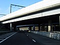
 A20 under Bridges - geograph.org.uk - 5122608.jpg 640 × 480; 66 KB
-
 Abutments of former railway bridge in Peene - geograph.org.uk - 5780207.jpg 5,184 × 3,888; 7 MB
-
 Access Road to Channel Tunnel Terminal - geograph.org.uk - 2267524.jpg 2,272 × 1,704; 726 KB
-
 Access Road to Channel Tunnel Terminal - geograph.org.uk - 2267552.jpg 2,272 × 1,704; 317 KB
-
 Access Road to Channel Tunnel Terminal - geograph.org.uk - 2267561.jpg 2,272 × 1,704; 294 KB
-
 Access Road to Channel Tunnel Terminal - geograph.org.uk - 2267576.jpg 2,272 × 1,704; 400 KB
-
 Access Road to Channel Tunnel Terminal - geograph.org.uk - 2267620.jpg 2,272 × 1,704; 888 KB
-
 Access road to Cheriton Terminus - geograph.org.uk - 2167161.jpg 3,072 × 2,304; 1.51 MB
-
 Another Pill Box - geograph.org.uk - 2434174.jpg 1,024 × 768; 282 KB
-
 Approaching Junction 12 on the M20 - geograph.org.uk - 3498771.jpg 640 × 480; 92 KB
-
 Approaching the Channel Tunnel - geograph.org.uk - 5100785.jpg 640 × 480; 50 KB
-
 Ashford Road (A20) - geograph.org.uk - 5797305.jpg 4,000 × 3,000; 4.98 MB
-
 Ashford Road, (A20), Newington - geograph.org.uk - 2356660.jpg 4,320 × 3,240; 4.13 MB
-
 Ashford Road, Frogholt - geograph.org.uk - 4908332.jpg 2,304 × 1,728; 838 KB
-
 At the foot of Summerhouse Hill - geograph.org.uk - 5797257.jpg 4,000 × 3,000; 4.93 MB
-
 Bargrove Cottages - geograph.org.uk - 1978274.jpg 1,024 × 768; 262 KB
-
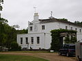 Beachborough House.jpg 640 × 480; 181 KB
-
 Blackdown Hill - geograph.org.uk - 1978281.jpg 1,024 × 683; 192 KB
-
 Blackhouse Hill Road bridge leads over the M20 Motorway - geograph.org.uk - 2167149.jpg 3,072 × 2,304; 1.71 MB
-
 Blackhouse Hill Road bridge over the CTRL - geograph.org.uk - 2167184.jpg 3,072 × 2,304; 1.64 MB
-
 Bridleway below Cheriton Hill - geograph.org.uk - 2164862.jpg 3,072 × 2,304; 2.21 MB
-
 Bridleway bridge over the M20 Motorway - geograph.org.uk - 2165143.jpg 3,072 × 2,304; 2.01 MB
-
 Bridleway junction near the M20 - geograph.org.uk - 2165175.jpg 3,072 × 2,304; 2.04 MB
-
 Bridleway junction on Elham Valley Way near Seabrook Valley - geograph.org.uk - 2165672.jpg 3,072 × 2,304; 2.54 MB
-
 Bridleway leading to Shuttlesfield - geograph.org.uk - 6396744.jpg 4,137 × 2,943; 2.26 MB
-
 Bridleway leading to Shuttlesfield - geograph.org.uk - 6396746.jpg 4,536 × 3,255; 2.04 MB
-
 Bridleway leading to Shuttlesfield - geograph.org.uk - 6396749.jpg 5,173 × 3,545; 1.99 MB
-
 Bridleway to Paddlesworth - geograph.org.uk - 2107685.jpg 3,072 × 2,304; 2.52 MB
-
 Buildings on Home Farm - geograph.org.uk - 1526649.jpg 640 × 480; 176 KB
-
 Burned-out trailer in field south of Arpinge - geograph.org.uk - 5338201.jpg 1,600 × 1,064; 415 KB
-
 Canterbury Road - geograph.org.uk - 1955707.jpg 1,024 × 768; 301 KB
-
 Canterbury Road and access road to Coombe Farm - geograph.org.uk - 2163564.jpg 3,072 × 2,304; 2.9 MB
-
 Car Park - Channel Tunnel Terminal - geograph.org.uk - 3601411.jpg 4,608 × 3,456; 3.39 MB
-
 Car park in Channel Tunnel waiting area - geograph.org.uk - 3008635.jpg 1,024 × 769; 219 KB
-
 Car Park, Channel Tunnel Terminal - geograph.org.uk - 3044433.jpg 1,600 × 1,069; 311 KB
-
 Cattle Grid - panoramio.jpg 1,502 × 1,572; 781 KB
-
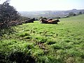 Cattle with a view near North Downs Way - geograph.org.uk - 2116278.jpg 1,280 × 960; 633 KB
-

-
 Channel Tunnel car park - geograph.org.uk - 1815147.jpg 640 × 480; 53 KB
-
-

-
 Channel Tunnel Terminal - geograph.org.uk - 2267492.jpg 2,272 × 1,704; 982 KB
-
 Channel Tunnel Terminal - geograph.org.uk - 2267608.jpg 2,272 × 1,704; 920 KB
-

-
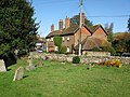 Church cottages from the churchyard - geograph.org.uk - 1526801.jpg 640 × 480; 170 KB
-
 Church Cottages, on School Lane - geograph.org.uk - 1526813.jpg 640 × 480; 159 KB
-

-

-
 Close-up of the Path Marker on the North Downs - geograph.org.uk - 2108146.jpg 2,304 × 3,072; 3.27 MB
-
 Closed Permissive path on the Elham Valley Railway - geograph.org.uk - 2164818.jpg 3,072 × 2,304; 2.39 MB
-

-
 Cow re-joins the herd - geograph.org.uk - 988535.jpg 640 × 480; 230 KB
-
 Cows under a pylon - geograph.org.uk - 988523.jpg 640 × 480; 218 KB
-
 CTRL Railway bridge over the A20 Ashford Road - geograph.org.uk - 2165133.jpg 3,072 × 2,304; 1.36 MB
-
 Disused car park and barn near Peene - geograph.org.uk - 1526639.jpg 640 × 480; 117 KB
-
 Disused pit beside the Pilgrims Way - geograph.org.uk - 989559.jpg 640 × 480; 190 KB
-
 Disused railway line bridge - geograph.org.uk - 982260.jpg 640 × 480; 268 KB
-
 Dollands Moor marshalling yard, 1992 - geograph.org.uk - 5416203.jpg 2,401 × 1,594; 2.41 MB
-
 Double stile near Summerhouse Hill - geograph.org.uk - 2163096.jpg 3,072 × 2,304; 2.6 MB
-
 Dry Valley above Coombe Wood - geograph.org.uk - 2073078.jpg 2,816 × 2,112; 2.21 MB
-
 Dry valley followed by the North Downs Way - geograph.org.uk - 2115975.jpg 1,280 × 960; 614 KB
-
 Dry valley near Swingsfield Radio Station - geograph.org.uk - 2115890.jpg 1,280 × 960; 648 KB
-

-

-
 Elham Valley Dismantled Railway - geograph.org.uk - 2164788.jpg 2,304 × 3,072; 2.32 MB
-
 Elham Valley Line Trust - geograph.org.uk - 2197864.jpg 2,272 × 1,704; 1.14 MB
-
 Elham Valley Railway in Wick Wood - geograph.org.uk - 2164838.jpg 3,072 × 2,304; 2.96 MB
-
 Elham Valley Railway through Ashley Wood - geograph.org.uk - 2164674.jpg 3,072 × 2,304; 2.51 MB
-
 Elham Valley Railway to Etchinghill - geograph.org.uk - 2164826.jpg 3,072 × 2,304; 2.36 MB
-

-
 Elham Valley Way in Ashley Wood (2) - geograph.org.uk - 2164727.jpg 3,072 × 2,304; 2.37 MB
-
 Elham Valley Way in Ashley Wood - geograph.org.uk - 2164721.jpg 3,072 × 2,304; 3.02 MB
-
 Elham Valley Way in Coombe Wood (2) - geograph.org.uk - 2163612.jpg 2,304 × 3,072; 2.84 MB
-
 Elham Valley Way in Coombe Wood - geograph.org.uk - 2163605.jpg 3,072 × 2,304; 3.04 MB
-
 Elham Valley Way to Newington - geograph.org.uk - 2165097.jpg 3,072 × 2,304; 1.97 MB
-
 Elham Valley Way to Newington - geograph.org.uk - 2165688.jpg 3,072 × 2,304; 3.03 MB
-
 Elham Valley Way towards the Seabrook Valley - geograph.org.uk - 2165182.jpg 3,072 × 2,304; 1.81 MB
-
 Enroute to France - geograph.org.uk - 3203587.jpg 640 × 480; 43 KB
-
 Entry to Ashley Wood - geograph.org.uk - 429045.jpg 480 × 640; 252 KB
-
 Eurostar Railway to the Channel Tunnel - geograph.org.uk - 2167199.jpg 3,072 × 2,304; 1.49 MB
-

-
 Eurotunnel office building - geograph.org.uk - 5661813.jpg 1,024 × 768; 143 KB
-
 Farmland near Shearins Leas Farm - geograph.org.uk - 4223134.jpg 640 × 480; 134 KB
-
 Field at Parsonage Farm - geograph.org.uk - 1978305.jpg 1,024 × 768; 215 KB
-
 Field by Coombe Farm - geograph.org.uk - 2072942.jpg 2,816 × 2,112; 2.19 MB
-
 Fields North of Penne - geograph.org.uk - 1978285.jpg 1,024 × 768; 195 KB
-
 Fishponds seen from the top of Summerhouse Hill - geograph.org.uk - 5797331.jpg 4,000 × 3,000; 4.36 MB
-
 Folkestone, M20 - geograph.org.uk - 2731675.jpg 3,648 × 2,736; 1.98 MB
-
 Footbridge over the Seabrook Stream - geograph.org.uk - 2164735.jpg 3,072 × 2,304; 3.01 MB
-
 Footpath beside Summerhouse Hill - geograph.org.uk - 2161948.jpg 3,072 × 2,304; 1.77 MB
-
 Footpath crosses Canterbury Road - geograph.org.uk - 2167101.jpg 3,072 × 2,304; 2.43 MB
-
 Footpath crosses Teddars Leas Road - geograph.org.uk - 2108255.jpg 3,072 × 2,304; 1.78 MB
-
 Footpath junction near Coombe Wood - geograph.org.uk - 2163586.jpg 3,072 × 2,304; 3.08 MB
-
 Footpath junction near Summerhouse Hill - geograph.org.uk - 2167130.jpg 3,072 × 2,304; 2.01 MB
-
 Footpath junction on the Pilgrim's Way - geograph.org.uk - 2108240.jpg 3,072 × 2,304; 3.95 MB
-

-
 Footpath on Tolsford Hill - geograph.org.uk - 2163297.jpg 3,072 × 2,304; 1.92 MB
-
 Footpath to Canterbury Road - geograph.org.uk - 2167140.jpg 3,072 × 2,304; 2.72 MB
-
 Footpath to Little Stone Wood - geograph.org.uk - 2161923.jpg 3,072 × 2,304; 1.84 MB
-
 Footpath to Tolsford Hill - geograph.org.uk - 2163260.jpg 3,072 × 2,304; 2.52 MB
-
 Footpath towards Summerhouse Hill - geograph.org.uk - 2163305.jpg 3,072 × 2,304; 2.01 MB
-
 Former railway bridge, Peene - geograph.org.uk - 4223507.jpg 640 × 480; 227 KB
-
 France seen from the top of Summerhouse Hill - geograph.org.uk - 5797366.jpg 4,000 × 3,000; 4.61 MB
-
 France seen from the top of Summerhouse Hill - geograph.org.uk - 5797368.jpg 4,000 × 3,000; 4.67 MB
-
 Freight Sidings near Cheriton - geograph.org.uk - 2170404.jpg 3,072 × 2,304; 1.5 MB
-
 Frosty customs - geograph.org.uk - 2223606.jpg 1,024 × 768; 176 KB
-
 Gate beside the Elham Valley Railway - geograph.org.uk - 2164655.jpg 3,072 × 2,304; 1.91 MB
-
 Gate beside the Elham Valley Railway - geograph.org.uk - 2164806.jpg 3,072 × 2,304; 2.11 MB
-
 Gate into Peene Quarry - geograph.org.uk - 2108113.jpg 3,072 × 2,304; 2.23 MB
-
 Gate on the Elham Valley Railway - geograph.org.uk - 2164648.jpg 3,072 × 2,304; 3.5 MB
-
 Gate on the Elham Valley Railway - geograph.org.uk - 2164847.jpg 3,072 × 2,304; 2.81 MB
-
 Gateway, military training land - geograph.org.uk - 4223079.jpg 640 × 480; 160 KB
-
 Grove Farm seen across chalky fields - geograph.org.uk - 1562176.jpg 640 × 480; 166 KB
-
 Hawthorn bushes on the Pilgrims Way - geograph.org.uk - 988542.jpg 640 × 480; 237 KB
-

-
 High Speed link to Cheriton Terminus - geograph.org.uk - 2170459.jpg 3,072 × 2,304; 2.41 MB
-
 Hollow leading from Peene Quarry - geograph.org.uk - 2073103.jpg 2,816 × 2,112; 2 MB
-
 Home Farm and houses of Newington - geograph.org.uk - 1526659.jpg 640 × 480; 124 KB
-
 Home Farm and the church from NW - geograph.org.uk - 1526816.jpg 640 × 480; 152 KB
-
 Home Farm outbuildings, Arpinge - geograph.org.uk - 3311224.jpg 730 × 547; 137 KB
-
 Home Farm outbuildings, Arpinge - geograph.org.uk - 3311242.jpg 1,142 × 856; 199 KB
-
 Home Farm outbuildings, Arpinge - geograph.org.uk - 3311250.jpg 1,142 × 856; 173 KB
-
 Home Farm, Arpinge - geograph.org.uk - 3311207.jpg 753 × 564; 118 KB
-

-
 Junction of path north of Grove Farm - geograph.org.uk - 6396674.jpg 5,456 × 3,632; 3.94 MB
-
 Kissing Gate on the North Downs Way and Saxon Shore Way - geograph.org.uk - 2108155.jpg 3,072 × 2,304; 2.69 MB
-
 Lane near Home Farm, Arpinge - geograph.org.uk - 4223306.jpg 640 × 480; 245 KB
-
 Lane towards Arpinge - geograph.org.uk - 4223451.jpg 640 × 480; 239 KB
-
 Leafy Road - geograph.org.uk - 5122610.jpg 640 × 480; 130 KB
-
 LeShuttle Terminal Folkestone - geograph.org.uk - 4585265.jpg 1,024 × 1,024; 188 KB
-
 Lone tree near Coombe Wood - geograph.org.uk - 2115939.jpg 1,280 × 960; 627 KB
-

-

-
 Looking N towards Ashalt or Ashley Wood - geograph.org.uk - 1526825.jpg 640 × 480; 131 KB
-

-
 Looking north towards Grove Farm - geograph.org.uk - 5338282.jpg 1,600 × 1,064; 455 KB
-
 Looking NW from footpath past Home Farm - geograph.org.uk - 1526820.jpg 640 × 480; 123 KB
-
 Looking S along Princess Margaret Avenue - geograph.org.uk - 734128.jpg 640 × 480; 200 KB
-

-
 Looking W along the Pilgrims Way - geograph.org.uk - 989561.jpg 640 × 480; 186 KB
-

-
 M20 approaching Junction 12 - geograph.org.uk - 2751220.jpg 640 × 480; 38 KB
-
 M20 coastbound at Junction 11a - geograph.org.uk - 4024152.jpg 640 × 480; 79 KB
-
 M20 Motorway and Junction 11a - geograph.org.uk - 2170461.jpg 3,072 × 2,304; 1.81 MB
-
 M20 Motorway to Folkestone - geograph.org.uk - 2165147.jpg 3,072 × 2,304; 1.49 MB
-
 M20 Motorway to Folkestone - geograph.org.uk - 2167171.jpg 3,072 × 2,304; 1.63 MB
-
 M20 Motorway to Junction 11 - geograph.org.uk - 2165164.jpg 3,072 × 2,304; 1.76 MB
-
 M20 westbound towards junction 11 - geograph.org.uk - 4060329.jpg 1,600 × 1,442; 1.53 MB
-

-
 Modern type trig point - panoramio.jpg 1,375 × 1,786; 707 KB
-
 Newington church - geograph.org.uk - 4766420.jpg 4,608 × 3,456; 3.45 MB
-
 No cars at Euro Tunnel - geograph.org.uk - 4469400.jpg 1,600 × 1,010; 441 KB
-
 No queues today - geograph.org.uk - 4469396.jpg 1,600 × 1,025; 436 KB
-
 North Downs at Etchinghill - geograph.org.uk - 315399.jpg 640 × 480; 60 KB
-
 North Downs Way above Peene - geograph.org.uk - 2116293.jpg 960 × 1,280; 590 KB
-

-
 North Downs Way and Saxon Shore Way to Shearins Bungalow - geograph.org.uk - 2108217.jpg 3,072 × 2,304; 3.11 MB
-
 North Downs Way at Peene Quarry Country Park - geograph.org.uk - 2116342.jpg 1,280 × 960; 633 KB
-
 North Downs Way crosses Canterbury Road - geograph.org.uk - 2163544.jpg 3,072 × 2,304; 2.93 MB
-
 Old Kent Cottage, Frogholt - geograph.org.uk - 1535542.jpg 640 × 480; 181 KB
-
-

-
 On the Pilgrims Way - geograph.org.uk - 2073092.jpg 2,816 × 2,112; 2.13 MB
-
 Only a few more metres to the top. - geograph.org.uk - 988547.jpg 640 × 480; 226 KB
-
 Panorama of Shuttlesfield - geograph.org.uk - 3169844.jpg 4,656 × 1,312; 2.68 MB
-
 Parsonage Farm - geograph.org.uk - 1978307.jpg 1,024 × 588; 158 KB
-
 Path leading to Arpinge - geograph.org.uk - 6396672.jpg 5,130 × 3,349; 3.69 MB
-
 Path leading to Paddlesworth - geograph.org.uk - 6396676.jpg 5,456 × 3,632; 3.24 MB
-
 Path leading to Paddlesworth - geograph.org.uk - 6396678.jpg 5,456 × 3,632; 4.51 MB
-
 Path leading towards Arpinge - geograph.org.uk - 6396665.jpg 5,456 × 3,632; 4 MB
-
 Path Marker on the North Downs Way - geograph.org.uk - 2108143.jpg 3,072 × 2,304; 3.71 MB
-
 Path towards Arpinge - geograph.org.uk - 6396629.jpg 5,456 × 3,632; 5.24 MB
-
 Path towards Arpinge - geograph.org.uk - 6396645.jpg 5,456 × 3,632; 3.18 MB
-
 Path towards Arpinge - geograph.org.uk - 6396668.jpg 5,456 × 3,632; 3.72 MB
-
 Peene - 2007 - geograph.org.uk - 3533943.jpg 2,272 × 1,704; 579 KB
-
 Peene - 2007 - geograph.org.uk - 3533946.jpg 2,272 × 1,704; 579 KB
-
 Peene - 2007 - geograph.org.uk - 3534076.jpg 2,272 × 1,704; 831 KB
-
 Peene - 2007 - geograph.org.uk - 3534081.jpg 2,272 × 1,704; 1.02 MB
-
 Peene - 2014 - geograph.org.uk - 4219359.jpg 3,648 × 2,736; 4.09 MB
-
 Peene - 2014 - geograph.org.uk - 4219532.jpg 3,648 × 2,736; 4.05 MB
-
 Peene - 2014 - geograph.org.uk - 4219535.jpg 3,648 × 2,736; 3.85 MB
-
 Peene - 2014 - geograph.org.uk - 4219544.jpg 3,648 × 2,736; 2.7 MB
-
 Peene - 2014 - geograph.org.uk - 4219551.jpg 3,648 × 2,736; 4.19 MB
-
 Peene - 2014 - geograph.org.uk - 4219555.jpg 3,648 × 2,736; 4.31 MB
-
 Peene - 2014 - geograph.org.uk - 4219563.jpg 3,648 × 2,736; 4.22 MB
-
 Peene - 2014 - geograph.org.uk - 4219568.jpg 3,648 × 2,736; 3.92 MB
-
 Peene - 2014 - geograph.org.uk - 4219577.jpg 3,648 × 2,736; 4.25 MB
-
 Peene - 2014 - geograph.org.uk - 4219584.jpg 3,648 × 2,736; 4.21 MB
-
 Peene - 2014 - geograph.org.uk - 4219602.jpg 3,648 × 2,736; 1.96 MB
-
 Peene - 2014 - geograph.org.uk - 4219821.jpg 3,648 × 2,736; 4.17 MB
-
 Peene - 2014 - geograph.org.uk - 4219835.jpg 3,648 × 2,736; 4.16 MB
-
 Peene - 2014 - geograph.org.uk - 4219849.jpg 3,648 × 2,736; 4.25 MB
-
 Peene - 2014 - geograph.org.uk - 4219869.jpg 3,648 × 2,736; 3.83 MB
-
 Peene - 2014 - geograph.org.uk - 4219887.jpg 3,648 × 2,736; 3.95 MB
-
 Peene - 2014 - geograph.org.uk - 4219900.jpg 3,648 × 2,736; 4.14 MB
-
 Peene - 2014 - geograph.org.uk - 4219913.jpg 3,648 × 2,736; 4.24 MB
-
 Peene - 2014 - geograph.org.uk - 4219943.jpg 3,648 × 2,736; 3.63 MB
-
 Peene - 2014 - geograph.org.uk - 4219952.jpg 3,648 × 2,736; 3.86 MB


_-_geograph.org.uk_-_5797305.jpg)
,_Newington_-_geograph.org.uk_-_2356660.jpg)


_Railway_from_Etchinghill_in_Coombe_Wood_-_geograph.org.uk_-_2163629.jpg)
_Railway_to_Etchinghill_in_Coombe_Wood_-_geograph.org.uk_-_2163621.jpg)


_-_geograph.org.uk_-_2164727.jpg)

_-_geograph.org.uk_-_2163612.jpg)


_-_geograph.org.uk_-_4058665.jpg)


