Category:Newington, Oxfordshire
Jump to navigation
Jump to search
village and civil parish in South Oxfordshire, England  | |||||
| Upload media | |||||
| Instance of | |||||
|---|---|---|---|---|---|
| Location | South Oxfordshire, Oxfordshire, South East England, England | ||||
| Area |
| ||||
 | |||||
Subcategories
This category has the following 2 subcategories, out of 2 total.
N
- Newington House (3 F)
- St Giles Church, Newington (4 F)
Media in category "Newington, Oxfordshire"
The following 100 files are in this category, out of 100 total.
-
 A 329 through Newington - geograph.org.uk - 2535344.jpg 1,024 × 683; 234 KB
-
 A Full Ditch - geograph.org.uk - 2228427.jpg 1,600 × 1,200; 854 KB
-
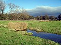
 A Small Muddy Pond - geograph.org.uk - 2445341.jpg 3,628 × 2,232; 2.34 MB
-
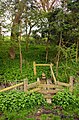 A stile and bridge in Newington - geograph.org.uk - 2386625.jpg 985 × 1,500; 375 KB
-
 A stile on the footpath - geograph.org.uk - 2386619.jpg 1,500 × 1,000; 437 KB
-
 A stile to the footpath - geograph.org.uk - 2386643.jpg 1,500 × 1,000; 294 KB
-
 A329 entering Newington - geograph.org.uk - 3672648.jpg 640 × 399; 70 KB
-
 A329 junction at Primrose Hill - geograph.org.uk - 2829723.jpg 3,648 × 2,595; 1.29 MB
-
 A329 leaving Newington - geograph.org.uk - 3043716.jpg 1,024 × 632; 138 KB
-
 A329 north of Newington - geograph.org.uk - 2830751.jpg 3,566 × 2,384; 1.16 MB
-
 A329 past the stone - geograph.org.uk - 2535338.jpg 1,024 × 683; 273 KB
-
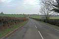
 A329 towards Thame - geograph.org.uk - 6191222.jpg 1,024 × 684; 262 KB
-
 A329, Newington - geograph.org.uk - 6191212.jpg 1,024 × 684; 277 KB
-
 Arch in the porch - geograph.org.uk - 2537014.jpg 1,024 × 683; 161 KB
-
 Benchmark on buttress of St Giles Church - geograph.org.uk - 3766240.jpg 683 × 1,024; 261 KB
-
 Bend in A329 at Primrose Hill - geograph.org.uk - 3767197.jpg 1,024 × 683; 198 KB
-
 Bridleway to Brightwell Baldwin - geograph.org.uk - 5513560.jpg 640 × 480; 138 KB
-
 Bridleway towards Ladybrook Copse - geograph.org.uk - 3766211.jpg 1,024 × 683; 185 KB
-
 Buttresses on the tower - geograph.org.uk - 2537024.jpg 426 × 640; 73 KB
-
 Cattle on the footpath - geograph.org.uk - 2386634.jpg 1,500 × 997; 189 KB
-
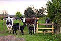 Cattle waiting by the stile - geograph.org.uk - 2386683.jpg 1,500 × 1,000; 240 KB
-
 Damaged benchmark on Lane End Cottage - geograph.org.uk - 3766261.jpg 683 × 1,024; 265 KB
-
 Deer in arable field neae Ewe Farm - geograph.org.uk - 3766226.jpg 1,024 × 683; 262 KB
-
 Duck Pond near Berrick Prior - geograph.org.uk - 2228375.jpg 3,648 × 2,736; 1.53 MB
-
 Duck Pond near Berrick Salome 2 - geograph.org.uk - 2228389.jpg 3,648 × 2,736; 1.46 MB
-
 Dusty Flat Footpath - geograph.org.uk - 2897065.jpg 1,600 × 1,170; 435 KB
-
 End of footpath from Ladybrook Copse - geograph.org.uk - 3766233.jpg 1,024 × 683; 275 KB
-
 Ewe Farm - geograph.org.uk - 2228328.jpg 3,364 × 2,456; 1.33 MB
-
 Farmland near Warborough - geograph.org.uk - 4179745.jpg 3,804 × 2,724; 2.39 MB
-
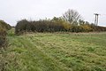
 Farmland, Newington - geograph.org.uk - 2818493.jpg 640 × 480; 129 KB
-
 Farmland, Newington - geograph.org.uk - 6081524.jpg 1,024 × 768; 209 KB
-
 Farmland, Newington - geograph.org.uk - 6081536.jpg 1,024 × 768; 259 KB
-
 Farmland, Newington - geograph.org.uk - 6081537.jpg 1,024 × 768; 204 KB
-
 Farmland, Newington - geograph.org.uk - 6157997.jpg 1,024 × 768; 199 KB
-
 Farmland, Newington - geograph.org.uk - 6165438.jpg 1,024 × 768; 275 KB
-
 Farmland, Stadhampton - geograph.org.uk - 2818496.jpg 640 × 480; 132 KB
-
 Feeder and Footpath - geograph.org.uk - 2557351.jpg 1,600 × 949; 339 KB
-
 Fence on the porch - geograph.org.uk - 2536790.jpg 533 × 800; 178 KB
-
 Field at Great Holcombe Farm - geograph.org.uk - 2386637.jpg 1,500 × 1,000; 156 KB
-
 Footbridge over the stream in Newington - geograph.org.uk - 2386623.jpg 1,500 × 1,000; 413 KB
-
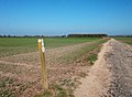
 Footpath across the field - geograph.org.uk - 2386616.jpg 1,500 × 1,000; 249 KB
-
 Footpath along the side of the field - geograph.org.uk - 2386667.jpg 1,500 × 1,000; 229 KB
-
 Footpath near Newington - geograph.org.uk - 2897086.jpg 2,048 × 1,536; 1.08 MB
-
 Footpath to Newington - geograph.org.uk - 2386677.jpg 1,500 × 983; 224 KB
-
 Footpath-bridleway junction - geograph.org.uk - 3766218.jpg 683 × 1,024; 282 KB
-
 Fountain at the top - geograph.org.uk - 2535347.jpg 1,024 × 683; 205 KB
-
 Gap in the corner - geograph.org.uk - 2542902.jpg 533 × 800; 164 KB
-
 Gated field entrance from A329 - geograph.org.uk - 3767289.jpg 1,024 × 683; 269 KB
-
 Graveyard across the road - geograph.org.uk - 2537021.jpg 1,024 × 683; 317 KB
-
 Great Holcombe Farm.jpg 640 × 480; 85 KB
-
 Griffin on the gatepost - geograph.org.uk - 2536771.jpg 1,024 × 683; 83 KB
-
 Hares Leap - geograph.org.uk - 3061022.jpg 3,464 × 2,468; 1.83 MB
-
 Headstone by the buttress - geograph.org.uk - 2542898.jpg 533 × 800; 151 KB
-
 Hedgerow Roses - geograph.org.uk - 2445372.jpg 3,560 × 2,156; 2.33 MB
-
 In between the buttress - geograph.org.uk - 2542895.jpg 533 × 800; 128 KB
-
 Junction of footpaths near Hares Leap - geograph.org.uk - 3916031.jpg 1,024 × 683; 253 KB
-
 Lane End Cottage - geograph.org.uk - 3766265.jpg 1,024 × 683; 229 KB
-
 Lane towards Chalgrove - geograph.org.uk - 5513568.jpg 640 × 480; 158 KB
-
 Laths on show - geograph.org.uk - 2537008.jpg 1,024 × 683; 211 KB
-
 Manor Farm, Berrick Prior - geograph.org.uk - 4075019.jpg 1,280 × 960; 263 KB
-
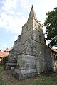
 Millennium stone - geograph.org.uk - 2535342.jpg 533 × 800; 198 KB
-
 Muddy Roller - geograph.org.uk - 2897098.jpg 2,048 × 1,536; 970 KB
-
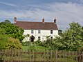
 Newington House - geograph.org.uk - 2536767.jpg 1,024 × 683; 200 KB
-
 Newington Nurseries entrance - geograph.org.uk - 3672651.jpg 640 × 447; 83 KB
-
 North side of St Giles - geograph.org.uk - 2542885.jpg 533 × 800; 136 KB
-
 Old Sheds at Lonesome Farm - geograph.org.uk - 1882419.jpg 1,839 × 1,404; 655 KB
-
 Pasture, Newington - geograph.org.uk - 6157999.jpg 1,024 × 768; 272 KB
-
 Path past the Church - geograph.org.uk - 2542892.jpg 1,024 × 683; 207 KB
-
 Pit (dis) - geograph.org.uk - 2446553.jpg 3,968 × 2,232; 2.01 MB
-
 Ploughed out footpath - geograph.org.uk - 1012926.jpg 640 × 480; 84 KB
-
 Pond at Great Holcombe Farm - geograph.org.uk - 3527454.jpg 2,560 × 1,920; 1.65 MB
-
 Porch and tower - geograph.org.uk - 2542904.jpg 533 × 800; 155 KB
-
 Red Hot Pokers - geograph.org.uk - 3527542.jpg 2,560 × 1,869; 1.45 MB
-
 Road junction on Primrose Hill - geograph.org.uk - 2372579.jpg 1,500 × 1,000; 124 KB
-
 Road to Berrick Prior on Primrose Hill - geograph.org.uk - 2372587.jpg 1,500 × 1,000; 341 KB
-
 Sheep by the wall - geograph.org.uk - 2537017.jpg 1,024 × 683; 245 KB
-

-
 South side of St Giles - geograph.org.uk - 2536783.jpg 1,024 × 683; 212 KB
-
 Spire on St Giles - geograph.org.uk - 2542900.jpg 533 × 800; 117 KB
-
 St Giles Church - geograph.org.uk - 2829729.jpg 2,736 × 3,648; 2.01 MB
-
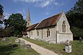
 St Giles Church - geograph.org.uk - 3766251.jpg 1,024 × 683; 202 KB
-
 St Giles Church in Newington - geograph.org.uk - 2386603.jpg 1,500 × 991; 177 KB
-
 St Giles Church in Newington - geograph.org.uk - 2386604.jpg 1,000 × 1,500; 183 KB
-
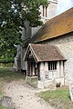
 St Giles Church porch in Newington - geograph.org.uk - 2386609.jpg 986 × 1,500; 260 KB
-
 St Giles Newington - geograph.org.uk - 2536780.jpg 1,024 × 683; 213 KB
-
 St Giles, Newington, grave - geograph.org.uk - 3943245.jpg 640 × 480; 109 KB
-
 St Giles, Newington, graves - geograph.org.uk - 3943256.jpg 640 × 478; 134 KB
-
 Stiles on the footpath - geograph.org.uk - 2386674.jpg 1,000 × 1,500; 354 KB
-
 Stormy Corn Field - geograph.org.uk - 3527469.jpg 1,024 × 733; 210 KB
-
 The A329 through Newington - geograph.org.uk - 2386614.jpg 1,500 × 1,000; 223 KB
-
 The A329 to Stadhampton - geograph.org.uk - 2372584.jpg 1,500 × 1,000; 197 KB
-
 The A329 to Warborough - geograph.org.uk - 2372585.jpg 1,500 × 1,000; 233 KB
-
 The footpath to Chalgrove - geograph.org.uk - 2386652.jpg 1,500 × 1,000; 159 KB
-
 The footpath to Newington - geograph.org.uk - 2386655.jpg 1,500 × 1,000; 197 KB
-
 The North door - geograph.org.uk - 2542890.jpg 533 × 800; 156 KB
-
 Tower of St Giles Church - geograph.org.uk - 3766245.jpg 683 × 1,024; 186 KB
-
 Track, farmland and copse, Newington - geograph.org.uk - 2321819.jpg 640 × 480; 142 KB
-
 Upper Grange - geograph.org.uk - 1012959.jpg 640 × 360; 56 KB
-
 View Over Newington - geograph.org.uk - 2791548.jpg 1,600 × 1,067; 333 KB
-
 View past the doorway - geograph.org.uk - 2542887.jpg 533 × 800; 111 KB


_-_geograph.org.uk_-_2446553.jpg)


_-_geograph.org.uk_-_3937574.jpg)


