Category:Newton by Castle Acre
Jump to navigation
Jump to search
English: Newton by Castle Acre is a village and civil parish in the English county of Norfolk. It is situated on the A1065 Mildenhall to Fakenham road, about from London.
village and civil parish in Norfolk, United Kingdom  | |||||
| Upload media | |||||
| Instance of | |||||
|---|---|---|---|---|---|
| Location | Breckland, Norfolk, East of England, England | ||||
| Area |
| ||||
 | |||||
Subcategories
This category has only the following subcategory.
A
Media in category "Newton by Castle Acre"
The following 46 files are in this category, out of 46 total.
-
 A1065 - geograph.org.uk - 3830131.jpg 640 × 430; 39 KB
-
 A1065 approaching Newton - geograph.org.uk - 3632198.jpg 640 × 482; 52 KB
-
 A1065 heading towards Newton - geograph.org.uk - 3632184.jpg 640 × 481; 60 KB
-
 A1065 near Castle Acre - geograph.org.uk - 3830163.jpg 640 × 430; 41 KB
-
 A1065 north of Newton - geograph.org.uk - 3830167.jpg 640 × 430; 43 KB
-
 All Saints, Newton by Castle Acre - geograph.org.uk - 4613634.jpg 800 × 531; 133 KB
-
 All Saints, Newton by Castle Acre - geograph.org.uk - 4613639.jpg 680 × 1,024; 260 KB
-
 Chalk quarry at Newton - geograph.org.uk - 2282608.jpg 760 × 570; 142 KB
-
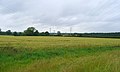
 Cultivated fields east of the A1065 road - geograph.org.uk - 1965778.jpg 640 × 480; 165 KB
-

-
 Field - geograph.org.uk - 891267.jpg 640 × 480; 71 KB
-
 Footpath and shortcut at West Lexham - geograph.org.uk - 2982954.jpg 1,024 × 768; 278 KB
-
 Footpath bend - geograph.org.uk - 891265.jpg 640 × 480; 115 KB
-
 Footpath sign - geograph.org.uk - 891256.jpg 480 × 640; 79 KB
-
 George and Dragon - geograph.org.uk - 891319.jpg 640 × 480; 72 KB
-
 George and Dragon, Newton - geograph.org.uk - 3830165.jpg 640 × 430; 59 KB
-
 George and Dragon, Newton, 9 March 2009.JPG 2,560 × 1,920; 3.77 MB
-
 George ^ Dragon at Newton - geograph.org.uk - 5437121.jpg 800 × 558; 99 KB
-
 Grass bank - geograph.org.uk - 891310.jpg 480 × 640; 108 KB
-
 Manor farm - geograph.org.uk - 891305.jpg 640 × 480; 116 KB
-
 Newton Mill near Castle Acre - geograph.org.uk - 5621257.jpg 5,184 × 2,920; 6.98 MB
-
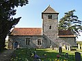 Newton St Mary and All Saints' church - geograph.org.uk - 2280923.jpg 760 × 570; 277 KB
-
 North along the A1065 at Newton - geograph.org.uk - 5437131.jpg 800 × 673; 129 KB
-
 Northbound A1065 - geograph.org.uk - 4634062.jpg 640 × 480; 408 KB
-
 Northbound A1065 near Newton - geograph.org.uk - 4634054.jpg 640 × 480; 416 KB
-
 Northbound A1065 near West Lexham - geograph.org.uk - 4634216.jpg 640 × 480; 404 KB
-
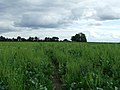
 Poppies next to Ruckold's Lane - geograph.org.uk - 5437135.jpg 800 × 504; 120 KB
-
 Ruckold's Lane east of Castle Acre - geograph.org.uk - 4694339.jpg 4,320 × 3,240; 5.46 MB
-
 Sheep's new best friend - geograph.org.uk - 890138.jpg 640 × 480; 112 KB
-

-

-
 Southbound A1065 near Castle Acre - geograph.org.uk - 4634057.jpg 640 × 480; 409 KB
-
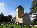
 St Mary and All Saints' church at Newton - geograph.org.uk - 5435575.jpg 800 × 607; 188 KB
-
 St Mary's and All Saints Church, Newton by Castle Acre - geograph.org.uk - 4450150.jpg 4,320 × 3,240; 5.73 MB
-
 Stile in the graveyard fence - geograph.org.uk - 4450098.jpg 4,320 × 3,240; 5.89 MB
-
 Stormy skies - geograph.org.uk - 891281.jpg 640 × 480; 94 KB
-
 The Church of St Mary and All Saints at Newton - geograph.org.uk - 4249672.jpg 4,000 × 3,000; 2.86 MB
-
 The George and Dragon at Newton - geograph.org.uk - 4634061.jpg 640 × 480; 447 KB
-
 The River Nar near Newton - geograph.org.uk - 5437113.jpg 800 × 569; 178 KB
-
 Towards Winchester Hill - geograph.org.uk - 891294.jpg 640 × 480; 105 KB
-

-

-
 Village seen - geograph.org.uk - 890510.jpg 640 × 480; 81 KB
-
 West Lexham or East Lexham - geograph.org.uk - 4039843.jpg 4,320 × 3,240; 5.82 MB
-
 Wheat field near Hill Farm - geograph.org.uk - 887942.jpg 640 × 383; 56 KB
-
 Hill Farm Entrance - geograph.org.uk - 417072.jpg 640 × 480; 131 KB


