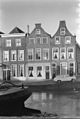
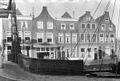
Category:Nieuwe Rijn 110, Leiden
Jump to navigation
Jump to search
| Object location | | View all coordinates using: OpenStreetMap |
|---|
 | |||||
| Upload media | |||||
| Instance of |
| ||||
|---|---|---|---|---|---|
| Location | Leiden, South Holland, Netherlands | ||||
| Street address |
| ||||
| Heritage designation |
| ||||
 | |||||
|
This is a category about rijksmonument number 25195
|
| Address |
|
Media in category "Nieuwe Rijn 110, Leiden"
The following 5 files are in this category, out of 5 total.
-
 Gevels - Leiden - 20136603 - RCE.jpg 805 × 1,200; 154 KB
-
 Gevels overzicht - Leiden - 20136602 - RCE.jpg 1,200 × 806; 180 KB
-
 Leiden - Nieuwe rijn 110.JPG 3,056 × 4,592; 4.01 MB
-
 Nieuwe Rijn, overzicht naar Rijnbrug rechts Oranjebrug - Leiden - 20133294 - RCE.jpg 1,200 × 1,190; 240 KB
-
 Oranjebrug, overzicht - Leiden - 20133813 - RCE.jpg 1,192 × 1,200; 274 KB


