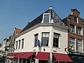
Category:Nieuwestad 39, Leeuwarden
Jump to navigation
Jump to search
| Object location | | View all coordinates using: OpenStreetMap |
|---|
 | |||||
| Upload media | |||||
| Instance of |
| ||||
|---|---|---|---|---|---|
| Location | Leeuwarden, Friesland, Netherlands | ||||
| Heritage designation |
| ||||
 | |||||
|
This is a category about rijksmonument number 24283
|
| Address |
|
Media in category "Nieuwestad 39, Leeuwarden"
The following 7 files are in this category, out of 7 total.
-
 Kleine Kerkstraat - Leeuwarden - 20130566 - RCE.jpg 1,190 × 1,200; 261 KB
-
 Kleine Kerkstraat - Leeuwarden - 20130567 - RCE.jpg 1,197 × 1,200; 284 KB
-
 Nieuwestad 37 Leeuwarden.jpg 4,288 × 3,216; 3.06 MB
-
 Nieuwestad 39 Leeuwarden beeldhouwwerk.jpg 4,288 × 3,216; 3.05 MB
-
 Nieuwestad 39 Leeuwarden.jpg 3,216 × 4,288; 3.45 MB
-
 Nieuwestad 41 Leeuwarden.jpg 4,288 × 3,216; 3.42 MB
-
 Voorgevels - Leeuwarden - 20132647 - RCE.jpg 1,200 × 809; 174 KB


