Category:Nieuwestad 63, Leeuwarden
Jump to navigation
Jump to search
| Object location | | View all coordinates using: OpenStreetMap |
|---|
 | |||||
| Upload media | |||||
| Instance of |
| ||||
|---|---|---|---|---|---|
| Location | Leeuwarden, Friesland, Netherlands | ||||
| Heritage designation |
| ||||
 | |||||
|
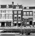
This is a category about rijksmonument number 24291
|
| Address |
|
Media in category "Nieuwestad 63, Leeuwarden"
The following 4 files are in this category, out of 4 total.
-
 Bistro - Leeuwarden - 20132664 - RCE.jpg 1,188 × 1,200; 309 KB
-
 M 71 - Leeuwarden - 20132663 - RCE.jpg 1,197 × 1,200; 357 KB
-
 RM24291 Leeuwarden - Nieuwestad 63.jpg 1,944 × 2,592; 1.55 MB
-
 Voorgevel - Leeuwarden - 20132662 - RCE.jpg 810 × 1,200; 246 KB


