Category:Nieuwstraat 11, Ameide
Jump to navigation
Jump to search
| Object location | | View all coordinates using: OpenStreetMap |
|---|
 | |||||
| Upload media | |||||
| Instance of | |||||
|---|---|---|---|---|---|
| Location | Ameide, South Holland, Netherlands | ||||
| Street address |
| ||||
| Located on street |
| ||||
| Heritage designation |
| ||||
 | |||||
|
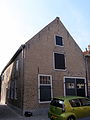
This is a category about rijksmonument number 7579
|
| Address |
|
Media in category "Nieuwstraat 11, Ameide"
The following 4 files are in this category, out of 4 total.
-
 Ameide RM Nieuwstraat 11.jpg 2,409 × 3,575; 2.5 MB
-
 Gevel - Ameide - 20008335 - RCE.jpg 828 × 1,200; 227 KB
-
 Nieuwstraat.11.Ameide.jpg 1,842 × 2,460; 844 KB
-
 Voorgevels - Ameide - 20008331 - RCE.jpg 1,200 × 820; 203 KB


