Category:Nieuwstraat 18, Ameide
Jump to navigation
Jump to search
| Object location | | View all coordinates using: OpenStreetMap |
|---|
house in Zederik, Netherlands  | |||||
| Upload media | |||||
| Instance of | |||||
|---|---|---|---|---|---|
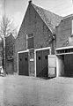
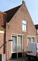
| Location | Ameide, South Holland, Netherlands | ||||
| Street address |
| ||||
| Located on street |
| ||||
| Heritage designation |
| ||||
 | |||||
|
This is a category about rijksmonument number 7583
|
| Address |
|
Media in category "Nieuwstraat 18, Ameide"
The following 6 files are in this category, out of 6 total.
-
 Gevel - Ameide - 20008342 - RCE.jpg 830 × 1,200; 240 KB
-
 Gevels - Ameide - 20008343 - RCE.jpg 823 × 1,200; 219 KB
-
 Gevels - Ameide - 20008344 - RCE.jpg 826 × 1,200; 178 KB
-
 Nieuwstraat.18.Ameide.jpg 1,293 × 2,072; 910 KB
-
 Voorgevel - Ameide - 20008345 - RCE.jpg 1,195 × 1,200; 342 KB
-
 Voorgevels - Ameide - 20008346 - RCE.jpg 1,185 × 1,200; 379 KB


