Category:Norbury, Cheshire
Jump to navigation
Jump to search
English: Norbury is a former civil parish in the unitary authority of Cheshire East and the ceremonial county of Cheshire. According to the 2001 census, the parish had a population of 190.
hamlet and former civil parish in Cheshire East, England, UK  | |||||
| Upload media | |||||
| Instance of |
| ||||
|---|---|---|---|---|---|
| Location | Marbury and District, Cheshire East, Cheshire, North West England, England | ||||
| Population |
| ||||
 | |||||
Media in category "Norbury, Cheshire"
The following 40 files are in this category, out of 40 total.
-
 'Suzie Joy' at Marbury - geograph.org.uk - 5342370.jpg 1,280 × 851; 452 KB
-
 Brook Farm, Gauntons Bank - geograph.org.uk - 189363.jpg 640 × 606; 126 KB
-
 Canal boat approaching Steer Bridge - geograph.org.uk - 380921.jpg 640 × 443; 125 KB
-
 Cheshire farmland - geograph.org.uk - 3179562.jpg 480 × 640; 101 KB
-
 Cheshire farmland near Norbury - geograph.org.uk - 5242721.jpg 1,600 × 609; 815 KB
-
 Coal, diesel and gas by Marbury Lock, Cheshire - geograph.org.uk - 5467222.jpg 1,280 × 960; 1.07 MB
-
 Drainage ditch behind the Lock House - geograph.org.uk - 5220292.jpg 1,024 × 768; 160 KB
-
-
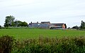
 Farm buildings, Higher Hall Farm, Norbury - geograph.org.uk - 380644.jpg 640 × 378; 135 KB
-
 Farming near Glebe Covert (1) - geograph.org.uk - 5220340.jpg 1,024 × 768; 225 KB
-
 Farming near Glebe Covert (2) - geograph.org.uk - 5220341.jpg 1,024 × 614; 107 KB
-
 Farmland north-east of Marbury in Cheshire - geograph.org.uk - 5234555.jpg 1,280 × 798; 854 KB
-
 Farmland north-east of Marbury in Cheshire - geograph.org.uk - 5234590.jpg 1,280 × 960; 980 KB
-
 Farmland west of Ryebank - geograph.org.uk - 5220327.jpg 1,024 × 768; 134 KB
-
 Former chapel, Norbury - geograph.org.uk - 380634.jpg 640 × 434; 145 KB
-
 Handley Park Farm - geograph.org.uk - 171821.jpg 640 × 480; 96 KB
-
 Lane north of Marbury in Cheshire - geograph.org.uk - 5470785.jpg 1,280 × 1,139; 1.06 MB
-
 Lane to Norbury in Cheshire - geograph.org.uk - 5470779.jpg 1,440 × 877; 1.13 MB
-
 Norbury - Norbury Common.jpg 640 × 455; 122 KB
-

-
 Paddocks at Ryebank, from the Llangollen Canal - geograph.org.uk - 5220326.jpg 1,024 × 768; 113 KB
-
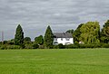 Pasture and cottage north of Marbury in Cheshire - geograph.org.uk - 5234718.jpg 1,280 × 878; 687 KB
-
 Pasture and cottage north of Marbury in Cheshire - geograph.org.uk - 5470798.jpg 1,280 × 934; 906 KB
-
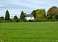
 Pasture south-east of Norbury in Cheshire - geograph.org.uk - 5470792.jpg 1,280 × 768; 1.01 MB
-

-

-
 Sea of bracken - geograph.org.uk - 190346.jpg 640 × 480; 125 KB
-
 Small mere near Norbury - geograph.org.uk - 380657.jpg 640 × 451; 191 KB
-
 Stokes Cottage, Swanwick Green.jpg 3,456 × 2,304; 3.33 MB
-
 Terraced cottages, Norbury - geograph.org.uk - 380607.jpg 640 × 411; 116 KB
-
 The Mount, Norbury - geograph.org.uk - 380664.jpg 640 × 397; 95 KB
-
 Tower Farm, Hurst Green - geograph.org.uk - 380899.jpg 640 × 386; 110 KB
-
 Welcome to Marbury - geograph.org.uk - 3179547.jpg 640 × 480; 151 KB
-
 Working boat with butty near Marbury, Cheshire - geograph.org.uk - 5466118.jpg 1,280 × 960; 1.06 MB
-
 Working boats above Marbury Lock in Cheshire - geograph.org.uk - 5467225.jpg 1,280 × 1,018; 1.04 MB
-

-
 Carthorse at Norbury - geograph.org.uk - 380615.jpg 640 × 439; 123 KB
-
 Fallow field, Holtridge - geograph.org.uk - 190331.jpg 640 × 494; 104 KB
-
 Farmland at Holtridge - geograph.org.uk - 190345.jpg 640 × 462; 130 KB
-
 Mown field, Gauntons Bank - geograph.org.uk - 189360.jpg 640 × 522; 123 KB


_-_geograph.org.uk_-_5220340.jpg)
_-_geograph.org.uk_-_5220341.jpg)


