Category:Northern State Hospital (Sedro-Woolley) unidentified building 2
Jump to navigation
Jump to search
| Object location | | View all coordinates using: OpenStreetMap |
|---|
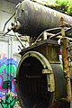
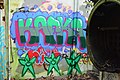
English: This category is for a particular building north of the dairy farm buildings of the former Northern State Hospital (Sedro-Woolley, Washington, U.S.). If someone can identify exactly what this building is, please change category name accordingly. An anonymous contributor says it was a farm slaughterhouse, built in the 1950s.
Media in category "Northern State Hospital (Sedro-Woolley) unidentified building 2"
The following 19 files are in this category, out of 19 total.
-
 Northern State Hospital - unidentified building 2 - 01.jpg 6,000 × 4,000; 13.12 MB
-
 Northern State Hospital - unidentified building 2 - 02.jpg 6,000 × 4,000; 14.62 MB
-
 Northern State Hospital - unidentified building 2 - 03.jpg 6,000 × 4,000; 13.33 MB
-
 Northern State Hospital - unidentified building 2 - 04.jpg 6,000 × 4,000; 13.49 MB
-
 Northern State Hospital - unidentified building 2 - detail 01.jpg 4,000 × 6,000; 13.24 MB
-
 Northern State Hospital - unidentified building 2 - detail 02.jpg 4,000 × 6,000; 12.96 MB
-
 Northern State Hospital - unidentified building 2 - detail 03.jpg 6,000 × 4,000; 12.7 MB
-
 Northern State Hospital - unidentified building 2 - detail 04.jpg 6,000 × 4,000; 13.1 MB
-
 Northern State Hospital - unidentified building 2 - detail 05.jpg 4,000 × 6,000; 12.75 MB
-
 Northern State Hospital - unidentified building 2 - detail 06.jpg 6,000 × 4,000; 13.11 MB
-
 Northern State Hospital - unidentified building 2 - detail 07.jpg 4,000 × 6,000; 13.91 MB
-
 Northern State Hospital - unidentified building 2 - detail 08.jpg 4,000 × 6,000; 13.11 MB
-
 Northern State Hospital - unidentified building 2 - detail 09.jpg 6,000 × 4,000; 14.31 MB
-
 Northern State Hospital - unidentified building 2 - detail 10.jpg 6,000 × 4,000; 12.67 MB
-
 Northern State Hospital - unidentified building 2 - detail 11.jpg 4,000 × 6,000; 11.79 MB
-
 Northern State Hospital - unidentified building 2 - detail 12.jpg 4,000 × 6,000; 12.68 MB
-
 Northern State Hospital - unidentified building 2 - detail 13.jpg 4,000 × 6,000; 11.8 MB
-
 Northern State Hospital - unidentified building 2 - pano 01.jpg 5,584 × 4,902; 7.21 MB
-
 Northern State Hospital - unidentified building near cemetery 01.jpg 6,000 × 4,000; 13.32 MB


