Category:Nottingham General Cemetery
Jump to navigation
Jump to search
cemetery in Nottingham  | |||||
| Upload media | |||||
| Instance of | |||||
|---|---|---|---|---|---|
| Location | City of Nottingham, Nottinghamshire, East Midlands, England | ||||
| Heritage designation |
| ||||
| Area |
| ||||
 | |||||
Subcategories
This category has only the following subcategory.
Media in category "Nottingham General Cemetery"
The following 76 files are in this category, out of 76 total.
-
 A bright tram in Goldsmith Street - geograph.org.uk - 5538654.jpg 1,024 × 1,024; 1.01 MB
-
 Across Canning Circus - geograph.org.uk - 5775394.jpg 1,024 × 819; 893 KB
-
 All Saints Church from All Saints Street - geograph.org.uk - 5628046.jpg 656 × 1,024; 226 KB
-
 Benchmark on wall of Burns Street - geograph.org.uk - 5628445.jpg 1,024 × 684; 298 KB
-
 Benchmark on wall outside ^9 Waverley Street - geograph.org.uk - 5628489.jpg 1,024 × 684; 239 KB
-
-
 Bright Memorial, Nottingham General Cemetery.jpg 960 × 1,280; 554 KB
-
 Building work at the top of Ilkeston Road - geograph.org.uk - 5768645.jpg 819 × 1,024; 973 KB
-
 Burnt-out car on Ayr Street - geograph.org.uk - 6087005.jpg 1,024 × 768; 300 KB
-
 Canning Chambers - geograph.org.uk - 874443.jpg 640 × 427; 199 KB
-
 Canning Circus, The Footman's Rest and The Falcon - geograph.org.uk - 5898166.jpg 1,024 × 1,024; 1.03 MB
-
 Canning Terrace, Nottingham.jpg 1,280 × 799; 242 KB
-
 Cemetery Gatehouse - geograph.org.uk - 1037966.jpg 640 × 426; 132 KB
-
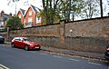
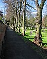
 Cemetery Wall - geograph.org.uk - 1037411.jpg 426 × 640; 241 KB
-

-
 Charles Bell Taylor memorial (1).jpg 3,672 × 4,896; 8.21 MB
-
 Charles Bell Taylor memorial (2).jpg 4,896 × 3,672; 8.85 MB
-
 Church of The Virgin Mary Eleousa, Derby Road - geograph.org.uk - 5810874.jpg 960 × 1,280; 430 KB
-
 Churchill Monument, Nottingham General Cemetery.jpg 960 × 1,280; 561 KB
-
 Derby Terrace, Derby Road, Nottingham - geograph.org.uk - 5810882.jpg 1,280 × 987; 307 KB
-
 Derby Terrace, Derby Road, Nottingham - geograph.org.uk - 5810904.jpg 1,280 × 960; 326 KB
-
 Down Ilkeston Road on a May morning - geograph.org.uk - 5768641.jpg 1,024 × 1,024; 1.15 MB
-

-
 Former Viyella building, Ilkeston Road - geograph.org.uk - 5855498.jpg 1,280 × 960; 283 KB
-
 Gill Street North - geograph.org.uk - 5906427.jpg 1,024 × 1,024; 1.03 MB
-
 Gravestone backs, General Cemetery - geograph.org.uk - 790074.jpg 480 × 640; 129 KB
-
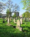
 Gravestones in the General Cemetery - geograph.org.uk - 790057.jpg 640 × 480; 140 KB
-
 Ilkeston Road, student flats nearer completion - geograph.org.uk - 5898179.jpg 819 × 1,024; 892 KB
-
 Ilkeston Road, the former Viyella factory - geograph.org.uk - 5768426.jpg 1,024 × 1,024; 1.2 MB
-
 Ilkeston Road, the gate to Christ Church Gardens - geograph.org.uk - 5768635.jpg 1,024 × 731; 1.14 MB
-
 In Nottingham General Cemetery - geograph.org.uk - 5768751.jpg 819 × 1,024; 1.21 MB
-
 In the General Cemetery - geograph.org.uk - 1037990.jpg 640 × 426; 82 KB
-

-
 New apartment block at Canning Circus - geograph.org.uk - 5864987.jpg 960 × 1,280; 286 KB
-
 New build at Canning Circus - geograph.org.uk - 5561733.jpg 1,043 × 1,280; 306 KB
-
 North Gate of The Park Estate - geograph.org.uk - 5810957.jpg 1,280 × 960; 298 KB
-
 Nottingham (2021-05-28) 10.jpg 5,568 × 3,712; 17.44 MB
-
 Nottingham (2021-05-28) 15.jpg 5,568 × 3,712; 18.84 MB
-
 Nottingham (2021-05-28) 16.jpg 5,568 × 3,712; 17.17 MB
-
 Nottingham (2021-05-28) 17.jpg 5,568 × 3,712; 16.36 MB
-
 Nottingham (2021-05-28) 18.jpg 5,568 × 3,712; 17.94 MB
-
 Nottingham (2021-05-28) 19.jpg 3,712 × 5,568; 17.1 MB
-
 Nottingham (2021-05-28) 20.jpg 3,712 × 5,568; 16.83 MB
-
 Nottingham (2021-05-28) 21.jpg 5,568 × 3,712; 16.88 MB
-
 Nottingham (2021-05-28) 22.jpg 3,712 × 5,568; 18.19 MB
-
 Nottingham (2021-05-28) 23.jpg 5,568 × 3,712; 16.87 MB
-
 Nottingham (2021-05-28) 24.jpg 3,712 × 5,568; 14.86 MB
-
 Nottingham (2021-05-28) 25.jpg 3,712 × 5,568; 14.36 MB
-
 Nottingham (2021-05-28) 26.jpg 5,568 × 3,712; 16.48 MB
-
 Nottingham (2021-05-28) 27.jpg 3,712 × 5,568; 15.3 MB
-
 Nottingham Arboretum in May - geograph.org.uk - 5774520.jpg 1,024 × 768; 1.29 MB
-
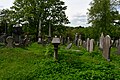
 Nottingham General Cemetery - geograph.org.uk - 790069.jpg 640 × 480; 141 KB
-
 Nottingham General Cemetery and All Saints' spire - geograph.org.uk - 5775401.jpg 819 × 1,024; 1.19 MB
-
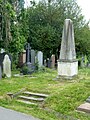
 Nottingham General Cemetery, gravestones - geograph.org.uk - 1408910.jpg 640 × 480; 106 KB
-
-
 Nottingham Trent University School of Art and Design - geograph.org.uk - 5790568.jpg 819 × 1,024; 1,012 KB
-
 Nottingham Trent University Students' Union reclad - geograph.org.uk - 5906432.jpg 1,024 × 1,024; 1.17 MB
-

-
 Office block conversion - geograph.org.uk - 5810947.jpg 1,280 × 960; 388 KB
-
 On Alfreton Road - geograph.org.uk - 6005532.jpg 1,024 × 1,024; 1.05 MB
-
 One More takeaway - geograph.org.uk - 5810950.jpg 960 × 1,280; 386 KB
-
 Passing by The Falcon Inn - panoramio.jpg 2,553 × 1,112; 1.1 MB
-
 Pub demolition - geograph.org.uk - 6087013.jpg 1,024 × 768; 148 KB
-
 Radford, Denman Street East and Diversity Way - geograph.org.uk - 5823687.jpg 1,024 × 682; 937 KB
-
 Radford, Wolsey Avenue - geograph.org.uk - 5823680.jpg 1,024 × 682; 745 KB
-
 Steps and railings at Brunel Terrace, Derby Road - geograph.org.uk - 5810886.jpg 972 × 1,280; 425 KB
-
 Sunlit headstones in Nottingham General Cemetery - geograph.org.uk - 5768756.jpg 819 × 1,024; 1.38 MB
-
 Tennyson Street houses at Burns Street junction - geograph.org.uk - 5628049.jpg 1,024 × 712; 171 KB
-

-
 The former School of Art, from Peel Street - geograph.org.uk - 5987499.jpg 1,024 × 819; 921 KB
-
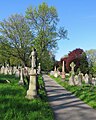
 The top end of Nottingham General Cemetery - geograph.org.uk - 5768736.jpg 1,024 × 732; 1,008 KB
-
 Up Albert Grove - geograph.org.uk - 5768624.jpg 1,024 × 1,024; 1.39 MB
-
 Up Douglas Road - geograph.org.uk - 5768627.jpg 1,024 × 1,024; 1.49 MB
-

-
 Waterloo Promenade and Forest Road West - geograph.org.uk - 6005539.jpg 1,024 × 819; 1.27 MB
-
 Waverley Street wall in front of ^9 - geograph.org.uk - 5628501.jpg 1,024 × 674; 239 KB


.jpg)
.jpg)


_10.jpg)
_15.jpg)
_16.jpg)
_17.jpg)
_18.jpg)
_19.jpg)
_20.jpg)
_21.jpg)
_22.jpg)
_23.jpg)
_24.jpg)
_25.jpg)
_26.jpg)
_27.jpg)


