Category:November 2009 in County Antrim
Jump to navigation
Jump to search
English: Images taken in County Antrim, Northern Ireland in this month of 2009 (not the date of the upload).
| Jan | Feb | Mar | Apr | May | Jun | Jul | Aug | Sep | Oct | Nov | Dec | ||
| ← | 12 | 27 | 9 | 30 | 19 | 11 | 23 | 17 | 35 | 32 | 36 | 24 | → |
|---|
Media in category "November 2009 in County Antrim"
The following 36 files are in this category, out of 36 total.
-
 Ballybentragh Road - geograph.org.uk - 1586490.jpg 640 × 480; 63 KB
-
 Ballybentragh Road, Dunadry - geograph.org.uk - 1586462.jpg 640 × 480; 71 KB
-
 Ballybentragh Road, Dunadry - geograph.org.uk - 1586475.jpg 640 × 480; 63 KB
-
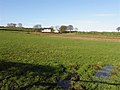
 Ballybentragh Townland - geograph.org.uk - 1586483.jpg 640 × 480; 72 KB
-
 Ballybentragh Townland - geograph.org.uk - 1586489.jpg 640 × 480; 53 KB
-
 Ballybentragh Townland - geograph.org.uk - 1586491.jpg 640 × 480; 105 KB
-
 Ballybentragh Townland - geograph.org.uk - 1586492.jpg 640 × 480; 61 KB
-
 Ballyclaverty Townland - geograph.org.uk - 1581025.jpg 640 × 480; 55 KB
-
 Ballyclaverty Townland - geograph.org.uk - 1581057.jpg 640 × 480; 72 KB
-
 Ballyearl Townland - geograph.org.uk - 1586848.jpg 640 × 480; 59 KB
-
 Ballylagan Townland - geograph.org.uk - 1598913.jpg 640 × 480; 50 KB
-
 Ballymartin Road - geograph.org.uk - 1586626.jpg 640 × 480; 50 KB
-
 Ballymartin Road - geograph.org.uk - 1586632.jpg 640 × 480; 59 KB
-
 Ballypalady Road, Ballypalady - geograph.org.uk - 1586619.jpg 640 × 480; 39 KB
-
 Ballypalady Townland - geograph.org.uk - 1586598.jpg 640 × 480; 56 KB
-
 Ballypalady Townland - geograph.org.uk - 1586604.jpg 640 × 480; 56 KB
-
 Ballypalady Townland - geograph.org.uk - 1586616.jpg 640 × 480; 57 KB
-
 Ballypalady Townland - geograph.org.uk - 1586638.jpg 640 × 480; 63 KB
-
 Bryantang Townland - geograph.org.uk - 1598900.jpg 640 × 480; 59 KB
-
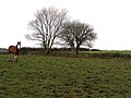
 Carntall Townland - geograph.org.uk - 1599013.jpg 640 × 480; 50 KB
-
 Carntall Townland - geograph.org.uk - 1599014.jpg 640 × 480; 63 KB
-
 Coggrey Townland - geograph.org.uk - 1580748.jpg 640 × 480; 58 KB
-
 Coggrey Townland - geograph.org.uk - 1580754.jpg 640 × 480; 55 KB
-
 Field in shadow, Ballybentagh - geograph.org.uk - 1586479.jpg 640 × 480; 48 KB
-
 Hollybank Road - geograph.org.uk - 1580951.jpg 640 × 480; 88 KB
-
 Hollybank Road, Ballyclaverty - geograph.org.uk - 1581029.jpg 640 × 480; 58 KB
-
 Hollybank Road, Ballyclaverty - geograph.org.uk - 1581034.jpg 640 × 480; 60 KB
-
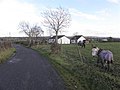
 Horses, Carntall - geograph.org.uk - 1599017.jpg 640 × 480; 58 KB
-
 Lane, Carntall - geograph.org.uk - 1599029.jpg 640 × 480; 39 KB
-
 The Sixmilewater, Ballyclare - geograph.org.uk - 1590026.jpg 640 × 450; 270 KB
-
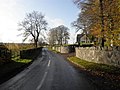
 Thiepval Barracks, Lisburn - geograph.org.uk - 1590410.jpg 640 × 480; 93 KB
-
 Tobergill Road - geograph.org.uk - 1581066.jpg 640 × 480; 50 KB
-
 Tobergill Road - geograph.org.uk - 1581083.jpg 640 × 480; 69 KB
-
 Tobergill Townland - geograph.org.uk - 1581088.jpg 640 × 480; 67 KB
-
 Tobergill Townland - geograph.org.uk - 1581109.jpg 640 × 480; 62 KB
-
 Tobergill Townland - geograph.org.uk - 1581113.jpg 640 × 480; 62 KB


