Category:Oberes Tor (Markgröningen)
Jump to navigation
Jump to search
| Object location | | View all coordinates using: OpenStreetMap |
|---|
  | |||||
| Upload media | |||||
| Instance of | |||||
|---|---|---|---|---|---|
| Location | Markgröningen, Ludwigsburg District, Stuttgart Government Region, Baden-Württemberg, Germany | ||||
| Inception |
| ||||
 | |||||
Media in category "Oberes Tor (Markgröningen)"
The following 21 files are in this category, out of 21 total.
-
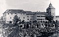
 1800 Keller-Oberes Tor.jpg 567 × 380; 218 KB
-
 Church And Cross - panoramio.jpg 2,248 × 4,000; 3.09 MB
-
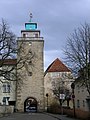 MarkgroeningenStadttor.jpg 972 × 1,296; 463 KB
-
 Markgröningen - Altstadt - Schlossgasse - Oberes Tor und Wimpelinhof (2).jpg 6,184 × 9,474; 27.14 MB
-
 Markgröningen Obere Kelter+Wimpelinhaus+Oberes Tor PF.jpg 907 × 508; 447 KB
-
 Markgröningen Rest vom Schloss Web.jpg 1,123 × 701; 875 KB
-
 Markgröningen Schloss 131224 Web.jpg 1,134 × 682; 856 KB
-
 Markgröningen Wimpelinhaus+Oberes Tor PF.jpg 1,123 × 1,269; 1.02 MB
-
 Obere Kelter Grüningen Web.jpg 794 × 814; 582 KB
-
 Oberes Tor Markgröningen 0161Web.jpg 794 × 1,188; 998 KB
-
 Oberes Tor Markgröningen 20220702 0079.jpg 3,456 × 5,195; 15.12 MB
-
 Oberes Tor Markgröningen 20220702 0080.jpg 5,748 × 3,825; 22.3 MB
-
 Oberes Tor Markgröningen 20220702 0081.jpg 5,805 × 3,862; 23.6 MB
-
 Oberes Tor Markgröningen 20220702 0082.jpg 3,263 × 5,515; 22.41 MB
-
 Oberes Tor Markgröningen 20220702 0083.jpg 3,714 × 5,582; 26.6 MB
-
 Oberes Tor Markgröningen 20220702 0084.jpg 3,241 × 5,852; 17.1 MB
-
 Oberes Tor Markgröningen Aufriss Leiberich Web.jpg 1,350 × 2,934; 1,002 KB
-
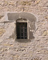 Oberes Tor MG Fenster Pulverkammer 090227Web.jpg 794 × 991; 763 KB
-
 Oberes Tor Südwand Zwingertor 0104W.jpg 794 × 1,194; 1,008 KB
-
 Oberes Tor und Schloss Markgröningen.jpg 4,608 × 3,456; 5.04 MB
-
 Wimpelinhaus und Oberes Tor Markgröningen 2105.jpg 2,916 × 2,952; 2.84 MB


.jpg)


