Category:October 2008 in Lancashire
Jump to navigation
Jump to search
Deutsch: Bilder, die im Oktober 2008 in Lancashire aufgenommen worden sind. Bitte beachten Sie, dass dies weder das Datum des Uploads noch das Datum des Scannens eines Fotos ist.
English: Images/pictures taken in Lancashire during October 2008. Note this is not the date of the upload, nor the date a photo was scanned.
Español: Fotografías o imágenes tomadas en Lancashire durante octubre 2008. No es la fecha de subida ni escaneo, sino la fecha en que las fotografías o imágenes se crearon.
Esperanto: Bildoj faritaj en Lancashire en oktobro 2008. Tio ne estas la dato, kiam la bildoj estis alŝutitaj aŭ skanitaj.
Français : Photographies ou images prises en Lancashire durant octobre 2008. Ce n'est pas la date du téléchargement ou du scan.
Galego: Fotografías ou imaxes tomadas en Lancashire durante outubro 2008. Non é a data de subida nin escaneamento, senón a data na que se crearon as fotografías ou imaxes.
Italiano: Fotografie o immagini scattate a Lancashire nel ottobre 2008. Nota bene: la data non si riferisce né a quella di upload né a quella in cui la foto è stata digitalizzata.
Norsk bokmål: Bilder tatt i Lancashire i løpet av oktober 2008. Merk at dette ikke er datoen for opplasting, eller når et bilde har blitt skannet.
Norsk nynorsk: Bilete teke i Lancashire i løpet av oktober 2008. Merk at dette ikkje er datoen for opplasting, eller når eit bilete har vorte skanna.
Русский: Изображения, сделанные в Lancashire в течение октябрь 2008 (не дата загрузки изображения).
Українська: Зображення, зроблені в Lancashire протягом жовтень 2008. Зауважте, що це не дата завантаження чи дата сканування фотографії.
| October 2007 | ← | October 2008 | → | October 2009 | |||||||
| Jan | Feb | Mar | Apr | May | Jun | Jul | Aug | Sep | Oct | Nov | Dec |
| 94 | 117 | 78 | 50 | 113 | 105 | 48 | 74 | 88 | 76 | 69 | 97 |
|---|---|---|---|---|---|---|---|---|---|---|---|
Media in category "October 2008 in Lancashire"
The following 76 files are in this category, out of 76 total.
-
 "The Slipway" - geograph.org.uk - 999209.jpg 640 × 480; 71 KB
-
 Abbey Street - geograph.org.uk - 1000720.jpg 640 × 639; 85 KB
-
 Above Crag Wood - geograph.org.uk - 1024207.jpg 480 × 640; 93 KB
-

-
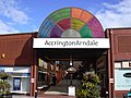 Accrington Arndale - geograph.org.uk - 1000773.jpg 640 × 480; 75 KB
-

-
 Ash Terrace, Bacup - geograph.org.uk - 1022262.jpg 640 × 480; 88 KB
-
 Barnes Avenue - geograph.org.uk - 1009091.jpg 640 × 480; 78 KB
-
 Blackacre Lane - geograph.org.uk - 996340.jpg 640 × 480; 91 KB
-
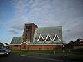
 Blackburn Cathedral - geograph.org.uk - 2257906.jpg 1,200 × 826; 242 KB
-
 Bon Voyage - geograph.org.uk - 1028495.jpg 640 × 425; 49 KB
-
 BP petrol station - geograph.org.uk - 1032162.jpg 640 × 480; 60 KB
-
 Bridge 121 - geograph.org.uk - 1007767.jpg 640 × 479; 141 KB
-
 Caton rail bridge - geograph.org.uk - 1069154.jpg 640 × 480; 59 KB
-
 Clough Road - geograph.org.uk - 1022220.jpg 640 × 356; 50 KB
-
 Cottages at Primrose Hill - geograph.org.uk - 1028208.jpg 640 × 480; 64 KB
-
 Crabtree Avenue, Bacup - geograph.org.uk - 1022044.jpg 640 × 296; 55 KB
-
 Crossroads on minor roads, Slyne - geograph.org.uk - 991105.jpg 640 × 426; 64 KB
-
 Damside Mill, Pilling - geograph.org.uk - 1015177.jpg 640 × 480; 109 KB
-
 Derby Terrace - geograph.org.uk - 1008872.jpg 640 × 396; 104 KB
-
 Dock Street, Fleetwood. - geograph.org.uk - 1026982.jpg 640 × 422; 36 KB
-
 Notice about Downham Mill - geograph.org.uk - 1026259.jpg 640 × 530; 135 KB
-
 Dunsop Bridge Post Office - geograph.org.uk - 1017620.jpg 640 × 480; 157 KB
-
 Dunsop Bridge Post Office - geograph.org.uk - 1017623.jpg 640 × 480; 215 KB
-

-
 Fields looking towards Gaw Hill - geograph.org.uk - 1028922.jpg 640 × 480; 80 KB
-
 Fish Quay, Heysham Harbour - geograph.org.uk - 991050.jpg 640 × 426; 47 KB
-
 Floodgate at Cockers Dyke, Preesall - geograph.org.uk - 995300.jpg 419 × 640; 87 KB
-

-
 Henry Street - geograph.org.uk - 1008934.jpg 640 × 362; 59 KB
-
 Heysham Harbour - geograph.org.uk - 991060.jpg 640 × 426; 43 KB
-
 Muddy track off Spring Lane - geograph.org.uk - 1014487.jpg 640 × 480; 100 KB
-
 Ogden Reservoir - geograph.org.uk - 1010298.jpg 640 × 345; 45 KB
-
 Ogden Reservoir Overspill - geograph.org.uk - 1010289.jpg 640 × 480; 99 KB
-
 Ogden Reservoir, Grane - geograph.org.uk - 1010268.jpg 480 × 640; 108 KB
-
 Ogden Reservoir, Grane - geograph.org.uk - 1010285.jpg 640 × 480; 80 KB
-
 Ogden Reservoir, Spillway - geograph.org.uk - 1010295.jpg 640 × 363; 71 KB
-
 Ormskirk West End Primary School - geograph.org.uk - 996373.jpg 640 × 480; 51 KB
-
 Our "local" - geograph.org.uk - 996369.jpg 640 × 480; 74 KB
-
 Outside Heysham Harbour - geograph.org.uk - 991056.jpg 640 × 426; 46 KB
-
 Pair of Houses, Haslingden Old Road - geograph.org.uk - 1009123.jpg 640 × 442; 100 KB
-
 Parsons Lane - geograph.org.uk - 1014496.jpg 640 × 480; 92 KB
-
 Partly harvested turf - geograph.org.uk - 1032145.jpg 640 × 480; 73 KB
-
 Pennine Road - geograph.org.uk - 1022128.jpg 640 × 385; 53 KB
-
 Public Library, rear view - geograph.org.uk - 1008852.jpg 640 × 369; 51 KB
-
 Rawtenstall Road - geograph.org.uk - 1014915.jpg 640 × 441; 77 KB
-
 Rhodes Avenue - geograph.org.uk - 1000866.jpg 640 × 480; 121 KB
-
 Rose and Crown, Manchester Road, Burnley - geograph.org.uk - 993259.jpg 640 × 480; 170 KB
-
 Schofield Road - geograph.org.uk - 1008819.jpg 640 × 480; 72 KB
-
 Sheep on the move - geograph.org.uk - 1028036.jpg 640 × 480; 74 KB
-
 St Bartholomews Parish Church - geograph.org.uk - 1189549.jpg 640 × 364; 52 KB
-

-
-

-

-

-
 St. Nicholas Church, Fleetwood. - geograph.org.uk - 1026976.jpg 640 × 480; 49 KB
-
 Stone - geograph.org.uk - 1016165.jpg 480 × 640; 168 KB
-
 Terminal station - geograph.org.uk - 999857.jpg 640 × 480; 121 KB
-
 The Assembly, Lune Street - geograph.org.uk - 1016174.jpg 640 × 480; 157 KB
-
 The Brockhole Arms, Claughton-On-Brock - geograph.org.uk - 1001014.jpg 616 × 460; 132 KB
-
 The former Mount Street Hospital - geograph.org.uk - 1016164.jpg 640 × 480; 183 KB
-
-
 The Golden Ball, Pilling - geograph.org.uk - 995480.jpg 640 × 420; 85 KB
-

-
 The Shawes Arms, London Road, Preston - geograph.org.uk - 1016161.jpg 640 × 480; 225 KB
-
 The Shooters - geograph.org.uk - 1016175.jpg 480 × 640; 185 KB
-
 The Victims - geograph.org.uk - 1016176.jpg 640 × 480; 201 KB
-
 The Warners Arms - geograph.org.uk - 1000812.jpg 640 × 443; 67 KB
-
 The Wheatsheaf Inn, Leyland Lane - geograph.org.uk - 1026695.jpg 612 × 460; 138 KB
-
 The Woolpack - geograph.org.uk - 1014960.jpg 640 × 411; 70 KB
-
 Thos. Yates, Jewellers - geograph.org.uk - 1017505.jpg 480 × 640; 207 KB
-

-
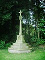
 War Memorial, Claughton - geograph.org.uk - 1001047.jpg 640 × 480; 197 KB
-

-
 Windbreak and drain - geograph.org.uk - 999882.jpg 640 × 480; 96 KB


