Category:October 2008 in North Yorkshire
Jump to navigation
Jump to search
Deutsch: Bilder, die im Oktober 2008 in North Yorkshire aufgenommen worden sind. Bitte beachten Sie, dass dies weder das Datum des Uploads noch das Datum des Scannens eines Fotos ist.
English: Images/pictures taken in North Yorkshire during October 2008. Note this is not the date of the upload, nor the date a photo was scanned.
Español: Fotografías o imágenes tomadas en North Yorkshire durante octubre 2008. No es la fecha de subida ni escaneo, sino la fecha en que las fotografías o imágenes se crearon.
Esperanto: Bildoj faritaj en North Yorkshire en oktobro 2008. Tio ne estas la dato, kiam la bildoj estis alŝutitaj aŭ skanitaj.
Français : Photographies ou images prises en North Yorkshire durant octobre 2008. Ce n'est pas la date du téléchargement ou du scan.
Galego: Fotografías ou imaxes tomadas en North Yorkshire durante outubro 2008. Non é a data de subida nin escaneamento, senón a data na que se crearon as fotografías ou imaxes.
Italiano: Fotografie o immagini scattate a North Yorkshire nel ottobre 2008. Nota bene: la data non si riferisce né a quella di upload né a quella in cui la foto è stata digitalizzata.
Norsk bokmål: Bilder tatt i North Yorkshire i løpet av oktober 2008. Merk at dette ikke er datoen for opplasting, eller når et bilde har blitt skannet.
Norsk nynorsk: Bilete teke i North Yorkshire i løpet av oktober 2008. Merk at dette ikkje er datoen for opplasting, eller når eit bilete har vorte skanna.
Русский: Изображения, сделанные в North Yorkshire в течение октябрь 2008 (не дата загрузки изображения).
Українська: Зображення, зроблені в North Yorkshire протягом жовтень 2008. Зауважте, що це не дата завантаження чи дата сканування фотографії.
| October 2007 | ← | October 2008 | → | October 2009 | |||||||
| Jan | Feb | Mar | Apr | May | Jun | Jul | Aug | Sep | Oct | Nov | Dec |
| 133 | 133 | 124 | 106 | 170 | 192 | 124 | 157 | 83 | 58 | 93 | 52 |
|---|---|---|---|---|---|---|---|---|---|---|---|
Subcategories
This category has the following 2 subcategories, out of 2 total.
Media in category "October 2008 in North Yorkshire"
The following 56 files are in this category, out of 56 total.
-
 After the harvest - geograph.org.uk - 1012073.jpg 640 × 358; 62 KB
-
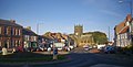 All Saints Church - geograph.org.uk - 1058162.jpg 640 × 323; 222 KB
-
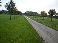
 An Arable Field Within the Croft Circuit - geograph.org.uk - 1005743.jpg 640 × 427; 290 KB
-
 Autumn ploughing, Humberton - geograph.org.uk - 1025966.jpg 640 × 298; 30 KB
-
 Bleaberry Gill - geograph.org.uk - 1016883.jpg 640 × 480; 93 KB
-
 Bleaberry Gill-Cringley Bottom - geograph.org.uk - 1016958.jpg 480 × 640; 102 KB
-
 Brompton-on-Swale - geograph.org.uk - 1026525.jpg 640 × 480; 93 KB
-
 Cambridge Street, Harrogate.jpg 2,816 × 2,112; 838 KB
-
-
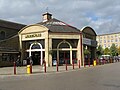
 Cononley railway station in 2008.jpg 640 × 480; 284 KB
-
 Cottages at Wath - geograph.org.uk - 1024714.jpg 640 × 480; 121 KB
-
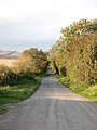
 Country road at Boythorpe - geograph.org.uk - 1012033.jpg 640 × 480; 133 KB
-
 Dead straight - geograph.org.uk - 1012055.jpg 480 × 640; 85 KB
-
 Field east of Ellerby Lane - geograph.org.uk - 1024521.jpg 640 × 480; 175 KB
-
 Fields to the west of Grassington - geograph.org.uk - 1024509.jpg 640 × 480; 68 KB
-
 Fieldside track to Burton Grange - geograph.org.uk - 1025958.jpg 640 × 480; 87 KB
-
 Footpath beside River Nidd - geograph.org.uk - 1024724.jpg 640 × 480; 105 KB
-
 Ford, Winterscales Beck - geograph.org.uk - 1024891.jpg 1,024 × 683; 151 KB
-

-
 Gate in a state^ - geograph.org.uk - 1022604.jpg 640 × 480; 109 KB
-
 Gateway - Hall Drive - geograph.org.uk - 1026364.jpg 640 × 445; 193 KB
-
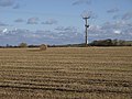
 Geometric countryside - geograph.org.uk - 1012046.jpg 640 × 313; 40 KB
-
 Green Lane near Cowlam - geograph.org.uk - 1012062.jpg 640 × 480; 141 KB
-
 Green Lane near Pasture Cottages - geograph.org.uk - 1012042.jpg 640 × 480; 128 KB
-
 Hargreaves Street - Skipton Road - geograph.org.uk - 1025028.jpg 640 × 459; 182 KB
-
 Harker Street - Main Street, Sutton - geograph.org.uk - 1026464.jpg 640 × 462; 209 KB
-
 Harrogate Fire Station - geograph.org.uk - 1001191.jpg 640 × 453; 53 KB
-
 Hopperton Pump - geograph.org.uk - 1015275.jpg 640 × 471; 93 KB
-
 Hopperton Village - geograph.org.uk - 1015256.jpg 640 × 480; 113 KB
-
 Hull Pot Beck - geograph.org.uk - 996221.jpg 640 × 480; 107 KB
-
 Ivy Scar - geograph.org.uk - 1024997.jpg 480 × 640; 97 KB
-
 Lime Lane Layby (Unofficial N Yorks Tip) - geograph.org.uk - 1022032.jpg 640 × 480; 122 KB
-
 Limekiln Cottage - geograph.org.uk - 1024324.jpg 640 × 453; 95 KB
-
 Local shops on Chain Lane - geograph.org.uk - 1027081.jpg 640 × 394; 60 KB
-
 Loftusdepot2008.JPG 451 × 300; 79 KB
-
 Main Street - Sutton - geograph.org.uk - 1026472.jpg 640 × 456; 194 KB
-
 Morrisons superstore, Skipton - geograph.org.uk - 1007886.jpg 640 × 480; 70 KB
-
 Nidderdale Way above Ashfold Side Beck - geograph.org.uk - 1024927.jpg 640 × 480; 108 KB
-
 Park Grove Methodist Church - geograph.org.uk - 1027075.jpg 640 × 480; 74 KB
-
 Rainbow with Matching Tractor Winch - geograph.org.uk - 1032753.jpg 640 × 480; 73 KB
-
 Rutson Hospital - geograph.org.uk - 1013063.jpg 427 × 640; 255 KB
-

-
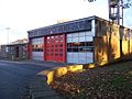 Skipton Fire Station.jpg 640 × 480; 79 KB
-
 Smelt Mill by Ashfold Side Beck - geograph.org.uk - 1024947.jpg 640 × 480; 125 KB
-
 St Andrew's Graveyard - Kildwick - geograph.org.uk - 1016821.jpg 640 × 480; 341 KB
-
 Stream running along Ashfold Side - geograph.org.uk - 965415.jpg 600 × 400; 254 KB
-
 The Dog and Gun public house Potto - geograph.org.uk - 1005357.jpg 640 × 480; 52 KB
-
 The Inn at Hawnby - geograph.org.uk - 1013389.jpg 640 × 427; 265 KB
-
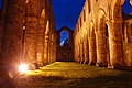 The nave, Fountains Abbey at dusk - geograph.org.uk - 1138542.jpg 640 × 428; 80 KB
-
 The tower at Fountains Abbey at dusk - geograph.org.uk - 1138494.jpg 640 × 428; 77 KB
-
-

-
 View from The Fleece - geograph.org.uk - 1058139.jpg 640 × 480; 294 KB
-
 Walking the dogs, Sandsend Beach - geograph.org.uk - 1013592.jpg 640 × 480; 98 KB
-
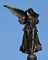 War Memorial Winged Victory, Skipton.jpg 515 × 640; 44 KB
-
 Yet another lay-by on the A168 north - geograph.org.uk - 1004758.jpg 640 × 480; 42 KB


_-_geograph.org.uk_-_1022032.jpg)


