Category:Ohio Lands
Jump to navigation
Jump to search
Subcategories
This category has the following 6 subcategories, out of 6 total.
Media in category "Ohio Lands"
The following 51 files are in this category, out of 51 total.
-
 1805 Survey - Twelve Mile Square Reserve.png 1,854 × 1,854; 1.16 MB
-
 1805 Treaty of Greenvile townships, Ohio country.jpg 3,496 × 4,648; 2.23 MB
-
 Congress Lands in Ohio.png 696 × 824; 734 KB
-
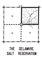 Delaware Salt Reservation.png 513 × 722; 37 KB
-
 Donation Tract (Ohio).png 970 × 507; 767 KB
-
 East of Scioto River Survey.png 697 × 919; 415 KB
-
 Fort Washington Cincinnati map.png 455 × 701; 45 KB
-
 French Grants.jpg 3,522 × 5,276; 1.27 MB
-
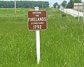 Frldsign.jpg 2,031 × 1,614; 1.08 MB
-
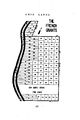
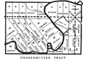 Gnadenhutten Tract.png 762 × 544; 91 KB
-
 Greenville Treaty Line Map.png 544 × 711; 79 KB
-
 Kilbourne 3.jpg 4,032 × 3,024; 8.35 MB
-
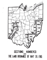
 Land Act of 1785 section numbering.png 1,327 × 1,239; 27 KB
-
 Move of Land Office to Wooster.JPG 800 × 1,400; 1.12 MB
-
 Map from Indian land cessions in the United States by Charles C. Royce 53.jpg 3,297 × 4,256; 5 MB
-

-
 Maumee Road Lands.png 936 × 543; 372 KB
-
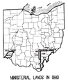 Ministerial lands.png 587 × 721; 79 KB
-
 Muskingum Salt Reservations.png 835 × 554; 83 KB
-
 North and East of First Principal Meridian.png 811 × 845; 701 KB
-
 North of Old Seven Ranges.png 764 × 828; 941 KB
-
 Ohio archæological and historical quarterly (1887) (14586329538).jpg 1,979 × 2,796; 717 KB
-
 Ohio Company and Donation Tract.png 538 × 822; 633 KB
-
 Ohio Country de.png 1,217 × 920; 1.42 MB
-
 Ohio Lands.svg 323 × 364; 242 KB
-
 Ohio-scioto lands.png 540 × 672; 396 KB
-
 Plssohio.gif 350 × 379; 47 KB
-
 PSM V45 D200 Map showing the contours of the ohio valley.jpg 2,809 × 1,670; 519 KB
-
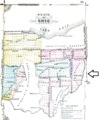
 Refugee in Ohio.png 697 × 919; 1.01 MB
-
 Refugee Tracts.png 929 × 451; 176 KB
-
 Royce-areas-ohio.jpg 1,567 × 1,661; 522 KB
-
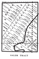 Salem Tract.png 525 × 794; 88 KB
-
 Schoenbrunn Tract.png 487 × 738; 78 KB
-
 Scioto salt reservation.png 546 × 761; 320 KB
-
 Seven in Ohio.png 794 × 918; 1.02 MB
-
 Seven Ranges.png 467 × 913; 699 KB
-
 South & East of First Principal Meridian.png 1,028 × 919; 1.04 MB
-
 Steubenville Land District.png 692 × 843; 298 KB
-
 Theoreticaltownshipmap.gif 694 × 751; 70 KB
-
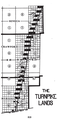 Turnpike Lands.png 462 × 949; 79 KB
-
 Two Mile Square Reserve.png 539 × 650; 53 KB
-
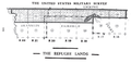
 US Military Dist (Ohio).png 1,143 × 597; 601 KB
-
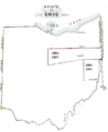
 US Military District in Ohio.png 697 × 919; 1.01 MB
-
 Uses 1785 numbering.png 620 × 782; 139 KB
-
 USMD Subdivisions.png 547 × 609; 97 KB
-
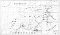
 Virginia Military District with counties.png 547 × 947; 283 KB
-
 West Of Miami River Survey.png 501 × 937; 250 KB
-
 Zane Hocking River Survey.png 512 × 582; 28 KB
-
 Zane Scioto River Survey.png 486 × 566; 29 KB
-
 Zane Survey on Muskingum River.png 699 × 601; 35 KB
-
 Zane's Trace.png 795 × 605; 332 KB


.png)


.jpg)


_(14586329538).jpg)


.png)


