Category:Okushiri Island
Jump to navigation
Jump to search
English: Okushiri Island
日本語: 奥尻島
island in Japan, Hokkaido, Hiyama Subprefecture   | |||||
| Upload media | |||||
| Instance of | |||||
|---|---|---|---|---|---|
| Part of | |||||
| Location | Okushiri, Okushiri district, Hiyama Subprefecture, Hokkaido, Japan | ||||
| Located in or next to body of water | |||||
| Capital | |||||
| Mascot |
| ||||
| Highest point | |||||
| Area |
| ||||
| Elevation above sea level |
| ||||
 | |||||
Subcategories
This category has the following 4 subcategories, out of 4 total.
Media in category "Okushiri Island"
The following 11 files are in this category, out of 11 total.
-
 Admiralty Chart No 3438 O Shima to Furubira Wan, Published 1904.jpg 11,341 × 17,710; 55.67 MB
-
 Horonaigawa Caldera Relief Map, SRTM-1.jpg 800 × 600; 253 KB
-
 Mottate-iwa 2011.JPG 2,560 × 1,920; 1.05 MB
-
 Nabetsuru iwa 2011.JPG 2,560 × 1,920; 1,014 KB
-
 Okushiri Island Aerial photograph.2017.jpg 10,000 × 14,166; 25.11 MB
-
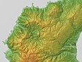
 Okushiri Island Relief Map, SRTM.jpg 900 × 1,200; 290 KB
-
 Okushiri port.jpg 3,840 × 2,160; 5.4 MB
-

-
 鍋釣岩 - panoramio.jpg 3,072 × 2,048; 2.27 MB
-
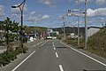 青苗地区 - panoramio.jpg 3,072 × 2,048; 2.28 MB
-
 青苗地区中心 - panoramio.jpg 3,072 × 2,048; 2.04 MB


