Category:Old Bolsover
Jump to navigation
Jump to search
English: Old Bolsover is the term used to describe the zone between Bolsover Castle, and the Eastern edge of the town, at Moor Hall, in Bolsover, Derbyshire, that is represented by Old Bolsover Town Council. This chiefly consists of Bolsover town centre, some council estates to the east of the centre, as well as houses in the Hill Top area, and on the road to Shuttlewood.
civil parish in Derbyshire, England, UK | |||||
| Upload media | |||||
| Instance of | |||||
|---|---|---|---|---|---|
| Location | Bolsover, Derbyshire, East Midlands, England | ||||
 | |||||
Subcategories
This category has the following 6 subcategories, out of 6 total.
Media in category "Old Bolsover"
The following 200 files are in this category, out of 656 total.
(previous page) (next page)-
 "The Anchor Inn", Bolsover - geograph.org.uk - 3220431.jpg 4,117 × 2,941; 2.98 MB
-
 "The Cavendish" in the centre of Bolsover - geograph.org.uk - 3220470.jpg 4,205 × 2,804; 2.46 MB
-
 "The Little Castle" at Bolsover - geograph.org.uk - 3220424.jpg 4,332 × 2,888; 2.72 MB
-
 49 High Street, Old Bolsover (geograph 7059277).jpg 1,024 × 768; 175 KB
-
 A busy M1 heads north - geograph.org.uk - 2842874.jpg 640 × 480; 72 KB
-
 A conduit house, Bolsover - geograph.org.uk - 2211741.jpg 708 × 900; 352 KB
-
 A fencing demonstration - geograph.org.uk - 3386774.jpg 640 × 524; 78 KB
-
 A fine pile of muck - geograph.org.uk - 2240563.jpg 3,648 × 2,736; 5.61 MB
-
 A king's mounted guard - geograph.org.uk - 3386798.jpg 640 × 427; 73 KB
-
 A model of Bolsover Castle and the real thing beyond - geograph.org.uk - 3220250.jpg 4,297 × 2,865; 3.2 MB
-
 A street in New Bolsover - geograph.org.uk - 4728426.jpg 1,995 × 1,470; 713 KB
-
 A632 descending from Bolsover - geograph.org.uk - 2140879.jpg 900 × 625; 350 KB
-
 A632, junction sign and tree - geograph.org.uk - 2224469.jpg 900 × 895; 362 KB
-
 Across "Dragonfly pool", Peter Fidler reserve - geograph.org.uk - 4113967.jpg 1,024 × 1,024; 346 KB
-
 Across "Dragonfly pool", Peter Fidler reserve - geograph.org.uk - 4113998.jpg 1,021 × 1,024; 326 KB
-

-
 Adin Avenue, Shuttlewood - geograph.org.uk - 2448675.jpg 950 × 662; 291 KB
-

-
 Anchor Inn - geograph.org.uk - 3667264.jpg 800 × 600; 98 KB
-
 Approaching Grove Wood - geograph.org.uk - 3818007.jpg 4,000 × 2,248; 5.57 MB
-
 Approaching Station Road, Bolsover - geograph.org.uk - 3782302.jpg 4,000 × 1,791; 4.95 MB
-
 Approaching the junction - geograph.org.uk - 2044904.jpg 640 × 480; 54 KB
-
 Approaching Woodside Farm - geograph.org.uk - 6168660.jpg 1,600 × 1,200; 422 KB
-
 Arable field and telegraph poles - geograph.org.uk - 3721688.jpg 750 × 348; 69 KB
-
 Arable field north of Langwith Road - near Bolsover - geograph.org.uk - 3220514.jpg 4,168 × 2,779; 2.85 MB
-
 Arable Land near Elmton Lane - geograph.org.uk - 2853578.jpg 3,296 × 2,472; 1,020 KB
-
 Autumn colours, Carr Vale Road - geograph.org.uk - 2151526.jpg 900 × 675; 434 KB
-
 B6417 heading north - geograph.org.uk - 4113533.jpg 640 × 480; 68 KB
-
 B6417 Mansfield Road heading north - geograph.org.uk - 4282776.jpg 640 × 481; 37 KB
-
 B6417 nearing Marlpit Lane junction - geograph.org.uk - 4282768.jpg 640 × 481; 33 KB
-
 B6417 past Moor Farm - geograph.org.uk - 2166216.jpg 900 × 502; 225 KB
-
 B6417-Mooracre Lane junction - geograph.org.uk - 4282764.jpg 640 × 481; 39 KB
-
 B6418 Clowne Road towards Shuttlewood - geograph.org.uk - 2441083.jpg 744 × 950; 314 KB
-
 B6418 southwest of Clowne - geograph.org.uk - 2166061.jpg 900 × 613; 342 KB
-
 Bainbridge Road, Boslover - geograph.org.uk - 3279781.jpg 1,024 × 768; 483 KB
-
 Barley ripening, east of Staveley - geograph.org.uk - 3058037.jpg 3,648 × 2,736; 4.76 MB
-
 Bathurst Road under snow - geograph.org.uk - 3305100.jpg 1,024 × 768; 249 KB
-
 Bee skep in a bee bole, Bolsover Castle - geograph.org.uk - 4728486.jpg 2,048 × 1,536; 813 KB
-
 Bench in the north west corner of Bolsover Castle - geograph.org.uk - 3220069.jpg 2,921 × 4,424; 2.61 MB
-
 Bentinck Road terrace - geograph.org.uk - 2441077.jpg 950 × 679; 296 KB
-
 Big red gate at Bolsover Castle - geograph.org.uk - 2889485.jpg 3,072 × 2,304; 1.24 MB
-
 Bird table in the Carr Vale reserve - geograph.org.uk - 2777322.jpg 1,024 × 798; 471 KB
-
 Blackbanks Farm - geograph.org.uk - 2166035.jpg 900 × 466; 242 KB
-
 Blind Lane, Bolsover - geograph.org.uk - 3782318.jpg 4,000 × 2,248; 5.32 MB
-
 Boarded up house, Stanfree - geograph.org.uk - 4116181.jpg 640 × 480; 80 KB
-
 Boggy area on reclaimed industrial land - geograph.org.uk - 5261619.jpg 5,113 × 3,694; 4.12 MB
-
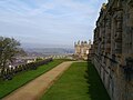
 Bolsover (a View from The Castle) - geograph.org.uk - 5547514.jpg 640 × 481; 549 KB
-
 Bolsover - Black Bull - geograph.org.uk - 2231686.jpg 1,600 × 1,200; 322 KB
-
 Bolsover - Doomed 'pre-fabs' on Oxcroft Lane - geograph.org.uk - 2302699.jpg 1,024 × 768; 159 KB
-
 Bolsover - former colliery offices - geograph.org.uk - 2290712.jpg 1,600 × 1,172; 380 KB
-
 Bolsover - Hilltop No 35 and 37 - geograph.org.uk - 2241213.jpg 1,600 × 1,207; 453 KB
-
 Bolsover - Methodist Church - geograph.org.uk - 2241206.jpg 1,170 × 1,600; 485 KB
-
 Bolsover - Moor Lane - geograph.org.uk - 1311283.jpg 640 × 480; 73 KB
-
 Bolsover - New Station Road - geograph.org.uk - 2182600.jpg 1,024 × 768; 131 KB
-
 Bolsover - New Station Road - geograph.org.uk - 2182608.jpg 1,024 × 768; 132 KB
-
 Bolsover - New Station Road - geograph.org.uk - 2366506.jpg 2,560 × 1,920; 2.38 MB
-
 Bolsover - Ovencroft Lane - geograph.org.uk - 993632.jpg 640 × 480; 108 KB
-
 Bolsover - Portland House - geograph.org.uk - 2290711.jpg 1,600 × 1,200; 367 KB
-
 Bolsover - railway and rear of colliery workshops - geograph.org.uk - 2290708.jpg 1,600 × 1,224; 570 KB
-
 Bolsover - Replacements for the old 'Pre-Fabs' - geograph.org.uk - 4313789.jpg 2,560 × 1,920; 2.35 MB
-
 Bolsover - Sandhills Road - geograph.org.uk - 1311354.jpg 640 × 480; 51 KB
-
 Bolsover - shops on Station Road - geograph.org.uk - 2231693.jpg 1,600 × 1,200; 414 KB
-
 Bolsover - St Mary ^ St Lawrence Church - geograph.org.uk - 3700441.jpg 1,600 × 1,265; 684 KB
-
 Bolsover - The Anchor Inn - geograph.org.uk - 2231698.jpg 1,600 × 1,201; 338 KB
-
 Bolsover - The Blue Bell - geograph.org.uk - 2270922.jpg 1,600 × 1,200; 404 KB
-
 Bolsover - The Cavendish - geograph.org.uk - 3700445.jpg 1,600 × 1,287; 628 KB
-
 Bolsover - Town Council building - geograph.org.uk - 2231705.jpg 1,600 × 1,203; 356 KB
-
 Bolsover - White Swan - geograph.org.uk - 2231681.jpg 1,600 × 1,200; 369 KB
-
 Bolsover -"The White Swan" and town centre shops - geograph.org.uk - 3220462.jpg 4,398 × 2,932; 2.94 MB
-
 Bolsover Antiques Centre - geograph.org.uk - 1935762.jpg 640 × 480; 71 KB
-
 Bolsover Antiques Centre - geograph.org.uk - 4073797.jpg 1,024 × 680; 230 KB
-
 Bolsover Castle - geograph.org.uk - 1930374.jpg 640 × 426; 75 KB
-
 Bolsover Castle - geograph.org.uk - 3386824.jpg 640 × 427; 44 KB
-
 Bolsover Castle - geograph.org.uk - 3565826.jpg 1,600 × 1,200; 416 KB
-
 Bolsover Castle - geograph.org.uk - 3643930.jpg 640 × 480; 78 KB
-
 Bolsover Castle - geograph.org.uk - 3782306.jpg 3,992 × 2,234; 4.08 MB
-
 Bolsover Castle - geograph.org.uk - 3783006.jpg 533 × 800; 126 KB
-
 Bolsover Castle - geograph.org.uk - 4072732.jpg 1,024 × 680; 280 KB
-
 Bolsover Castle - geograph.org.uk - 4072735.jpg 800 × 531; 120 KB
-
 Bolsover Castle - geograph.org.uk - 4072736.jpg 800 × 531; 108 KB
-
 Bolsover Castle - geograph.org.uk - 4072740.jpg 800 × 531; 115 KB
-
 Bolsover Castle - geograph.org.uk - 4072741.jpg 800 × 531; 129 KB
-
 Bolsover Castle - geograph.org.uk - 4072757.jpg 800 × 531; 141 KB
-
 Bolsover Castle - geograph.org.uk - 4072762.jpg 800 × 531; 129 KB
-
 Bolsover Castle - geograph.org.uk - 4072768.jpg 1,024 × 680; 238 KB
-
 Bolsover Castle - geograph.org.uk - 4072769.jpg 800 × 531; 83 KB
-
 Bolsover Castle - geograph.org.uk - 4072770.jpg 531 × 800; 110 KB
-
 Bolsover Castle - geograph.org.uk - 4528026.jpg 1,920 × 1,080; 662 KB
-
 Bolsover Castle - geograph.org.uk - 5018436.jpg 2,048 × 1,536; 1.52 MB
-
 Bolsover Castle - geograph.org.uk - 5547470.jpg 640 × 481; 417 KB
-
 Bolsover Castle - geograph.org.uk - 5571608.jpg 640 × 480; 416 KB
-
 Bolsover Castle - geograph.org.uk - 5905687.jpg 1,378 × 1,034; 834 KB
-
 Bolsover Castle - geograph.org.uk - 5905692.jpg 1,056 × 793; 398 KB
-
 Bolsover Castle - geograph.org.uk - 5905700.jpg 4,592 × 3,448; 5.8 MB
-
 Bolsover Castle - geograph.org.uk - 5905703.jpg 4,592 × 3,448; 5.38 MB
-
 Bolsover Castle - geograph.org.uk - 5946083.jpg 5,184 × 3,888; 3.93 MB
-
 Bolsover Castle from Station Road - geograph.org.uk - 4282744.jpg 640 × 480; 63 KB
-
 Bolsover Castle on a grey afternoon - geograph.org.uk - 6180051.jpg 1,024 × 768; 790 KB
-
 Bolsover Castle, a fine copper beech - geograph.org.uk - 6180074.jpg 1,024 × 683; 731 KB
-
 Bolsover Castle, a gloomy June view - geograph.org.uk - 6179974.jpg 1,024 × 1,024; 1.03 MB
-

-
 Bolsover Castle, Elysium Closet - geograph.org.uk - 5547693.jpg 640 × 481; 448 KB
-
 Bolsover Castle, seen from Sutton Scarsdale - geograph.org.uk - 2843392.jpg 4,000 × 3,000; 2.52 MB
-
 Bolsover Castle, Star Chamber - geograph.org.uk - 5547679.jpg 640 × 485; 466 KB
-
 Bolsover Castle, Terrace range - geograph.org.uk - 5547702.jpg 640 × 481; 514 KB
-
 Bolsover Castle, The Fountain Garden - geograph.org.uk - 5547714.jpg 640 × 481; 548 KB
-
 Bolsover Castle, the gate to the Little Castle - geograph.org.uk - 6179939.jpg 1,024 × 1,024; 963 KB
-
 Bolsover Castle, The Lantern - geograph.org.uk - 5547698.jpg 640 × 510; 431 KB
-
 Bolsover Castle, the Lantern - geograph.org.uk - 6179935.jpg 1,024 × 1,024; 1.03 MB
-
 Bolsover Castle, the roof of the Riding School - geograph.org.uk - 6180072.jpg 819 × 1,024; 959 KB
-
 Bolsover Castle, The Terrace Range - geograph.org.uk - 5547504.jpg 640 × 481; 467 KB
-
 Bolsover Castle, the Terrace Range - geograph.org.uk - 6179931.jpg 819 × 1,024; 943 KB
-

-
 Bolsover Cemetery Maintenance - geograph.org.uk - 3900498.jpg 2,349 × 1,879; 1.91 MB
-
 Bolsover Civic Society Pump - geograph.org.uk - 1935771.jpg 480 × 640; 95 KB
-
 Bolsover Colliery - geograph.org.uk - 2259362.jpg 647 × 480; 103 KB
-
 Bolsover Colliery - geograph.org.uk - 2259364.jpg 800 × 503; 116 KB
-
 Bolsover fire station - geograph.org.uk - 2024548.jpg 640 × 427; 182 KB
-
 Bolsover Fire Station - geograph.org.uk - 4073791.jpg 1,024 × 680; 245 KB
-
 Bolsover from Woodhouse Lane - geograph.org.uk - 2812243.jpg 640 × 423; 81 KB
-
 Bolsover from Woodhouse Lane - geograph.org.uk - 3258338.jpg 1,024 × 601; 98 KB
-
 Bolsover High Street - geograph.org.uk - 2240317.jpg 1,024 × 747; 128 KB
-
 Bolsover Hill and The Fidler's Rest - geograph.org.uk - 2412500.jpg 950 × 686; 372 KB
-
 Bolsover hillside and rainbow - geograph.org.uk - 2345726.jpg 950 × 936; 411 KB
-
 Bolsover Hospital, Marlpit Lane - geograph.org.uk - 2269800.jpg 3,648 × 2,736; 5.41 MB
-
 Bolsover housing estate - geograph.org.uk - 3279819.jpg 1,024 × 533; 303 KB
-
 Bolsover Library - geograph.org.uk - 2240269.jpg 1,024 × 768; 191 KB
-
 Bolsover Little Castle - geograph.org.uk - 4665188.jpg 800 × 533; 87 KB
-
 Bolsover Methodist Church - geograph.org.uk - 2240282.jpg 1,024 × 731; 189 KB
-
 Bolsover Methodist Church - geograph.org.uk - 3782324.jpg 3,980 × 2,212; 5.82 MB
-
 Bolsover Mine once - geograph.org.uk - 2812218.jpg 640 × 397; 81 KB
-
 Bolsover Moor - geograph.org.uk - 4459705.jpg 4,000 × 3,000; 1.61 MB
-
 Bolsover Moor arable 1 - geograph.org.uk - 1291257.jpg 640 × 480; 220 KB
-
 Bolsover Moor arable 2 - geograph.org.uk - 1291258.jpg 640 × 480; 201 KB
-
 Bolsover Moor Farm and nearby cottages - geograph.org.uk - 3220491.jpg 4,152 × 2,966; 2.95 MB
-
 Bolsover Moor in flower - geograph.org.uk - 2945474.jpg 3,456 × 2,304; 3.56 MB
-
 Bolsover Moor Quarry - geograph.org.uk - 2269840.jpg 3,648 × 2,736; 6.23 MB
-
 Bolsover Moor Quarry Entrance Sign - geograph.org.uk - 2668440.jpg 2,464 × 3,296; 1,019 KB
-
 Bolsover Parish Church - geograph.org.uk - 2182614.jpg 1,024 × 768; 142 KB
-
 Bolsover Parish Church - geograph.org.uk - 3220628.jpg 4,191 × 2,994; 2.71 MB
-
 Bolsover path - geograph.org.uk - 3667985.jpg 800 × 600; 216 KB
-
 Bolsover police station - geograph.org.uk - 2448742.jpg 950 × 684; 304 KB
-
 Bolsover rooftops - geograph.org.uk - 3258341.jpg 1,024 × 768; 169 KB
-
 Bolsover War Memorial Base - geograph.org.uk - 5547748.jpg 640 × 482; 460 KB
-
 Bolsover, churchyard - geograph.org.uk - 2240299.jpg 1,024 × 768; 157 KB
-
 Bolsover, Cotton Street - geograph.org.uk - 2240289.jpg 1,024 × 768; 167 KB
-
 Bolsover, hillside houses down to Carr Vale - geograph.org.uk - 3279831.jpg 1,024 × 768; 365 KB
-
 Bolsover, Market Place - geograph.org.uk - 2240250.jpg 1,024 × 768; 159 KB
-
 Bolsover, south-west from the Terrace Range - geograph.org.uk - 6180061.jpg 1,024 × 732; 711 KB
-
 Bolsover, The Blue Bell - geograph.org.uk - 2240307.jpg 1,024 × 768; 142 KB
-

-
 Bolsover, view - geograph.org.uk - 2240334.jpg 768 × 1,024; 222 KB
-
 Bonds Main Colliery (5435980375).jpg 3,648 × 2,056; 2.66 MB
-
 Bread delivery on a snowy morning - geograph.org.uk - 2181775.jpg 900 × 675; 313 KB
-
 Bridge over the M1 - geograph.org.uk - 2441052.jpg 950 × 717; 296 KB
-
 Bridge over the M1 near Oxcroft Junction - geograph.org.uk - 3900543.jpg 2,526 × 1,805; 2.11 MB
-
 Bridleway view towards Whaley Common - geograph.org.uk - 1382809.jpg 640 × 480; 66 KB
-
 By Accident or Design ^ - geograph.org.uk - 4313810.jpg 2,560 × 1,920; 2.39 MB
-
 By Grave Wood west of Whaley - geograph.org.uk - 4938641.jpg 3,888 × 5,184; 5.53 MB
-

-
 Cantilevered advance sign for Junction 29A on M1 - geograph.org.uk - 4618236.jpg 1,600 × 1,067; 920 KB
-
 Cantilevered sign and footbridge on M1 near Junction 29A - geograph.org.uk - 4618275.jpg 1,600 × 1,067; 969 KB
-
 Car park by Castle Street - geograph.org.uk - 2418106.jpg 950 × 663; 291 KB
-
 Car park under snow, Bolsover - geograph.org.uk - 2184151.jpg 900 × 524; 233 KB
-
 Carr Vale - Sculpture on Peter Fidler Reserve - geograph.org.uk - 2366445.jpg 2,560 × 1,920; 2.38 MB
-
 Carr Vale and beyond - geograph.org.uk - 2349491.jpg 2,560 × 1,920; 2.36 MB
-
 Carr Vale Flashes - geograph.org.uk - 2141412.jpg 675 × 900; 340 KB
-
 Carr Vale Road and the social club - geograph.org.uk - 2184143.jpg 900 × 675; 365 KB
-
 Castle Cafe - geograph.org.uk - 3667276.jpg 800 × 600; 73 KB
-
 Castle Door view - geograph.org.uk - 3667688.jpg 600 × 800; 147 KB
-

-
 Castle Lane and Carr Vale under snow - geograph.org.uk - 2182332.jpg 900 × 626; 259 KB
-
 Castle Lane, Bolsover - geograph.org.uk - 2140865.jpg 900 × 614; 339 KB
-
 Castle Parking - geograph.org.uk - 3667268.jpg 800 × 582; 76 KB
-
 Castle Street, Bolsover - geograph.org.uk - 2166647.jpg 900 × 520; 299 KB
-
 Castle View - geograph.org.uk - 3666646.jpg 800 × 600; 79 KB
-
 Cavendish Hotel, Town End, Bolsover - geograph.org.uk - 3530190.jpg 549 × 640; 108 KB
-
 Cedar Park Drive - geograph.org.uk - 2457100.jpg 640 × 480; 56 KB
-

-
 Chapel Road, Carr Vale - geograph.org.uk - 3297395.jpg 1,024 × 768; 489 KB
-
 Charlesworth Street and Dotti Deli - geograph.org.uk - 2414194.jpg 950 × 618; 338 KB
-
 Chesterfield Road and houses - geograph.org.uk - 2448645.jpg 950 × 617; 264 KB
-
 Church building, Carr Vale - geograph.org.uk - 2216214.jpg 900 × 584; 211 KB
-

-
 Church of St Mary and St Laurence, Bolsover - geograph.org.uk - 4728598.jpg 2,048 × 1,536; 745 KB
-
 Church Road in Stanfree - geograph.org.uk - 4113621.jpg 4,000 × 3,000; 1.8 MB
-
 Church Road in Stanfree - geograph.org.uk - 4113642.jpg 3,900 × 2,811; 2.47 MB
-
 Church Road, Shuttlewood - geograph.org.uk - 2967673.jpg 3,648 × 2,736; 4.69 MB
-
 Churchyard scene, Bolsover - geograph.org.uk - 2211726.jpg 686 × 900; 385 KB
-
 Citizens of Bolsover - Remembrance Sunday 2012 - geograph.org.uk - 3220451.jpg 4,477 × 2,811; 3.32 MB
-
 Clowne Road (B6418) - geograph.org.uk - 4116188.jpg 640 × 480; 69 KB
-

-
 Coalite Works, Gate No. 5 - geograph.org.uk - 2967600.jpg 3,648 × 2,736; 4.67 MB
-
 Coat of Arms at Bolsover Castle - geograph.org.uk - 5547492.jpg 640 × 481; 520 KB
-

-
 Conduit Road by Eastern Avenue - geograph.org.uk - 3279794.jpg 1,024 × 744; 268 KB
-
 Conduit Road, Bolsover - geograph.org.uk - 3279798.jpg 1,024 × 768; 293 KB
-
 Congestion on the M1 heading north - geograph.org.uk - 2842881.jpg 640 × 480; 55 KB
-
 Cottages in Stanfree - geograph.org.uk - 6146819.jpg 640 × 480; 72 KB
-
 Cottages on Blind Lane - geograph.org.uk - 3782284.jpg 800 × 533; 83 KB


.jpg)


_-_geograph.org.uk_-_5547514.jpg)


.jpg)


_-_geograph.org.uk_-_4116188.jpg)


