Category:Old Dalby
Jump to navigation
Jump to search
English: Old Dalby is a village in the English county of Leicestershire. It is located to the north-west of Melton Mowbray. It was originally known as "Wold Dalby" or "Dalby on the Wolds". (→Old Dalby)
Polski: Old Dalby – wieś w Anglii, w hrabstwie Leicestershire, w dystrykcie Melton. Leży 22 km na północny wschód od miasta Leicester i 155 km na północ od Londynu. (→Old Dalby)

village in Leicestershire, United Kingdom | |||||
| Upload media | |||||
| Instance of | |||||
|---|---|---|---|---|---|
| Location | Broughton and Old Dalby, Melton, Leicestershire, East Midlands, England | ||||
 | |||||
Subcategories
This category has the following 3 subcategories, out of 3 total.
C
- Crown Inn, Old Dalby (7 F)
O
Media in category "Old Dalby"
The following 47 files are in this category, out of 47 total.
-
 1st Old Dalby Scout hut - geograph.org.uk - 2846366.jpg 1,024 × 768; 282 KB
-
 Bridleway near Saxelby Pastures - geograph.org.uk - 212192.jpg 640 × 480; 106 KB
-
 Countryside near Old Dalby - geograph.org.uk - 906809.jpg 640 × 482; 89 KB
-
 Countryside near Old Dalby - geograph.org.uk - 906810.jpg 640 × 480; 85 KB
-
 Countryside north of Old Dalby - geograph.org.uk - 906821.jpg 640 × 480; 106 KB
-
 Crop Spraying near Old Dalby - geograph.org.uk - 159827.jpg 640 × 427; 127 KB
-
 Farm track near Old Dalby - geograph.org.uk - 906808.jpg 640 × 527; 99 KB
-
 Farmland and buildings near Old Dalby - geograph.org.uk - 906823.jpg 640 × 420; 80 KB
-
 Footpath, Queensway, Old Dalby - geograph.org.uk - 2846176.jpg 1,024 × 768; 316 KB
-
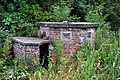 Gun Position Old Dalby.jpg 5,448 × 3,624; 5.1 MB
-
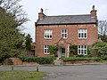 Home Farm, Old Dalby.jpg 1,280 × 960; 389 KB
-
-

-
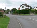
 Main Road in Old Dalby - geograph.org.uk - 906803.jpg 640 × 478; 90 KB
-
 Main Road in Old Dalby - geograph.org.uk - 906806.jpg 640 × 481; 63 KB
-
 Marriott's Spinney near Old Dalby - geograph.org.uk - 159692.jpg 427 × 640; 176 KB
-
 Midshires Way on Longcliff Hill - geograph.org.uk - 906816.jpg 640 × 440; 92 KB
-
 Wesleyan Church in Old Dalby - geograph.org.uk - 906804.jpg 640 × 496; 93 KB
-

-
 Old Dalby Manor House.JPG 4,520 × 2,240; 2.91 MB
-
 Old Dalby Pollarded Oak 2019.jpg 4,000 × 6,016; 14.34 MB
-
 Old Dalby Village Hall 2019.jpg 5,836 × 3,338; 10.27 MB
-
 Ploughed field near Old Dalby - geograph.org.uk - 159808.jpg 640 × 427; 182 KB
-
 Queensway 2019 Spring.jpg 3,459 × 1,539; 5.25 MB
-
 Queensway, The Park.jpg 5,633 × 3,574; 7.52 MB
-
 Railway bridge over Station Lane - geograph.org.uk - 906813.jpg 640 × 480; 91 KB
-
 The Midshires Way, north of Old Dalby - geograph.org.uk - 906822.jpg 640 × 480; 106 KB
-
 UK OldDalby.jpg 757 × 1,793; 301 KB
-
 View east from Longcliff Hill - geograph.org.uk - 906825.jpg 640 × 462; 81 KB
-
 View from Longcliff Hill - geograph.org.uk - 906817.jpg 640 × 480; 103 KB
-
 Village Hall and former Reading Room - geograph.org.uk - 2847007.jpg 1,024 × 768; 128 KB
-
 Wavendon Grange - geograph.org.uk - 906790.jpg 640 × 549; 78 KB
-
 Farm Track near Old Dalby, Leicestershire - geograph.org.uk - 130651.jpg 640 × 427; 190 KB
-
 Farmland near Grimston, Leicestershire - geograph.org.uk - 130648.jpg 640 × 427; 127 KB
-
 Farmland near Old Dalby - geograph.org.uk - 159816.jpg 640 × 427; 119 KB
-
 Gibson's Lane near Old Dalby - geograph.org.uk - 148210.jpg 640 × 427; 99 KB
-
 Gibson's Lane near Old Dalby - geograph.org.uk - 148221.jpg 640 × 427; 112 KB
-
 Green Hill near Old Dalby, Leicestershire - geograph.org.uk - 148260.jpg 640 × 427; 107 KB
-

-

-
 Old Dalby Industrial Estate - geograph.org.uk - 148250.jpg 640 × 427; 112 KB
-
 Queensway, Old Dalby - geograph.org.uk - 148257.jpg 640 × 427; 101 KB
-
 Saxelby Wood, Leicestershire - geograph.org.uk - 130058.jpg 640 × 427; 150 KB
-

-
 View from Longcliffe Hill, Old Dalby - geograph.org.uk - 148214.jpg 640 × 427; 98 KB
-
 View north from Gibson's Lane - geograph.org.uk - 148226.jpg 640 × 427; 103 KB
-
 Woods Hill, Nottingham Road, Old Dalby - geograph.org.uk - 148207.jpg 640 × 480; 168 KB


