Category:Old Moat
Jump to navigation
Jump to search
English: Old Moat is a Manchester City Council ward in the City of Manchester and includes part of Withington
electoral ward of Manchester City Council _2018.png) | |||||
| Upload media | |||||
| Instance of |
| ||||
|---|---|---|---|---|---|
| Named after |
| ||||
| Location | Manchester, Greater Manchester, North West England, England | ||||
| Inception |
| ||||
| Different from | |||||
 | |||||
Media in category "Old Moat"
The following 69 files are in this category, out of 69 total.
-
 86, Palatine Road - geograph.org.uk - 5928515.jpg 1,024 × 746; 271 KB
-
 Al Jameirah - geograph.org.uk - 5671259.jpg 1,280 × 1,062; 972 KB
-
 Alford Avenue - geograph.org.uk - 6310999.jpg 1,600 × 1,200; 729 KB
-
 Apartment block, Burton Road, Withington - geograph.org.uk - 6310205.jpg 1,600 × 1,200; 1.03 MB
-
 Birchington Road - geograph.org.uk - 6310991.jpg 1,600 × 1,200; 846 KB
-
 Boarded-up shop, Hill Street, Withington - geograph.org.uk - 6310222.jpg 1,600 × 1,200; 718 KB
-
 Borchardt Medical Centre, Withington - geograph.org.uk - 6310139.jpg 1,600 × 1,200; 1.01 MB
-
 Burton Road - geograph.org.uk - 5764012.jpg 1,280 × 745; 713 KB
-
 Car park for Withington Baths - geograph.org.uk - 6310194.jpg 1,600 × 1,043; 894 KB
-
 Children's swings, Old Moat Park - geograph.org.uk - 6310979.jpg 1,600 × 1,200; 1.06 MB
-
 Corner of Doncaster Avenue with Mauldeth Road West - geograph.org.uk - 6310996.jpg 1,600 × 1,200; 1.02 MB
-
 Davenport Buildings - geograph.org.uk - 6310937.jpg 1,600 × 1,200; 903 KB
-
 Doncaster Avenue houses, Withington - geograph.org.uk - 6310092.jpg 1,600 × 1,200; 730 KB
-
 EIIR Postbox (M20 634D) - geograph.org.uk - 5764005.jpg 1,280 × 960; 1.45 MB
-

-
 Entrance to Withington Baths and Leisure Centre - geograph.org.uk - 6310198.jpg 1,600 × 1,200; 1.03 MB
-
 Exuberant brickwork, Wilmslow Road, Withington - geograph.org.uk - 6310946.jpg 1,600 × 1,093; 748 KB
-
 Former NatWest bank, Wilmslow Road - geograph.org.uk - 6310933.jpg 1,600 × 1,200; 684 KB
-
 Former White Lion Hotel, now Sainsbury's supermarket - geograph.org.uk - 6310266.jpg 1,200 × 1,600; 776 KB
-
 Ghost sign (advert), Mauldeth Road West - geograph.org.uk - 6310982.jpg 1,600 × 1,200; 845 KB
-
 Hasper Avenue, Withington - geograph.org.uk - 6310108.jpg 1,600 × 1,200; 801 KB
-
 Hasper Avenue, Withington from Whitchurch Road - geograph.org.uk - 6310126.jpg 1,600 × 1,200; 1.02 MB
-
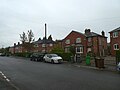
 Hill Street, to the west of Old Moat Park - geograph.org.uk - 6310961.jpg 1,600 × 1,200; 1.05 MB
-
 Hopelea Street, Withington - geograph.org.uk - 6310234.jpg 1,600 × 1,200; 727 KB
-
 Houses in Old Moat Lane, Withington - geograph.org.uk - 6310096.jpg 1,600 × 1,200; 799 KB
-
 Hungry in Withington^ Spoilt for choice - geograph.org.uk - 5671434.jpg 1,280 × 920; 907 KB
-
 Hungry in Withington^ Spoilt for choice - geograph.org.uk - 6370555.jpg 1,280 × 960; 927 KB
-
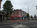
 Junction of Wilmslow Road and Palatine Road - geograph.org.uk - 5682081.jpg 1,280 × 960; 848 KB
-
 Lausanne Road, Withington - geograph.org.uk - 6310949.jpg 1,600 × 1,200; 860 KB
-
 Mauldeth Road West, Withington - geograph.org.uk - 6310957.jpg 1,200 × 1,600; 1.04 MB
-
 Meltham Avenue, Withington - geograph.org.uk - 6310130.jpg 1,600 × 1,200; 789 KB
-
 Narrow footpath to Ashford Road, Withington - geograph.org.uk - 6310185.jpg 1,200 × 1,600; 994 KB
-
 Number One Passage, off Mauldeth Road West - geograph.org.uk - 6310960.jpg 1,600 × 1,200; 930 KB
-
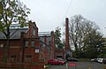
 Oak Bank Buildings 1876 - geograph.org.uk - 5773577.jpg 1,280 × 833; 899 KB
-

-
 Old Moat (Manchester City Council ward) 2018.png 2,043 × 3,776; 632 KB
-
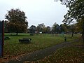
 Old Moat Park - geograph.org.uk - 6310966.jpg 1,600 × 1,200; 1.08 MB
-
 One large tree, Wellington Road, Withington - geograph.org.uk - 6310955.jpg 1,600 × 1,200; 953 KB
-
 Optician's shop, Withington - geograph.org.uk - 6310263.jpg 1,200 × 1,600; 808 KB
-
 Patten Street, Withington - geograph.org.uk - 6310243.jpg 1,600 × 1,200; 792 KB
-
 Pharmacy and medical centre, Copson Street, Withington - geograph.org.uk - 6310248.jpg 1,600 × 1,200; 746 KB
-
 Pickmere Avenue - geograph.org.uk - 6310984.jpg 1,600 × 1,200; 843 KB
-
 Playground, Old Moat Park - geograph.org.uk - 6310968.jpg 1,600 × 1,200; 1.07 MB
-
 Princess Road - geograph.org.uk - 5574273.jpg 1,280 × 1,059; 904 KB
-
 Rose Cottage Road - geograph.org.uk - 6310972.jpg 1,600 × 1,200; 783 KB
-
 Row of shops, Mauldeth Road West - geograph.org.uk - 6310975.jpg 1,600 × 1,200; 828 KB
-
 Sainsbury's supermarket, Wilmslow Road, Withington - geograph.org.uk - 6310259.jpg 1,200 × 1,600; 811 KB
-
 Shops on Wilmslow Road - geograph.org.uk - 5773573.jpg 1,280 × 960; 841 KB
-
 Sign of the Victoria - geograph.org.uk - 5670992.jpg 1,280 × 1,667; 1.33 MB
-
 Somerford Avenue - geograph.org.uk - 6310989.jpg 1,600 × 1,179; 995 KB
-
 Springhead Avenue - geograph.org.uk - 6311004.jpg 1,600 × 1,200; 800 KB
-
 St Bernadette's Tower - geograph.org.uk - 5574311.jpg 1,280 × 1,280; 911 KB
-
 Stanthorne Avenue - geograph.org.uk - 6311003.jpg 1,600 × 1,200; 695 KB
-
 Strathblane Close - geograph.org.uk - 5826473.jpg 1,280 × 960; 1.01 MB
-
 The Albert, Withington - geograph.org.uk - 6310919.jpg 1,600 × 1,200; 819 KB
-
 The Victoria Hotel, Wilmslow Road - geograph.org.uk - 6310923.jpg 1,600 × 1,200; 843 KB
-
 Thurlwood Avenue, Withington - geograph.org.uk - 6310103.jpg 1,600 × 1,200; 670 KB
-

-
 Veterinary Surgery, Copson Street, Withington - geograph.org.uk - 6310241.jpg 1,600 × 1,200; 676 KB
-
 Victoria Hotel - geograph.org.uk - 5670981.jpg 1,280 × 928; 993 KB
-
 Victoria Hotel, Purveyors of Fine Cask Ales - geograph.org.uk - 5670988.jpg 1,280 × 960; 993 KB
-
 West Didsbury Bus Terminus - geograph.org.uk - 6069427.jpg 1,280 × 960; 1,018 KB
-
 Westcott Avenue, Withington - geograph.org.uk - 6310179.jpg 1,600 × 1,200; 820 KB
-
 Wilmslow Road - geograph.org.uk - 5682075.jpg 1,280 × 831; 721 KB
-
 Withington Adult Learning Centre - geograph.org.uk - 6310218.jpg 1,600 × 1,200; 856 KB
-
 Withington Baths and Leisure Centre - geograph.org.uk - 6310188.jpg 1,600 × 1,212; 1.08 MB
-
 Withington Library - geograph.org.uk - 6310944.jpg 1,600 × 1,200; 753 KB
-
 Withington Methodist Church - geograph.org.uk - 5671347.jpg 1,280 × 1,387; 1.06 MB
-
 Yew Tree Road beside Old Moat Park - geograph.org.uk - 6310980.jpg 1,200 × 1,600; 989 KB


_-_geograph.org.uk_-_5764005.jpg)


,_Mauldeth_Road_West_-_geograph.org.uk_-_6310982.jpg)


