Category:Old Woughton
Aller à la navigation
Aller à la recherche
village britannique  | |||||
| Téléverser des médias | |||||
| Nature de l’élément |
| ||||
|---|---|---|---|---|---|
| Lieu | Milton Keynes (borough), Buckinghamshire, Angleterre du Sud-Est, Angleterre | ||||
| site officiel | |||||
 | |||||
Média dans la catégorie « Old Woughton »
Cette catégorie comprend 83 fichiers, dont les 83 ci-dessous.
-
 A pond in Ouzel Valley Park - geograph.org.uk - 3963688.jpg 1 500 × 999 ; 160 kio
-
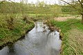
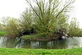 An oxbow in Ouzel Valley Park - geograph.org.uk - 3963657.jpg 1 500 × 999 ; 253 kio
-
 Around Woughton on the Green - geograph.org.uk - 5153889.jpg 640 × 480 ; 83 kio
-
 Around Woughton on the Green - geograph.org.uk - 5153891.jpg 640 × 480 ; 93 kio
-
 Around Woughton on the Green - geograph.org.uk - 5153892.jpg 480 × 640 ; 112 kio
-
 Around Woughton on the Green - geograph.org.uk - 5153894.jpg 640 × 480 ; 35 kio
-
 Around Woughton on the Green - geograph.org.uk - 5153895.jpg 640 × 480 ; 69 kio
-
 Around Woughton on the Green - geograph.org.uk - 5153896.jpg 640 × 480 ; 65 kio
-
 Around Woughton on the Green - geograph.org.uk - 5153897.jpg 640 × 480 ; 72 kio
-
 Around Woughton on the Green - geograph.org.uk - 5153899.jpg 640 × 480 ; 80 kio
-
 Around Woughton on the Green - geograph.org.uk - 5153900.jpg 640 × 480 ; 117 kio
-
 Around Woughton on the Green - geograph.org.uk - 5153902.jpg 640 × 480 ; 62 kio
-
 Around Woughton Park - geograph.org.uk - 5153905.jpg 640 × 480 ; 81 kio
-
 Around Woughton Park - geograph.org.uk - 5153908.jpg 640 × 480 ; 60 kio
-
 Around Woughton Park - geograph.org.uk - 5153909.jpg 640 × 480 ; 39 kio
-
 Bench by the path - geograph.org.uk - 3963648.jpg 1 500 × 999 ; 224 kio
-
 Benchmark on St Mary's Church - geograph.org.uk - 5208860.jpg 683 × 1 024 ; 261 kio
-
 Bridge 85A taking Chaffron Way over the canal - geograph.org.uk - 2845569.jpg 1 600 × 1 200 ; 768 kio
-
 Bridge 86, Grand Junction Canal - geograph.org.uk - 2715222.jpg 4 000 × 3 000 ; 4,64 Mio
-
 Bridge 87, Grand Junction Canal - geograph.org.uk - 2715224.jpg 4 000 × 3 000 ; 4,85 Mio
-
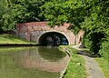
 Bridge 88, Grand Junction Canal - geograph.org.uk - 2715194.jpg 4 000 × 3 000 ; 4,94 Mio
-
 Bridge 89, Grand Junction Canal - geograph.org.uk - 2715209.jpg 4 000 × 3 000 ; 4,71 Mio
-
 Bridge 90, Grand Junction Canal - geograph.org.uk - 2715213.jpg 4 000 × 3 000 ; 4,8 Mio
-
 Bridge 90A taking Standing Way over the canal - geograph.org.uk - 2845582.jpg 1 600 × 1 200 ; 453 kio
-
 Bridge 90A, Grand Junction Canal - geograph.org.uk - 2715216.jpg 4 000 × 3 000 ; 4,93 Mio
-
 Bridge 90B, Grand Junction Canal - geograph.org.uk - 2713321.jpg 4 000 × 3 000 ; 4,81 Mio
-
 Bridge 90B, Grand Junction Canal - geograph.org.uk - 2713323.jpg 4 000 × 3 000 ; 5,05 Mio
-
 Bridge 90C, Grand Junction Canal - geograph.org.uk - 2668223.jpg 4 000 × 3 000 ; 5,07 Mio
-
 Castle Rose - geograph.org.uk - 3846523.jpg 640 × 480 ; 130 kio
-
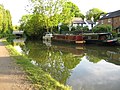 Domestic mooring - geograph.org.uk - 2845592.jpg 1 600 × 1 200 ; 604 kio
-
 Entrance to Milton Keynes Marina - geograph.org.uk - 4750096.jpg 800 × 588 ; 163 kio
-
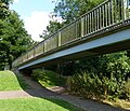
 Footbridge No 86 crossing the Grand Union Canal - geograph.org.uk - 4750052.jpg 800 × 585 ; 189 kio
-
 Footbridge over the Canal - geograph.org.uk - 2845574.jpg 1 600 × 1 200 ; 675 kio
-
 Footbridge over the River Ouzel - geograph.org.uk - 3963606.jpg 1 500 × 999 ; 265 kio
-
 Footbridge over the River Ouzel - geograph.org.uk - 3963670.jpg 1 500 × 999 ; 253 kio
-
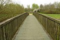 Footbridge to Monkton Park - geograph.org.uk - 3963678.jpg 1 500 × 999 ; 182 kio
-
 Gate and cattle grid on the path - geograph.org.uk - 3963613.jpg 1 500 × 999 ; 256 kio
-
 Gate on the path - geograph.org.uk - 3963684.jpg 1 500 × 999 ; 232 kio
-
 Grand Union Canal - geograph.org.uk - 4156011.jpg 1 024 × 683 ; 275 kio
-
 Grand Union Canal Walk - geograph.org.uk - 5628000.jpg 640 × 480 ; 94 kio
-
 Grand Union Canal Walk - geograph.org.uk - 5628002.jpg 640 × 480 ; 112 kio
-
 Grand Union Canal, Bridge Number 86 - geograph.org.uk - 3682332.jpg 640 × 480 ; 98 kio
-
 Grand Union Canal, Bridge Number 90A - geograph.org.uk - 3683491.jpg 640 × 475 ; 78 kio
-
 Grand Union Canal, Bridge Number 90B - geograph.org.uk - 3683513.jpg 640 × 480 ; 103 kio
-
 Grand Union Canal, Woughton on the Green - geograph.org.uk - 6324826.jpg 1 280 × 851 ; 382 kio
-
 Milton Keynes , Marlborough Street B4034 - geograph.org.uk - 5732987.jpg 6 000 × 4 000 ; 5,89 Mio
-
 Milton Keynes , Newport Road - geograph.org.uk - 5732989.jpg 5 460 × 3 641 ; 7,44 Mio
-
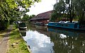 Narrowboats moored along the Grand Union Canal - geograph.org.uk - 4750086.jpg 800 × 502 ; 139 kio
-
 Newport Road - geograph.org.uk - 3846515.jpg 640 × 480 ; 101 kio
-
 Path around the pond - geograph.org.uk - 3963598.jpg 1 500 × 999 ; 223 kio
-
 Path in Ouzel Valley Park - geograph.org.uk - 3963681.jpg 1 500 × 999 ; 175 kio
-
 Path through the Ouzel Valley Park - geograph.org.uk - 2827747.jpg 3 072 × 2 304 ; 4,76 Mio
-
 Path to the River Ouzel - geograph.org.uk - 3963604.jpg 1 500 × 999 ; 212 kio
-
 Paths in the Ouzel Valley Park - geograph.org.uk - 3963667.jpg 1 500 × 999 ; 194 kio
-
 Peartree Bridge No 88 - geograph.org.uk - 4750092.jpg 800 × 576 ; 196 kio
-
 Pollarded willows by the Ouzel - geograph.org.uk - 6340657.jpg 1 600 × 1 066 ; 586 kio
-
 Pond in Ouzel Valley Park - geograph.org.uk - 3960435.jpg 1 500 × 999 ; 182 kio
-
 St Mary's Church - geograph.org.uk - 3846519.jpg 640 × 480 ; 81 kio
-
 St Mary's Church - geograph.org.uk - 5209527.jpg 1 024 × 683 ; 167 kio
-
 St Mary's Church - geograph.org.uk - 5766821.jpg 640 × 480 ; 102 kio
-
 St Mary's church, Woughton-on-the-Green - geograph.org.uk - 3228701.jpg 1 067 × 1 600 ; 359 kio
-
 The Green Bridge No 89 - geograph.org.uk - 4750101.jpg 800 × 600 ; 156 kio
-
 The path runs under Chaffron Way - geograph.org.uk - 3963619.jpg 1 500 × 999 ; 167 kio
-
 The pond in Ouzel Valley Park - geograph.org.uk - 3963600.jpg 1 500 × 999 ; 141 kio
-
 The River Ouzel from the footbridge - geograph.org.uk - 3963608.jpg 1 500 × 999 ; 254 kio
-
 The River Ouzel from the footbridge - geograph.org.uk - 3963671.jpg 1 500 × 999 ; 265 kio
-
 The River Ouzel from the footbridge - geograph.org.uk - 3963677.jpg 1 500 × 999 ; 289 kio
-
 The River Ouzel in Milton Keynes - geograph.org.uk - 3963631.jpg 1 500 × 999 ; 222 kio
-
 The River Ouzel in Milton Keynes - geograph.org.uk - 3963653.jpg 1 500 × 999 ; 194 kio
-
 The River Ouzel in Milton Keynes - geograph.org.uk - 3963654.jpg 1 500 × 999 ; 200 kio
-
 Tinkers Bridge No 90B - geograph.org.uk - 4750111.jpg 800 × 686 ; 212 kio
-
 Towpath near Peartree Bridge - geograph.org.uk - 2845578.jpg 1 600 × 1 200 ; 743 kio
-
 Towpath under bridge 90B by Tinkers Bridge - geograph.org.uk - 2845586.jpg 1 600 × 1 200 ; 569 kio
-
 Tree by the Ouzel - geograph.org.uk - 2827742.jpg 3 072 × 2 304 ; 4,74 Mio
-
 Tree in Ouzel Valley Park - geograph.org.uk - 3963685.jpg 999 × 1 500 ; 216 kio
-
 Walton Lake - geograph.org.uk - 5153904.jpg 640 × 480 ; 70 kio
-
 Winter Floods - geograph.org.uk - 368826.jpg 640 × 480 ; 87 kio
-
 Woughton on the Green Bridge No 87 - geograph.org.uk - 4750079.jpg 716 × 800 ; 123 kio
-
 Woughton Park turning (Groveway) - geograph.org.uk - 2676022.jpg 640 × 480 ; 74 kio
-
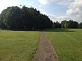
 Woughton Playing Fields, Milton Keynes - geograph.org.uk - 1908682.jpg 640 × 450 ; 302 kio
-
 Ye Olde Swan - geograph.org.uk - 3846517.jpg 640 × 480 ; 66 kio
-
 Ye Olde Swan - geograph.org.uk - 3846521.jpg 640 × 480 ; 71 kio
-
 Ye Olde Swan - geograph.org.uk - 5766823.jpg 640 × 480 ; 70 kio


_-_geograph.org.uk_-_2676022.jpg)


