Category:Old maps of Batavia
Jump to navigation
Jump to search
Subcategories
This category has the following 3 subcategories, out of 3 total.
- 17th-century maps of Batavia (59 F)
- 19th-century maps of Batavia (11 F)
Media in category "Old maps of Batavia"
The following 10 files are in this category, out of 10 total.
-
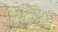 1909 Atlas sekolah Hindia-Nederland map of Batavia.jpg 1,227 × 670; 154 KB
-
 Location of the Aceh Monument on the 'Plan of Batavia' (1910).jpg 879 × 681; 252 KB
-
 Map of Batavia (Baedeker, 1914).jpg 1,784 × 1,815; 1.39 MB
-
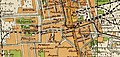
 Batavia (side detail in a 1914 map of Dutch Indonesia).jpg 440 × 442; 36 KB
-
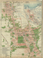
 Dutch Colonial Maps - NIGM.jpg 581 × 509; 401 KB
-
 Batavia, 1920.png 1,174 × 1,596; 1.31 MB
-

-
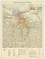 Garnizoens-Kaart Batavia en omstreken - btv1b53121546p.jpg 6,874 × 9,032; 11.16 MB
-
 1943 Japanese WWII map of Batavia.jpg 1,600 × 1,096; 508 KB
-
 Peta Kolonial Batavia milik G Colff n CO.jpg 748 × 357; 344 KB

.jpg)
.jpg)
.jpg)


