Category:Old maps of Bonn
Jump to navigation
Jump to search
Use the appropriate category for maps showing all or a large part of Bonn. See subcategories for smaller areas:
| If the map shows | Category to use |
|---|---|
| Bonn on a recently created map | Category:Maps of Bonn or its subcategories |
| Bonn on a map created more than 70 years ago | Category:Old maps of Bonn or its subcategories |
| the history of Bonn on a recently created map | Category:Maps of the history of Bonn or its subcategories |
| the history of Bonn on a map created more than 70 years ago | Category:Old maps of the history of Bonn or its subcategories |
Subcategories
This category has only the following subcategory.
M
Media in category "Old maps of Bonn"
The following 25 files are in this category, out of 25 total.
-
 Jülich-Cleve-Berg1836.jpg 2,899 × 2,172; 2.46 MB
-
 Meyer‘s Zeitungsatlas 048 – Bonn 1849.jpg 1,684 × 1,400; 1.34 MB
-
 Belagerung Bonn 1689 Plan.jpg 1,992 × 1,574; 661 KB
-
 Belagerung Bonn 1689 Stadt.jpg 2,000 × 1,608; 865 KB
-
 Belagerung Bonn 1703 Plan.jpg 2,008 × 1,664; 727 KB
-
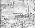
 Beueler Schanze.jpg 933 × 735; 203 KB
-
 Bonn (Merian 1646).jpg 2,338 × 1,654; 6.17 MB
-
 Bonn Halbvilla Rolffs Situationsplan 1911.jpg 724 × 817; 70 KB
-
 Bonn map Roman settlement area.jpg 644 × 960; 419 KB
-
 Bonn Merian.jpg 1,381 × 1,197; 880 KB
-
 Bonn Schaumburg-Lippe-Straße 6 Lageplan 1911.jpg 604 × 492; 57 KB
-
 Bonn Schaumburg-Lippe-Straße Plan 2.jpg 445 × 597; 63 KB
-
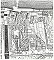
 Bonn Südstadt Thomann-Plan.jpg 3,003 × 2,032; 1.41 MB
-
 BONN1646.jpg 1,839 × 1,128; 2.82 MB
-
 Bonn1906.jpg 3,252 × 3,353; 7.84 MB
-
 Bonner Stadtplan 1912.gif 2,616 × 1,622; 4.36 MB
-
 Bonner Stadtplan Alter Zoll.jpg 1,018 × 1,130; 456 KB
-

-
 De Merian Mainz Trier Köln 085.jpg 3,804 × 3,408; 1.63 MB
-

-
 Stadtbahnhaltestelle-bad-godesberg-bahnhof-08.jpg 5,074 × 3,382; 4.38 MB
-
 Stadtplan von Bonn mit dem Schmidt-Schneider Stadion.jpg 1,024 × 646; 130 KB
-
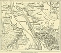 The earth and its inhabitants (1883) (21102660636).jpg 1,884 × 1,652; 976 KB
-
 Vilich Karte 1689.jpg 1,435 × 1,169; 437 KB
-
 WP Bundeszone.jpg 1,387 × 1,229; 561 KB


.jpg)


_(21102660636).jpg)

