Category:Old maps of Catania
Jump to navigation
Jump to search
| Category Old maps of Catania on sister projects: | |||||||||
|---|---|---|---|---|---|---|---|---|---|
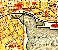
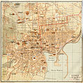
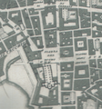
Old maps of Catania.
Subcategories
This category has only the following subcategory.
Media in category "Old maps of Catania"
The following 31 files are in this category, out of 31 total.
-
Catania 120320d.jpg 975 × 842; 207 KB
-
Catania 202ßß2.jpg 911 × 373; 233 KB
-
Catania map 1206456435.jpg 224 × 288; 23 KB
-
Admiralty Chart No 187 Sicily Sheet 3 Palma to Catania, Published 1872.jpg 12,198 × 8,172; 11.35 MB
-
Admiralty Chart No 188 Catania to Cefalu Published 1872.jpg 10,426 × 7,208; 8.26 MB
-
Admiralty Chart No 190 Ports on the Coast of Sicily, Published 1872.jpg 8,248 × 6,076; 5.87 MB
-
Catania - f de roberto - 0025.jpg 2,550 × 4,001; 779 KB
-
Catania - f de roberto - 0026.jpg 2,597 × 3,936; 594 KB
-
Catania carta12003.jpg 2,645 × 2,277; 3.08 MB
-
Catania carta1243e3.jpg 1,024 × 1,621; 429 KB
-
Catania carta12453.jpg 2,650 × 2,421; 2.66 MB
-
Ct919.jpg 2,866 × 2,902; 2.39 MB
-
HWScan.jpg 1,079 × 1,463; 90 KB
-
Italy; handbook for travellers (1900) (14784548952).jpg 1,671 × 1,170; 275 KB
-
Ittar Plan of Catania 1833, amphitheatre area.png 953 × 1,091; 2.36 MB
-
Pianta delle Mura di Catania (1637).jpg 1,280 × 960; 522 KB
-
Piazza Duomo Ittar.png 1,001 × 1,073; 2.34 MB
-
Planimetria Biblioteche Riunite "Civica e A. Ursino Recupero".jpg 2,440 × 2,221; 860 KB
-
Planimetria dell'Anfiteatro romano di Catania.jpg 3,872 × 2,592; 4.49 MB
-
Planimetria di Catania - Sebastiano Ittar, 1833.jpg 1,282 × 894; 276 KB
-
SanGaetanoGrotte1.png 335 × 268; 219 KB
-
SciutoPatti.png 961 × 1,021; 2.44 MB
-
Sebastiano Ittar Pianta topografica della città di Catania.jpg 1,986 × 1,202; 1.12 MB
-
Terme Achilliane-O. D'Arcangelo 1633.jpg 1,561 × 1,169; 228 KB
-
Vittorioemanuele-catania.png 1,078 × 244; 195 KB
-
Voyage pittoresque des isles de Sicile, de Malte et de Lipari. T. 2 1784 (5419245).jpg 8,688 × 6,336; 26.19 MB


