Category:Old maps of Diu
Jump to navigation
Jump to search
Subcategories
This category has only the following subcategory.
M
- Maps of Diu by Braun & Hogenberg (15 F)
Media in category "Old maps of Diu"
The following 15 files are in this category, out of 15 total.
-
 Diu map1729.jpg 1,024 × 768; 345 KB
-
 Ville de Diu, ou Dio,1750.jpg 3,905 × 3,125; 1.41 MB
-

-
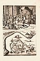
 A view from a Portuguese atlas, 1630.jpg 900 × 734; 119 KB
-

-

-

-

-
 Cidade de Diu, Dom João Mascarenhas (14781553281).jpg 2,668 × 2,512; 1.6 MB
-
 Diu 2a.jpg 800 × 600; 150 KB
-
 Diu map 1886.jpg 2,040 × 1,596; 4.46 MB
-
 Map of Diu.jpg 906 × 740; 155 KB
-
 Plan of Diu Island by John McCluer 1788 RMG L4267.tiff 6,000 × 4,827; 82.86 MB
-
-
 The Portuguese Fortress of Diu in the mid-16th century.png 2,704 × 1,682; 3.2 MB


.jpg)


.jpg)


