Category:Old maps of East Timor
Jump to navigation
Jump to search
Subcategories
This category has the following 2 subcategories, out of 2 total.
Media in category "Old maps of East Timor"
The following 36 files are in this category, out of 36 total.
-
 1 Oe-Cusse Ambeno 1904.jpg 2,048 × 1,449; 784 KB
-
 Old map timor by pigafetta.JPG 834 × 836; 120 KB
-
 Mapa de Timor (1731).jpg 4,160 × 2,928; 1.08 MB
-
 Timor map 1820 (02).jpg 1,318 × 1,019; 120 KB
-
 Timor map 1820.jpg 6,790 × 4,733; 5.83 MB
-
 Oecusse 1859.jpg 960 × 739; 204 KB
-
 Isla del Timor.JPG 339 × 251; 62 KB
-
-
 1920s Timor Island Map.jpg 2,737 × 1,936; 1.08 MB
-
 Admiralty Chart No 3244 Eastern Timor and Sermata Eilanden, Published 1944.jpg 16,228 × 11,032; 27.07 MB
-
 2 Oe-Cusse Ambeno 1904.jpg 2,048 × 1,516; 816 KB
-
 3 Oe-Cusse Ambeno 1904.jpg 1,449 × 2,048; 701 KB
-
 ATLAS JUSTUS PERTHES 14.jpg 4,349 × 3,845; 12.34 MB
-
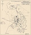
 Australian militar map of Lautém 1942.jpeg 2,514 × 1,662; 421 KB
-
 Australian military map of Fuiloro 1942.jpeg 1,925 × 2,132; 433 KB
-
 Australian military map of Hato-Udo 1942.jpg 1,454 × 2,771; 285 KB
-
 Dampier-nh2-05.jpg 500 × 727; 69 KB
-
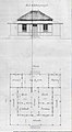 Fort Maubara Plan.jpg 497 × 904; 57 KB
-
 Map 1 of Oe-Cusse Ambeno 1909.jpg 657 × 960; 57 KB
-
 Map 2 of Oe-Cusse Ambeno 1909.jpg 739 × 1,080; 45 KB
-
 Oecusse Ambeno AHU doc No. 733.png 3,710 × 2,943; 1.2 MB
-
 Oecusse Ambeno Leste AHU doc No. 733.png 3,076 × 3,735; 1.89 MB
-
 PCA Timor Annexe A.jpg 7,016 × 4,960; 1.61 MB
-
 PCA Timor Annexe B.jpg 4,960 × 7,016; 1.64 MB
-
 PCA Timor Annexe C.jpg 4,960 × 7,016; 2.25 MB
-
 PCA Timor Annexe I.jpg 1,356 × 900; 719 KB
-
 PCA Timor Annexe II.jpg 1,366 × 900; 775 KB
-
 PCA Timor Annexe III.jpg 900 × 1,394; 544 KB
-
 PCA Timor Annexe IV.jpg 900 × 1,364; 565 KB
-
 PCA Timor Annexe V.jpg 1,546 × 2,448; 1.39 MB
-
 PCA Timor Annexe VI.jpg 900 × 1,403; 788 KB
-
 PCA Timor Annexe VII.jpg 1,608 × 2,514; 1.36 MB
-

-
 Port-timor.jpg 524 × 286; 51 KB
-
 Portuguese Timor 1937.jpg 13,129 × 8,213; 10.93 MB
-
 Timor 1914.png 3,602 × 2,487; 626 KB


.jpg)
.jpg)


.png)


