Category:Old maps of Flanders
Jump to navigation
Jump to search
Use the appropriate category for maps showing all or a large part of Flanders. See subcategories for smaller areas:
| If the map shows | Category to use |
|---|---|
| Flanders on a recently created map | Category:Maps of Flanders or its subcategories |
| Flanders on a map created more than 70 years ago | Category:Old maps of Flanders or its subcategories |
| the history of Flanders on a recently created map | Category:Maps of the history of Flanders or its subcategories |
| the history of Flanders on a map created more than 70 years ago | Category:Old maps of the history of Flanders or its subcategories |
Subcategories
This category has the following 30 subcategories, out of 30 total.
A
B
- Old maps of Blankenberge (2 F)
C
- Corte Cronikel (2 F)
D
- Old maps of De Pinte (2 F)
- Old maps of Deinze (3 F)
- Old maps of Dendermonde (9 F)
- Old maps of Diksmuide (15 F)
E
- Old maps of Eeklo (5 F)
G
- Old maps of Geraardsbergen (6 F)
K
M
N
- Old maps of Nieuwpoort (7 F)
O
R
- Old maps of Ronse (3 F)
T
- Old maps of Tielt (1 F)
- Old maps of Torhout (4 F)
V
W
- Old maps of Wachtebeke (4 F)
- Old maps of Wervik (3 F)
- Old maps of Wetteren (1 F)
Y
Z
- Old maps of Zelzate (1 F)
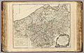
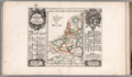
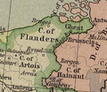
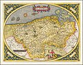
Media in category "Old maps of Flanders"
The following 89 files are in this category, out of 89 total.
-
 12 of 'Geschiedenis der Stad Eecloo' (11057202126).jpg 1,508 × 2,519; 765 KB
-
 12 of 'Het Westland in den Franschen Tijd' (11245491724).jpg 2,288 × 1,465; 796 KB
-
 123 of 'Geschiedenis van de Gemeenten der Provincie Oost-Vlaanderen' (11065657834).jpg 1,343 × 1,851; 462 KB
-
 1274 Dampier Vander Spriet.jpg 3,625 × 2,403; 4.7 MB
-

-
 Bodleian Libraries, Map of the north coast of France.jpg 672 × 1,000; 167 KB
-
 Print, book-illustration, map (BM 1982,U.2433).jpg 1,799 × 1,380; 775 KB
-
 Kaart van de fortificaties langs de Schelde nabij Antwerpen, 22 december 1584.jpg 3,764 × 2,932; 2.24 MB
-

-
 Nieuport-Walcheren - carte française - btv1b53009556z (1 of 2).jpg 9,982 × 7,534; 9.12 MB
-

-

-

-
 Carte particulière des Pays Bas Catholiques - Harrewyn fecit - btv1b59729484.jpg 6,858 × 5,230; 4.82 MB
-
 2756 Print 16080kopie.jpg 500 × 387; 2.22 MB
-

-
 411 of 'Histoire de Mardick et de la Flandre maritime' (11038142513).jpg 1,544 × 2,558; 539 KB
-
 43411 blaeu-1612-kaart-04.jpg 6,638 × 3,050; 3.67 MB
-

-

-
 A description of the coast FLANDERS from the Island Walcheren to Calice NYPL1640700.tiff 7,230 × 5,428; 112.28 MB
-
 Atlas Ortelius KB PPN369376781-033av-033br.jpg 3,000 × 2,194; 4.84 MB
-
 Berey Flandres.jpg 2,792 × 2,320; 10.02 MB
-
 Blaeu 1635 - Flandriæ Teutonicæ pars orientalior Ausschnitt1.png 968 × 784; 3.71 MB
-
 C. 1000 Holy Roman Empire (Northern).jpg 3,816 × 2,989; 5.81 MB
-
 C. 1150 France, Lotharingia and Burgundy.jpg 2,979 × 3,931; 4.77 MB
-
 C. 1250 Holy Roman Empire (Northwestern region).jpg 796 × 1,014; 989 KB
-
 C. 1350 Holy Roman Empire (Northwestern region).jpg 940 × 1,201; 1.42 MB
-
 C. 1450 Benelux region.jpg 1,079 × 1,201; 1.54 MB
-
 C. 1540 Austrian territories (Western).jpg 1,414 × 2,064; 2.95 MB
-
 C. 1540 Flanders and Benelux region.jpg 1,102 × 1,318; 1.57 MB
-
 C. 1575 France (Northern).jpg 2,206 × 1,275; 3.11 MB
-
 C. 1668-1699 Europe (treaty adjustments).jpg 1,753 × 984; 760 KB
-
 Carte de Flandres - Bruxelles, Louvain, Aerschoot, Malines, Dendermonde, Lier.jpg 11,829 × 8,456; 10.71 MB
-
 Charte van Vlaendren 1538 Pieter van der Beke.jpg 1,528 × 1,172; 1.27 MB
-
 County of Flanders in 1704.jpg 10,710 × 7,075; 16.08 MB
-
 County of Flanders in 1752.jpg 11,130 × 7,052; 15.55 MB
-
 Die Niederland Nach denen XVII Provincien Eingetheilet (11170024).jpg 8,211 × 4,777; 18.75 MB
-
 Die Niederland Nach denen XVII Provincien Eingetheilet (11170024).png 8,211 × 4,777; 56.91 MB
-

-
 Eugene-Henry-Fricx-Table-des-cartes-des-Pays-Bas MG 0560.tif 4,666 × 3,583; 47.86 MB
-
 Exactissima flandria descriptio.png 13,655 × 9,939; 4.39 MB
-
 Flandern 1477.png 278 × 242; 127 KB
-
 Flandern 1500.png 679 × 546; 932 KB
-
 Flandres, Carte des Comtez, 1660.jpg 3,944 × 2,905; 3.46 MB
-
 Flandria (Vlaanderen Flanders) 1584 Map by Abraham Ortelius.jpg 12,583 × 9,989; 44.7 MB
-
 Flandria - Petrus Kaerius caelavit - btv1b53213945d (1 of 2).jpg 3,902 × 2,890; 2.46 MB
-
 Flandria nova descriptio - CBT 6612630.jpg 5,588 × 4,738; 9.3 MB
-

-

-

-

-

-

-
 Golfe de l'Aa.jpg 1,055 × 570; 191 KB
-

-
 Guettard-1780--carte mineralogique-02--flandre--bergues-wormhout-steenvorde.png 1,563 × 686; 1.37 MB
-
-

-
 Jan van Kriekenborch - Frankrijk en Vlaanderen.jpg 2,274 × 3,008; 2.14 MB
-
 Jean-Rousset-de-Missy-Histoire-du-cardinal-Alberoni MG 1307.tif 5,454 × 1,956; 30.55 MB
-
 Kaart van de "Département de l'Escaut", Gent inbegrepen.jpg 4,365 × 3,505; 2.56 MB
-
 Kaart van de "Département de la Lys", Brugge en Oostende inbegrepen.jpg 4,293 × 3,583; 2.57 MB
-
 Kaart van de Schelde bij Antwerpen.jpg 5,652 × 4,674; 5.86 MB
-
-
 Kaart van het Land van Waas, inclusief de omgeving van Antwerpen, Gent, Hulst, enz..jpg 7,596 × 5,844; 6.53 MB
-
 Kaart van het Land van Waas, tussen Antwerpen en Gent.jpg 7,610 × 6,013; 7.64 MB
-

-
-
 Kanalen tussen Gent en Brugge.jpg 1,000 × 586; 691 KB
-
 Land van Beveren.gif 672 × 628; 20 KB
-
 Map of Flanders and inset map of part of Zeeland by Abraham Ortelius.jpeg 1,585 × 1,176; 650 KB
-
 Map of Flanders by Frederik De Wit.jpg 5,500 × 4,390; 4.62 MB
-
 Map of French Flanders.png 722 × 896; 194 KB
-
 Map of the Netherlands 1780.JPG 1,092 × 882; 255 KB
-
 Map of the Ypres district.png 857 × 1,391; 792 KB
-
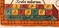
 Mercator scale.png 3,216 × 1,600; 4.92 MB
-

-
 Pars Flandriae Teutonicae occidentalior.jpg 991 × 789; 1.42 MB
-
 Procés-verbal-entre-les-procureurs-des-deux-roys MG 1285.tif 4,212 × 3,522; 42.48 MB
-
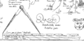
 Quad Flandria detail.jpg 2,528 × 1,204; 3.12 MB
-
 Quad Flandria.jpg 3,345 × 2,498; 7.53 MB
-
 Tabula Nova Geographica exhibens Ducatum Brabantiae.jpg 6,681 × 7,824; 7.77 MB
-

-

-
 Theatrum orbis terrarum - Flandria.jpg 12,426 × 9,644; 180.9 MB
-
 Verzaemelinge-van-eenige-staets-stukken-over-het-grond-gebied-in-de-Nederlanden-1782 MG 0685.tif 5,616 × 1,440; 23.17 MB
-
 Vlaanderen en Zeeland (tg-uapr-43).jpg 7,928 × 6,780; 7.74 MB
-
 Vlaanderen en Zeeland.jpg 7,992 × 6,621; 7.15 MB
.jpg)
.jpg)
.jpg)

.jpg)

.jpg)


.jpg)
_-_Geographicus_-_Flandre-lafeuille-1747.jpg)

.jpg)


_(With_maps.))%27_(11093244003).jpg)
.jpg)

.jpg)
.jpg)


.jpg)

.jpg)
.jpg)

.jpg)

.jpg)
.jpg)


.jpg)
.png)
_Gabriel_Bodenehr.jpg)


_1584_Map_by_Abraham_Ortelius.jpg)
.jpg)


_Serie_10_Nederlandse_en_Buitenlandse_Gebeurtenissen,_1587-1612_(serietitel),_RP-P-OB-78.784-308.jpg)
_Serie_10_Nederlandse_en_Buitenlandse_Gebeurtenissen,_1587-1612_(serietitel),_RP-P-OB-78.785-326.jpg)


.jpg)


.jpg)
