Category:Old maps of Gran Canaria
Jump to navigation
Jump to search
Islands of the Canary Islands: Fuerteventura · La Gomera · Gran Canaria · El Hierro · Lanzarote · La Palma · Tenerife
Subcategories
This category has only the following subcategory.
L
Media in category "Old maps of Gran Canaria"
The following 21 files are in this category, out of 21 total.
-

-

-

-
 AFR V3 D096 Cirque de Tejeda - Canary Islands.jpg 2,066 × 1,727; 819 KB
-
 AFR V3 D097 North-East Slope of Gran Canaria.jpg 2,039 × 2,548; 1.19 MB
-
 AFR V3 D098 Las Palmas and Port of La Luz - Canary Islands.jpg 1,436 × 2,634; 860 KB
-
 Carte de l'île de Grande Canarie - Iphigénie.jpg 4,865 × 3,836; 3.07 MB
-
 ETH-BIB-Gran Canaria, Karte (Neujahrsblatt 1939)-Dia 247-12356.tif 3,176 × 2,843; 25.94 MB
-
 ETH-BIB-Gran Canaria, Karte-Dia 247-Z-00183.tif 3,600 × 2,712; 9.4 MB
-
 ETH-BIB-Karte Gran Canaria-Dia 247-Z-00183-1.tif 3,624 × 2,712; 9.45 MB
-
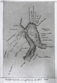
 Gando Pesthouse (lazareto) Old Map of 1896 Gran Canaria.jpg 495 × 568; 326 KB
-
 Gran Canaria & Las Palmas & Gando & Maspalomas Lighthouse Old Map 1895.jpg 1,528 × 1,153; 218 KB
-
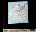
 Gran Canaria & Las Palmas City & Las Palmas Province Old Map 1896.jpg 1,565 × 1,209; 311 KB
-
-
 Isla de la gran Canaria - por Don Tomas López... - btv1b53227008c (1 of 2).jpg 7,384 × 5,683; 4.37 MB
-
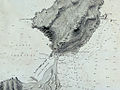 Isleta Confital Puerto de la Luz Las Palmas Gran Canaria 1879.jpg 1,024 × 768; 625 KB
-
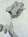 Isleta-peninsula-Gran-Canaria-Old-Map-1879.jpg 1,445 × 1,934; 1.49 MB
-
 Las Palmas de Gran Canaria (Bahía) Cartas náuticas 1879.jpg 1,228 × 1,659; 194 KB
-
 Mapa Gran Canaria Siglo xviii.jpg 718 × 643; 593 KB
-
 Old Map of San Mateo 1896.jpg 1,024 × 768; 740 KB
-
 Puerto de La Luz Old Map of 1895 Las Palmas Gran Canaria.jpg 578 × 634; 427 KB
%27_(11305553096).jpg)
%27_(11234185944).jpg)
%27_(11246727255).jpg)


_Old_Map_of_1896_Gran_Canaria.jpg)


.jpg)


_Cartas_n%C3%A1uticas_1879.jpg)


