Category:Old maps of Jharkhand
Jump to navigation
Jump to search
States of India: Andhra Pradesh · Arunachal Pradesh · Assam · Bihar · Goa · Gujarat · Jharkhand · Karnataka · Kerala · Madhya Pradesh · Maharashtra · Manipur · Meghalaya · Odisha · Sikkim · Tamil Nadu · Telangana · Tripura · Uttar Pradesh · Uttarakhand · West Bengal
Union territories: Andaman and Nicobar Islands · Dadra and Nagar Haveli and Daman and Diu · Delhi · Jammu and Kashmir · Ladakh · Lakshadweep · Puducherry
Former states of India: Jammu and Kashmir ·
Former union territories: Daman and Diu ·
Union territories: Andaman and Nicobar Islands · Dadra and Nagar Haveli and Daman and Diu · Delhi · Jammu and Kashmir · Ladakh · Lakshadweep · Puducherry
Former states of India: Jammu and Kashmir ·
Former union territories: Daman and Diu ·
Subcategories
This category has only the following subcategory.
Media in category "Old maps of Jharkhand"
The following 13 files are in this category, out of 13 total.
-
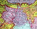
 Bihar and Orissa province.jpg 588 × 896; 71 KB
-
 Bihar-Orissa-Province.png 577 × 892; 818 KB
-
 Bihār. 7-69. LOC gm70003327.jpg 3,161 × 4,172; 1.68 MB
-
 Bihār. 7-69. LOC gm70003327.tif 3,161 × 4,172; 37.73 MB
-
-
 Chhota Nagpur 1902.jpg 4,328 × 2,999; 2.16 MB
-
 Chota Nagpur area-IGI.jpg 1,103 × 647; 148 KB
-
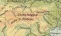 Chota Nagpur Plateau-IGI.jpg 1,080 × 648; 149 KB
-
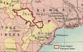
 Chota Nagpur States-a.jpg 965 × 647; 162 KB
-
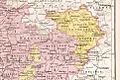
 Chota Nagpur States-b.jpg 1,125 × 649; 221 KB
-
 Chota Nagpur States-IGI 2.jpg 800 × 502; 121 KB
-
 Provincial Geographies of India Volume 2 0013.jpg 1,995 × 1,971; 681 KB
-
 South Bihar map by James Rennell.jpg 4,784 × 5,136; 2.56 MB


