Category:Old maps of Kassel
Jump to navigation
Jump to search
Subcategories
This category has only the following subcategory.
M
Media in category "Old maps of Kassel"
The following 21 files are in this category, out of 21 total.
-
 546 of 'Neumanns Orts-Lexikon des Deutschen Reichs' (11228182683).jpg 1,684 × 2,725; 1.27 MB
-
 547 of 'Neumanns Orts-Lexikon des Deutschen Reichs' (11225412726).jpg 1,756 × 2,725; 1.17 MB
-
 A Plan of the City of Cassel.jpg 1,317 × 889; 1.2 MB
-
 De Merian Hassiae 045.jpg 3,924 × 3,216; 3.53 MB
-
 De Merian Hassiae 050.jpg 4,224 × 2,471; 2.74 MB
-
 Eisenbahndirektion-cassel.jpg 792 × 526; 431 KB
-
 Karte der Residenzstadt Kassel und ihrer Umgebung.tif 5,366 × 2,877; 44.18 MB
-
 Karte Kassel (Generalstab) 1835.jpg 6,611 × 4,583; 8.59 MB
-
 Karte Kassel (Neumann) 1878.jpg 6,611 × 4,672; 6.71 MB
-
 Kassel Friedrichsplatz.png 1,430 × 1,990; 1.16 MB
-
 Kassel map 1860.jpg 1,544 × 1,025; 283 KB
-
 Kassel-merian.jpg 1,575 × 1,293; 380 KB
-
 Leopoldplan (Kassel) 1742.jpg 5,217 × 4,672; 6.33 MB
-
 Meyers b9 s0592a.jpg 2,048 × 1,773; 759 KB
-
 Müllerplan Kassel 1547.jpg 3,233 × 3,444; 4.01 MB
-
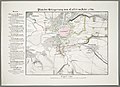 Plan der Belagerung von Cassel im Jahr 1762.jpg 6,654 × 4,843; 8.45 MB
-
 Plan du Siege de Cassel (Frederic Auguste) 1762.jpg 4,672 × 6,511; 9.46 MB
-
 Roth Kassel fortifications 1736.png 926 × 1,252; 2.27 MB
-
 Roth Kassel map 1736.jpg 1,462 × 962; 1.21 MB
-
 Unterneustadt 1895.jpg 1,002 × 1,008; 875 KB
-
 Карта к статье «Кассель». Военная энциклопедия Сытина (Санкт-Петербург, 1911-1915).jpg 1,409 × 1,014; 136 KB
.jpg)
.jpg)


_1835.jpg)
_1878.jpg)


_1742.jpg)


_1762.jpg)


.jpg)