Category:Old maps of Lesbos
Jump to navigation
Jump to search
Media in category "Old maps of Lesbos"
The following 35 files are in this category, out of 35 total.
-
 "Metelin" (22765249173).jpg 3,324 × 4,563; 1.21 MB
-
 I Lesbos nunc Metellino - Buondelmonti Cristoforo - 1420.jpg 768 × 986; 229 KB
-
 Liber Insularum Cycladum (Arundel MS 93.art.7, f.152r).jpeg 5,469 × 7,925; 55.47 MB
-
 (Metelin) - Sonetti Bartolommeo Dalli - 1485.jpg 1,176 × 1,500; 390 KB
-

-
 Venetian map of Metelin circa 1485 (Isolario, Bartolomeo da li Sonetti).jpg 957 × 1,205; 354 KB
-
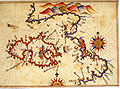
 Lesbos and Ayvalik by Piri Reis (cropped).jpg 775 × 548; 644 KB
-
 Lesbos and Ayvalik by Piri Reis.jpg 807 × 597; 582 KB
-
 Map of Lesbos and the coast of Asia Minor - Bordone Benedetto - 1547.jpg 723 × 800; 260 KB
-

-
 Metelin - Marco Boschini - btv1b53011681w (1 of 2).jpg 1,762 × 2,599; 730 KB
-
 Metelin - Boschini Marco - 1658.jpg 527 × 800; 213 KB
-
 De Sio et de Psara - (par Allain Manesson-Mallet) - btv1b53011766p.jpg 1,421 × 1,969; 668 KB
-
 Insula Metileme - Sandrart Jacob Von - 1686.jpg 756 × 1,410; 724 KB
-
 Metelino Isola - Enderlin Jacob - 1686.jpg 892 × 655; 333 KB
-
 Insula Metileme - Sandrart Jacob Von - 1687.jpg 756 × 1,410; 724 KB
-
 Metelin - Piacenza Francesco - 1688.jpg 1,034 × 1,500; 794 KB
-
 Metelin - Dapper Olfert - 1688.jpg 800 × 658; 248 KB
-

-

-
 Mitelen01.jpg 1,100 × 763; 247 KB
-
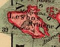 Heinrich Kiepert. Asia citerior.Lesbos.jpg 349 × 272; 25 KB
-
 Admiralty Chart No 1087 Kόlpos Petaliόn to Edremit Körfezi, Published 1955 (cropped).jpg 8,898 × 10,557; 20.21 MB
-
 Admiralty Chart No 1087 Kόlpos Petaliόn to Edremit Körfezi, Published 1955.jpg 18,332 × 11,242; 39.8 MB
-
 Admiralty Chart No 1664 Ports and anchorages in Lesvos, Published 1959.jpg 11,254 × 16,383; 47.72 MB
-
 Admiralty Chart No 1665 Mityleni Island (Lesbos), Published 1860.jpg 12,378 × 8,314; 13.24 MB
-
 Admiralty Chart No 1665 Nisos Lesvos, Published 1962.jpg 16,425 × 11,256; 26.68 MB
-
 Metileme by Giacomo Franco.jpg 1,251 × 713; 394 KB
-
 Mitileme - Peeters Jacob - 1690.jpg 1,500 × 1,064; 927 KB
-
 Mitilini chart.jpg 1,230 × 878; 312 KB
-
 Muğla 21.jpg 458 × 441; 73 KB
-

-
 Plan du port Sigre sur l'isle Metelin - Roux Joseph - 1804.jpg 1,500 × 1,071; 688 KB
-
 Χάρτης της Λέσβου - Millo Antonio - 1582-1591.jpg 1,500 × 2,171; 1.22 MB
-

.jpg)

.jpeg)
_-_Sonetti_Bartolommeo_Dalli_-_1485.jpg)
.jpg)
.jpg)
.jpg)


.jpg)
.jpg)

_-_btv1b53011766p.jpg)


.jpg)


,_Published_1860.jpg)


.jpg)