Category:Old maps of Middlesex
Jump to navigation
Jump to search
Ceremonial counties of England: Bedfordshire · Berkshire · Buckinghamshire · Cambridgeshire · Cheshire · Cornwall · Cumbria · Derbyshire · Devon · Dorset · Durham · East Riding of Yorkshire · East Sussex · Essex · Gloucestershire · Greater London · Greater Manchester · Hampshire · Herefordshire · Hertfordshire · Isle of Wight · Kent · Lancashire · Leicestershire · Lincolnshire · Norfolk · North Yorkshire · Northamptonshire · Northumberland · Nottinghamshire · Oxfordshire · Rutland · Shropshire · Somerset · South Yorkshire · Staffordshire · Suffolk · Surrey · Warwickshire · West Midlands · West Sussex · West Yorkshire · Wiltshire · Worcestershire
City-counties: Bristol · City of London
Former historic counties: Cumberland · Huntingdonshire · Middlesex · Sussex · Westmorland · Yorkshire
Other former counties:
City-counties: Bristol · City of London
Former historic counties: Cumberland · Huntingdonshire · Middlesex · Sussex · Westmorland · Yorkshire
Other former counties:
Subcategories
This category has the following 3 subcategories, out of 3 total.
Media in category "Old maps of Middlesex"
The following 24 files are in this category, out of 24 total.
-

-
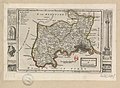
 A Mapp of the County of Middlesex with its Hundreds (BM 1864,1114.37).jpg 2,500 × 1,737; 1.29 MB
-
 A Mapp of the County of Midlesex (BM 1927,1126.1.17.34).jpg 2,500 × 1,690; 589 KB
-
 Gascoyne, Enfield Chase.jpg 2,503 × 1,706; 1.49 MB
-
 Midlesex - By H. Moll Geographer - btv1b530568320.jpg 4,248 × 3,120; 2.1 MB
-
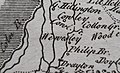 Wewesley (Yiewsley) John Rocque Middlesex 1769.jpg 1,675 × 1,015; 515 KB
-
 Ordnance Survey Drawings - Stratford (OSD 131).jpg 4,000 × 3,874; 4.77 MB
-
 Ordnance Survey Drawings - Chipping Barnet (OSD 151).jpg 3,000 × 4,000; 4.6 MB
-
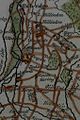
 1820 map of the Edmonton Hundred.jpg 750 × 689; 108 KB
-

-

-

-

-

-

-
 General Roys Baseline.jpg 909 × 742; 325 KB
-
 Middle-sexia (12993238895).jpg 2,083 × 2,000; 1.7 MB
-
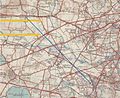
 Ordnance Survey One-Inch Tourist Map of Country Round London, Published 1921.jpg 15,484 × 12,002; 27.13 MB
-
-
 Plan of Hounslow Heath Baseline Roy 1785 Plate 16.jpg 15,806 × 6,002; 30.09 MB
-

-

-

-
 The making of England (1900) (14765084975).jpg 3,664 × 2,268; 1.27 MB

.jpg)
.jpg)


_John_Rocque_Middlesex_1769.jpg)
.jpg)
.jpg)

.jpg)
.jpg)
.jpg)
.jpg)


.jpg)


_(14765084975).jpg)