Category:Old maps of Milwaukee
Jump to navigation
Jump to search
Subcategories
This category has only the following subcategory.
Media in category "Old maps of Milwaukee"
The following 13 files are in this category, out of 13 total.
-
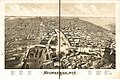
 (Bird's-eye view of South Milwaukee) LOC 87690559.jpg 5,846 × 3,418; 4.62 MB
-
 1920 Milwaukee Wisconsin Automobile Blue Book.jpg 883 × 818; 251 KB
-
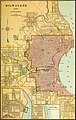
 EB9 Milwaukee.jpg 833 × 1,110; 441 KB
-
 Milwaukee 1872.jpg 11,952 × 8,416; 19.76 MB
-
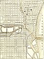
 Milwaukee 1880 map.jpg 3,880 × 5,124; 2.43 MB
-
 Milwaukee 1892.jpg 9,424 × 6,288; 11.78 MB
-
 Milwaukee birdseye map by Bailey (1872). loc call no g4124m-pm010450.jpg 9,999 × 6,650; 13.61 MB
-
 Milwaukee Sewerage Map 1880.jpg 1,305 × 1,526; 468 KB
-
 Milwaukee, Wis. 1879. LOC 75696716.jpg 12,656 × 8,384; 22.09 MB
-
 Milwaukee, Wis. LOC 75696717.jpg 8,192 × 4,904; 7.77 MB
-
 Milwaukee, Wis. LOC 76693067.jpg 11,952 × 8,416; 20.6 MB
-
 Milwaukee1879.jpg 12,656 × 8,384; 22.03 MB
-
 NIE 1905 Milwaukee and Vicinity.jpg 1,562 × 2,467; 1.63 MB
_LOC_87690559.jpg)


._loc_call_no_g4124m-pm010450.jpg)


