Category:Old maps of Paramaribo
Jump to navigation
Jump to search
Subcategories
This category has only the following subcategory.
Media in category "Old maps of Paramaribo"
The following 20 files are in this category, out of 20 total.
-
 Plan von Paramaribo.jpg 3,107 × 2,235; 3.63 MB
-

-
 Encyclopaedie van Nederlandsch West-Indië-Surinam north-Benj004ency01ill stitched.jpg 3,987 × 5,378; 31.32 MB
-
 Encyclopaedie van Nederlandsch West-Indië-Surinam south-Benj004ency01ill03.gif 4,035 × 3,215; 5.56 MB
-
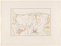
 Extract of the Dutch Map Representing the Colony of Surinam - WDL.png 1,590 × 1,024; 2.61 MB
-
-
 FortNieuwAmsterdam.jpg 1,623 × 2,274; 1.64 MB
-
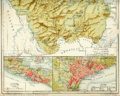
 G.P.H. Zimmerman - Kaart van Suriname (1877).jpg 3,501 × 5,500; 1.67 MB
-
 Kaart van Paramaribo.png 1,126 × 776; 1.44 MB
-
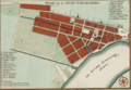
 Map of Paramaribo (1920).jpg 5,500 × 4,733; 2.38 MB
-
 Map of Paramaribo 1898.png 1,927 × 1,317; 4 MB
-
 Paramaribo - btv1b85967996.jpg 5,814 × 4,263; 4.43 MB
-

-
 Plan of the town of Paramaribo (T. Conder).jpg 794 × 1,156; 130 KB
-
 Plan van Paramaribo, hoofdstad van Suriname (1853).jpg 1,200 × 839; 271 KB
-
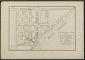
 Platte grond van de stad Paramaribo (1804).jpg 3,881 × 2,934; 1.11 MB
-
 Platte grond van de stad Paramaribo (1821).jpg 4,015 × 3,704; 1.77 MB
-
 Schets Kaart van de Kolonie Suriname of Ned.sche Guiana (titel op object), NG-1064-1.jpg 5,894 × 4,396; 2.22 MB
-
 Stadsplattegrond van Paramaribo uit 1766 - 20651478 - RCE.jpg 1,200 × 799; 373 KB
-
 Tekening van de omgeving van Paramibo - Paramaribo - 20419955 - RCE.jpg 1,200 × 784; 306 KB


.jpg)

.jpg)


,_RP-P-1896-A-19368-3085.jpg)
.jpg)
.jpg)
.jpg)
.jpg)
,_NG-1064-1.jpg)

