Category:Old maps of Port-Louis
Jump to navigation
Jump to search
Subcategories
This category has only the following subcategory.
Media in category "Old maps of Port-Louis"
The following 17 files are in this category, out of 17 total.
-
 063 Le Port Louis plan 1705.jpg 3,027 × 2,219; 2.74 MB
-
 079 Carte de Blavet fin XVIIe.jpg 2,558 × 1,601; 1.77 MB
-
 Anciennes et nouvelles sondes à Portlouis - Lebloch ; Lesage - btv1b53153586z (1 of 2).jpg 9,666 × 6,474; 6.22 MB
-
 Blavet Tassin 16003.jpg 3,333 × 2,332; 4.29 MB
-
 Blavet Tassin 16004.jpg 3,234 × 2,249; 5.05 MB
-
 Carte environs de Lorient et Port-Louis 1758.jpg 1,355 × 500; 439 KB
-

-
 Cassini Merlevenez.jpg 1,600 × 900; 1.48 MB
-
 Cassini Petite mer de Gâvres.jpg 804 × 570; 438 KB
-
 Gavresetportlouis1750.JPG 599 × 450; 61 KB
-
 Gavresetportlouisen1750.JPG 456 × 447; 57 KB
-
 Plan particulier du Port-Louis - de la Voye - btv1b53153579w.jpg 8,956 × 6,166; 6.88 MB
-
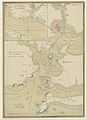 Plans des ports de France (1777) - Baie du Port-Louis.jpg 4,748 × 6,555; 4.2 MB
-
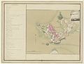 Plans des ports de France (1777) - Le Port-Louis.jpg 6,338 × 4,800; 3.9 MB
-
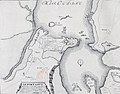 Port-Louis Plan du XVIII siècle.jpg 544 × 428; 163 KB
-
 Ville du Port Louis - Bellin - btv1b8591951h.jpg 3,481 × 4,208; 2.41 MB
-
 Le petit atlas maritim 1764 (101587554).jpg 6,557 × 8,075; 8.56 MB


.jpg)


_-_Baie_du_Port-Louis.jpg)
_-_Le_Port-Louis.jpg)


.jpg)