Category:Old maps of Roman Britain
Jump to navigation
Jump to search
Subcategories
This category has only the following subcategory.
O
- Old maps of Hadrian's Wall (20 F)
Media in category "Old maps of Roman Britain"
The following 62 files are in this category, out of 62 total.
-
 C. 350 Roman Britain.jpg 3,848 × 3,010; 2.54 MB
-
 C. 350 Roman Empire.jpg 4,117 × 3,031; 3.44 MB
-
 C. 395 Roman Provinces.jpg 1,774 × 1,385; 3.03 MB
-
 Tabula Peutingeriana Britannia.jpg 371 × 786; 172 KB
-

-

-
 Map of ancient Britain, 1685.jpg 624 × 900; 413 KB
-

-
 MappaBritanniaeFacie.jpg 2,954 × 2,557; 837 KB
-
 MappaBritanniaeFacie2.png 1,500 × 1,312; 4.43 MB
-
 MappaBritanniaeFacie3.png 1,100 × 936; 2.13 MB
-
 MappaBritanniaeFacie4.png 1,400 × 1,690; 4.25 MB
-
 Roman Roads in Yorkshire Map Gri 33125011105661 0103-4.jpg 2,440 × 1,938; 1.57 MB
-

-

-

-

-
-

-

-

-

-

-
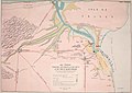 The Archaeological journal (1844) (14586191240).jpg 3,562 × 2,536; 1.67 MB
-
 Orbis Antiqui Descriptio - Germanien Britannien.png 1,557 × 1,211; 4.17 MB
-

-
 Britannia et Hibernia - Roman Britain and Ireland (Spruner-Menke, Atlas Atiquus, 1865).jpg 5,590 × 6,398; 23.1 MB
-

-

-
 The Forest of Anderida during the Roman Occupation of Britain (cropped).jpg 1,292 × 865; 482 KB
-

-
 Roman Roads in Delamere Forest and Neighbourhood, c.1885.jpg 2,543 × 1,751; 822 KB
-
 Roman Britain (Droysen).jpg 2,143 × 2,803; 1.47 MB
-
 OldMapKent.jpg 410 × 324; 90 KB
-

-

-
-
 Roman Britain.png 2,486 × 3,007; 14.17 MB
-
 Map of Roman Britain.jpg 2,198 × 2,888; 1.27 MB
-
 Public Schools Historical Atlas - Roman Britain 400.jpg 880 × 1,152; 364 KB
-
 Roman britain 400.jpg 880 × 1,152; 306 KB
-
 Atlas of ancient and classical geography (1909) (14779212651).jpg 2,336 × 2,938; 1.99 MB
-
 Nr. 30. Britannien.png 4,072 × 3,329; 38.81 MB
-
 Boudicca-Aufstand.PNG 730 × 673; 426 KB
-
 Midlands Watling Street.png 400 × 347; 94 KB
-
 Romanbritain-Bannaventa.jpg 880 × 1,394; 225 KB
-
 Romanbritain.jpg 854 × 1,364; 712 KB
-
 Scots Watling Street.png 1,000 × 882; 562 KB
-
 Watling Street route.jpg 762 × 517; 300 KB
-
 Watling Streets.png 854 × 1,364; 1.03 MB
-
 Welsh Watling Street.png 350 × 501; 110 KB
-
 1911Watling Street.png 2,016 × 1,314; 169 KB
-
 Britain roman.png 2,184 × 3,006; 202 KB
-
-
 Karte aus dem Buch Römische Provinzen von Theodor Mommsen 1921 06.jpg 1,440 × 1,983; 3.57 MB
-
 Brittain 410.jpg 1,111 × 1,497; 369 KB
-
 Ordnance Survey Map of Roman Britain, Published 1956.jpg 9,334 × 12,647; 8.63 MB
-

-

-
 C. 410 Britannia.jpg 1,025 × 1,358; 1.56 MB
-
 Leintwardine. Carte. Morden.jpg 620 × 505; 127 KB
-
 Print, book-illustration, map (BM 1977,U.367.1).jpg 2,500 × 2,000; 644 KB


.jpg)
.jpg)


_(14595125590).jpg)
_(14778690001).jpg)
_(14759446966).jpg)
_(14782090542).jpg)
_(14597244588).jpg)
_(14597227829).jpg)
_(14783546712).jpg)

_(14586191240).jpg)

.jpg)
.jpg)
_-_Geographicus_-_Britannia-spruner-1865.jpg)
%27_(11126923554).jpg)
.jpg)
.jpg)

.jpg)

.jpg)
.jpg)
.jpg)


_(14779212651).jpg)


_(14800942903).jpg)


_..._In_two_volumes.)%27_(11002775445).jpg)
_..._In_two_volumes.)%27_(11003006433).jpg)


.jpg)
%27_(11001796034).jpg)