Category:Old maps of Sainte-Maure-de-Touraine
Jump to navigation
Jump to search
Media in category "Old maps of Sainte-Maure-de-Touraine"
The following 4 files are in this category, out of 4 total.
-
 Centre historique de Sainte-Maure-de-Touraine plan cadastral napoléonien.jpg 1,016 × 526; 70 KB
-
 Halles de Sainte-Maure-de-Touraine CADASTRE NAPOLEONIEN 1832.jpg 736 × 520; 62 KB
-
 Sainte-Maure cadastre napoléonien.jpg 572 × 342; 37 KB
-
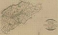
 Sainte-Maure-de-Touraine Carte de Cassini.jpg 771 × 503; 129 KB


