Category:Old maps of Santander (Spain)
Jump to navigation
Jump to search
Subcategories
This category has only the following subcategory.
Media in category "Old maps of Santander (Spain)"
The following 18 files are in this category, out of 18 total.
-
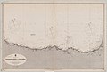 Admiralty Chart No 2728 Spain north coast Bidassoa River to Cape Peñas, Published 1887.jpg 12,204 × 8,287; 10.5 MB
-
 Admiralty Chart No 2925 San Sebastian to Santander, Published 1934.jpg 17,631 × 11,287; 35.58 MB
-
 Admiralty Chart No 2926 Santander to Gijon, Published 1933.jpg 17,613 × 11,215; 30.78 MB
-
 Admiralty Chart No 76 Puerto de Santander, Published 1931.jpg 16,233 × 11,127; 66.5 MB
-
 Agustin de Colosia - Ensanche de Santander 1788.jpg 888 × 661; 247 KB
-

-

-
 Junta de las obras del puerto de Santander - btv1b531565091.jpg 9,735 × 7,901; 13.07 MB
-

-
 Mapa de la provincia de Santander ; edicion corregida y aumentada... - btv1b8443811n.jpg 9,804 × 6,984; 8.31 MB
-

-
 Plan de la baie de Santander à marée basse avec indication des endiguements - btv1b84437683.jpg 10,500 × 6,168; 9.12 MB
-
 Plan du havre de St. Andere en la coste de Biscaye - btv1b530569348.jpg 3,592 × 2,728; 1.18 MB
-

-

-
 Santander - btv1b53056710w.jpg 2,048 × 1,768; 517 KB
-
 Santander map 1908.jpg 3,496 × 2,315; 2.9 MB
-
 Santoña e Laredo - btv1b53056466h.jpg 960 × 1,512; 207 KB


